Mali Breg: Difference between revisions
Appearance
Content deleted Content added
m Bot: Migrating 3 interwiki links, now provided by Wikidata on d:q2710080 |
Tom.Reding (talk | contribs) |
||
| (5 intermediate revisions by 2 users not shown) | |||
| Line 31: | Line 31: | ||
|pushpin_label_position = top |
|pushpin_label_position = top |
||
|pushpin_map_caption = Location in Slovenia |
|pushpin_map_caption = Location in Slovenia |
||
|coordinates_display = inline,title |
|||
|coordinates_region = SI |
|||
|subdivision_type = Country |
|subdivision_type = Country |
||
|subdivision_name = [[Image:Flag of Slovenia.svg|25px]] [[Slovenia]] |
|subdivision_name = [[Image:Flag of Slovenia.svg|25px]] [[Slovenia]] |
||
| Line 38: | Line 36: | ||
|subdivision_name1 = [[Lower Styria|Styria]] |
|subdivision_name1 = [[Lower Styria|Styria]] |
||
|subdivision_type2 = [[Statistical regions of Slovenia|Statistical region]] |
|subdivision_type2 = [[Statistical regions of Slovenia|Statistical region]] |
||
|subdivision_name2 = [[ |
|subdivision_name2 = [[Savinja Statistical Region|Savinja]] |
||
|subdivision_type3 = [[Municipalities of Slovenia|Municipality]] |
|subdivision_type3 = [[Municipalities of Slovenia|Municipality]] |
||
|subdivision_name3 = [[Slovenske Konjice]] |
|subdivision_name3 = [[Municipality of Slovenske Konjice|Slovenske Konjice]] |
||
|subdivision_type4 = |
|subdivision_type4 = |
||
|subdivision_name4 = |
|subdivision_name4 = |
||
| Line 97: | Line 95: | ||
|timezone_DST = |
|timezone_DST = |
||
|utc_offset_DST = |
|utc_offset_DST = |
||
|coordinates = {{coord|46|18|42.62|N|15|29|51.64|E|region:SI|display=inline,title}} |
|||
|latd=46|latm=18 |lats=42.62 |latNS=N |
|||
|longd=15|longm=29 |longs=51.64|longEW=E |
|||
|elevation_footnotes = |
|elevation_footnotes = |
||
|elevation_m = 280.8 |
|elevation_m = 280.8 |
||
| Line 113: | Line 110: | ||
}} |
}} |
||
'''Mali Breg''' is a settlement in the [[Municipality |
'''Mali Breg''' ({{IPA|sl|ˈmaːli ˈbɾeːk|pron}}) is a settlement in the [[Municipality of Slovenske Konjice]] in eastern [[Slovenia]]. It lies on the [[Dravinja|Dravinja River]] north of [[Loče, Slovenske Konjice|Loče]]. The municipality is part of the traditional region of [[Lower Styria|Styria]] and is now included in the [[Savinja Statistical Region]].<ref>[http://www.slovenskekonjice.si Slovenske Konjice municipal site]</ref> |
||
==Name== |
==Name== |
||
The name of the settlement was changed from Breg to Mali Breg in 1953.<ref>''Spremembe naselij 1948–95''. 1996. Database. Ljubljana: Geografski inštitut ZRC SAZU, DZS.</ref> |
The name of the settlement was changed from ''Breg'' to ''Mali Breg'' in 1953.<ref>''Spremembe naselij 1948–95''. 1996. Database. Ljubljana: Geografski inštitut ZRC SAZU, DZS.</ref> |
||
==References== |
==References== |
||
| Line 122: | Line 119: | ||
==External links== |
==External links== |
||
*[ |
*[https://www.geopedia.world/#T12_L362_F2473:1883_x1725170.256935939_y5830289.566700396_s15_b2345 Mali Breg on Geopedia] |
||
{{Slovenske Konjice}} |
{{Slovenske Konjice}} |
||
Latest revision as of 16:26, 23 August 2024
Mali Breg
Breg (until 1953) | |
|---|---|
| Coordinates: 46°18′42.62″N 15°29′51.64″E / 46.3118389°N 15.4976778°E | |
| Country | |
| Traditional region | Styria |
| Statistical region | Savinja |
| Municipality | Slovenske Konjice |
| Area | |
• Total | 0.48 km2 (0.19 sq mi) |
| Elevation | 280.8 m (921.3 ft) |
| Population (2002) | |
• Total | 58 |
| [1] | |
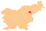
Mali Breg (pronounced [ˈmaːli ˈbɾeːk]) is a settlement in the Municipality of Slovenske Konjice in eastern Slovenia. It lies on the Dravinja River north of Loče. The municipality is part of the traditional region of Styria and is now included in the Savinja Statistical Region.[2]
Name
[edit]The name of the settlement was changed from Breg to Mali Breg in 1953.[3]
References
[edit]- ^ Statistical Office of the Republic of Slovenia
- ^ Slovenske Konjice municipal site
- ^ Spremembe naselij 1948–95. 1996. Database. Ljubljana: Geografski inštitut ZRC SAZU, DZS.


