Sematan Airport: Difference between revisions
Appearance
Content deleted Content added
m →External links: add authority control |
Citation bot (talk | contribs) Altered url. URLs might have been anonymized. | Use this bot. Report bugs. | #UCB_CommandLine |
||
| (7 intermediate revisions by 4 users not shown) | |||
| Line 1: | Line 1: | ||
{{Infobox airport |
{{Infobox airport |
||
| name = Sematan Airport |
| name = Sematan Airport |
||
| nativename = |
| nativename = |
||
| image = |
| image = |
||
| IATA = BSE |
| IATA = BSE |
||
| ICAO = WBGN |
| ICAO = WBGN |
||
| type = |
| type = Private |
||
| owner = |
| owner = |
||
| operator = [[Malaysia Airports Berhad]] |
| operator = [[Malaysia Airports Berhad]] |
||
| city-served = [[Sematan]], [[Sarawak]], [[Malaysia]] |
| city-served = [[Sematan]], [[Sarawak]], [[Malaysia]] |
||
| location = |
| location = |
||
| timezone = [[Time in Malaysia|MST]] |
| timezone = [[Time in Malaysia|MST]] |
||
| utc = [[UTC+08:00]] |
| utc = [[UTC+08:00]] |
||
| elevation-f = |
| elevation-f = |
||
| coordinates = {{coord|01|48|49|N|109|45|46|E|region:MY|display=inline,title}} |
| coordinates = {{coord|01|48|49|N|109|45|46|E|region:MY|display=inline,title}} |
||
| pushpin_map = Malaysia East |
| pushpin_map = Malaysia East |
||
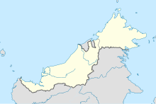
| pushpin_map_caption = Location in East Malaysia |
| pushpin_map_caption = Location in East Malaysia |
||
| pushpin_label = WBGN |
| pushpin_label = WBGN |
||
| website = |
| website = |
||
| metric-rwy = y |
| metric-rwy = y |
||
| r1-number = |
| r1-number = |
||
| r1-length-m = |
| r1-length-m = |
||
| r1-surface = |
| r1-surface = |
||
| footnotes = Source: Great Circle Mapper<ref name=GCM/> |
| footnotes = Source: Great Circle Mapper<ref name=GCM/> |
||
}} |
}} |
||
'''Sematan Airport''' {{airport codes|BSE|WBGN}} is located in [[Sematan]], [[Malaysia]].<ref name=GCM>{{GCM|BSE}}</ref> |
'''Sematan Airport''' {{airport codes|BSE|WBGN}} is located in [[Sematan]], [[Lundu District]], [[Sarawak]], [[Malaysia]].<ref name=GCM>{{GCM|BSE}}</ref> |
||
==History== |
|||
The Sematan airfield was officiated in September 1958 where [[Borneo Airways]] Twin Pioneer was the first aircraft landed here.<ref>{{cite book |last1=Ah Chon |first1=Ho |title=The Sarawak River |date=1995 |publisher=University of Michigan |isbn=9789839172041 |page=113 |url=https://books.google.com/books?id=vIBuAAAAMAAJ |access-date=27 April 2024}}</ref> |
|||
There are no scheduled flights at this airport. The fact that this airport is for RMAF. In 1974 there was a helicopter crash killing 2 or 3 generals. From then, no more than one high tanking officer was allowed per helicopter.{{citation needed|date=April 2024}} |
|||
==See also== |
==See also== |
||
| Line 38: | Line 43: | ||
{{Airports in Malaysia}} |
{{Airports in Malaysia}} |
||
{{authority control}} |
{{authority control}} |
||
[[Category:Airports in Sarawak]] |
[[Category:Airports in Sarawak]] |
||
[[Category:Lundu District]] |
|||
Latest revision as of 06:33, 27 August 2024
Sematan Airport | |
|---|---|
| Summary | |
| Airport type | Private |
| Operator | Malaysia Airports Berhad |
| Serves | Sematan, Sarawak, Malaysia |
| Time zone | MST (UTC+08:00) |
| Coordinates | 01°48′49″N 109°45′46″E / 1.81361°N 109.76278°E |
| Map | |
 | |
Source: Great Circle Mapper[1] | |
Sematan Airport (IATA: BSE, ICAO: WBGN) is located in Sematan, Lundu District, Sarawak, Malaysia.[1]
History
[edit]The Sematan airfield was officiated in September 1958 where Borneo Airways Twin Pioneer was the first aircraft landed here.[2]
There are no scheduled flights at this airport. The fact that this airport is for RMAF. In 1974 there was a helicopter crash killing 2 or 3 generals. From then, no more than one high tanking officer was allowed per helicopter.[citation needed]
See also
[edit]References
[edit]- ^ a b Airport information for BSE at Great Circle Mapper.
- ^ Ah Chon, Ho (1995). The Sarawak River. University of Michigan. p. 113. ISBN 9789839172041. Retrieved 27 April 2024.
External links
[edit]

