Hóa An, Biên Hòa: Difference between revisions
Appearance
Content deleted Content added
m clean up, added uncategorised tag |
Rescuing 1 sources and tagging 0 as dead.) #IABot (v2.0.9.5 |
||
| (3 intermediate revisions by 2 users not shown) | |||
| Line 68: | Line 68: | ||
|timezone_DST = |
|timezone_DST = |
||
|utc_offset_DST = |
|utc_offset_DST = |
||
|coordinates = {{coord|10|56|10|N|106| |
|coordinates = {{coord|10|56|10|N|106|47|54|E|region:VN|display=inline}} |
||
|elevation_footnotes = <!--for references: use <ref> </ref> tags--> |
|elevation_footnotes = <!--for references: use <ref> </ref> tags--> |
||
|elevation_m = |
|elevation_m = |
||
| Line 83: | Line 83: | ||
|footnotes = |
|footnotes = |
||
}} |
}} |
||
'''Hóa An''' is a [[Ward (Vietnam)|ward]] located in [[Biên Hòa]] city of [[Đồng Nai province]], [[Vietnam]].<ref>{{cite web|publisher=Cổng thông tin điện tử Chính phủ (Vietnamese government web portal)|title=Hệ thống bản đồ hành chính Việt Nam (Administrative map system) |
'''Hóa An''' is a [[Ward (Vietnam)|ward]] located in [[Biên Hòa]] city of [[Đồng Nai province]], [[Vietnam]].<ref>{{cite web|publisher=Cổng thông tin điện tử Chính phủ (Vietnamese government web portal)|title=Hệ thống bản đồ hành chính Việt Nam (Administrative map system)|url=http://gis.chinhphu.vn/|access-date=2023-01-07|archive-date=2012-08-20|archive-url=https://web.archive.org/web/20120820161058/http://gis.chinhphu.vn/|url-status=dead}}</ref> It has an area of about 6.8km2 and the population in 2017 was 28,968.<ref>{{cite web|publisher=UBND Thành phố Biên Hòa (Biên Hòa official website)|title=Thông tin chung Phường Hóa An (General information about Hóa An Ward) |url=http://bienhoa.dongnai.gov.vn/Pages/gioithieu.aspx?CatID=85}}</ref> |
||
==References== |
==References== |
||
| Line 92: | Line 92: | ||
{{DongNai-geo-stub}} |
{{DongNai-geo-stub}} |
||
[[Category:Bien Hoa]] |
|||
{{Uncategorized stub|date=January 2023}} |
|||
Latest revision as of 04:44, 28 August 2024
Hóa An | |
|---|---|
| Coordinates: 10°56′10″N 106°47′54″E / 10.93611°N 106.79833°E | |
| Country | |
| Province | Đồng Nai |
| provincial city | Biên Hòa |
| Area | |
• Total | 2.6 sq mi (6.8 km2) |
| Population (2017) | |
• Total | 28,968 |
| Time zone | UTC+7 (UTC+7) |
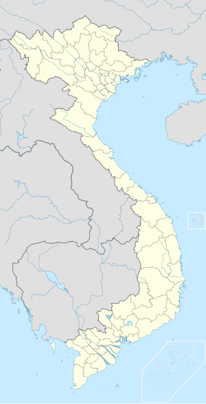
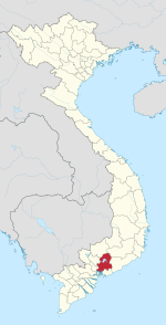
Hóa An is a ward located in Biên Hòa city of Đồng Nai province, Vietnam.[1] It has an area of about 6.8km2 and the population in 2017 was 28,968.[2]
References
[edit]- ^ "Hệ thống bản đồ hành chính Việt Nam (Administrative map system)". Cổng thông tin điện tử Chính phủ (Vietnamese government web portal). Archived from the original on 2012-08-20. Retrieved 2023-01-07.
- ^ "Thông tin chung Phường Hóa An (General information about Hóa An Ward)". UBND Thành phố Biên Hòa (Biên Hòa official website).


