Norberg: Difference between revisions
Luckas-bot (talk | contribs) m robot Adding: pl:Norberg |
RodRabelo7 (talk | contribs) |
||
| (47 intermediate revisions by 36 users not shown) | |||
| Line 1: | Line 1: | ||
{{other uses}} |
|||
{{Infobox |
{{Infobox settlement |
||
|official_name = Norberg |
|official_name = Norberg |
||
|image_skyline = Elsa Andersons |
|image_skyline = Elsa Andersons konditori Norberg 2017.jpg |
||
|image_caption = ''Elsa Andersons konditori'' in Norberg |
|image_caption = ''[[Elsa Andersons konditori]]'' in Norberg |
||
|pushpin_map = Sweden |
|pushpin_map = Sweden Västmanland#Sweden |
||
|pushpin_label_position = |
|pushpin_label_position = |
||
|subdivision_type = [[Country]] |
|subdivision_type = [[Country]] |
||
| Line 13: | Line 14: | ||
|subdivision_type1 = [[Provinces of Sweden|Province]] |
|subdivision_type1 = [[Provinces of Sweden|Province]] |
||
|subdivision_name1 = [[Västmanland]] |
|subdivision_name1 = [[Västmanland]] |
||
|area_footnotes = <ref name= |
|area_footnotes = <ref name=scb>{{cite web |url=http://www.scb.se/Statistik/MI/MI0810/2010A01/Tatorternami0810tab1_4.xls |title=Tätorternas landareal, folkmängd och invånare per km<sup>2</sup> 2005 och 2010 |date=14 December 2011 |publisher=[[Statistics Sweden]] |language=Swedish |archiveurl=https://web.archive.org/web/20120127055525/http://www.scb.se/Statistik/MI/MI0810/2010A01/Tatorternami0810tab1_4.xls |archivedate=27 January 2012 |url-status=live |accessdate=10 January 2012 }}</ref> |
||
|area_total_km2 = 8. |
|area_total_km2 = 8.09 |
||
|population_as_of = |
|population_as_of = 31 December 2015 |
||
|population_footnotes = <ref name= |
|population_footnotes = <ref name=scb /> |
||
|population_total = |
|population_total = 6,969 <!-- This is the official figure from Statistics Sweden (Statistiska centralbyrån). --> |
||
|population_density_km2 = |
|population_density_km2 = 690 |
||
|timezone = [[Central European Time|CET]] |
|timezone = [[Central European Time|CET]] |
||
|utc_offset = +1 |
|utc_offset = +1 |
||
|timezone_DST = [[Central European Summer Time|CEST]] |
|timezone_DST = [[Central European Summer Time|CEST]] |
||
|utc_offset_DST = +2 |
|utc_offset_DST = +2 |
||
| |
|coordinates = {{coord|60|05|N|15|57|E|region:SE|display=inline,title}} |
||
|latd=60 |latm=05 |lats= |latNS=N |
|||
|longd=15 |longm=57 |longs= |longEW=E |
|||
|website = http://www.norberg.se |
|website = http://www.norberg.se |
||
}} |
}} |
||
'''Norberg''' is a [[urban areas of Sweden|locality]] and the seat of [[Norberg Municipality]] in [[Västmanland County]], [[Sweden]] with 4, |
'''Norberg''' ({{IPA|sv|ˈnûːrbærj}})<ref>{{cite book|url=https://runeberg.org/ortnamn/0022.html|author1=Jöran Sahlgren|author2=Gösta Bergman|title=Svenska ortnamn med uttalsuppgifter|language=sv|year=1979|page=18}}</ref> is a [[urban areas of Sweden|locality]] and the seat of [[Norberg Municipality]] in [[Västmanland County]], [[Sweden]] with 4,518 inhabitants in 2010.<ref name=scb /> Best known for the [[Norbergfestival]] which is Scandinavias biggest electronic music festival, organized in an old iron ore mine. |
||
Norberg consists of two large parts, the actual Norberg in the south and [[Kärrgruvan]] (Marsh Mine) in the north, along with smaller settlements scattered around the area. |
|||
==History== |
|||
Iron-making in Norberg can be traced back to the 6th century, but the area has been populated since the Nordic Stone Age. |
|||
The blast furnace plant at Lapphyttan, probably originates from the 11–1200s (currently under reconstruction elsewhere), shows the beginning of the mining community that grew up in Bergslagen. In the Middle Ages, Norberg was a marketplace where mountain men in the surrounding districts gathered. |
|||
The oldest preserved buildings in Norberg are in Norbergsån, the area around Norberg church with farms that originate from the Middle Ages, while many current buildings are from the 18th century. The oldest parts of Norberg's church, including the vaults, date from the 13th century. The interior was changed after a big fire in 1727 and the church tower was rebuilt in 1904. In the cemetery is a bone chamber from the 18th century. |
|||
Despite an extensive fire in the mid-18th century, one can still see the original settlement pattern in central Norberg with booths, laundries and a wash-house along the river, while farm houses and residential buildings are nearby. |
|||
In the 1970s, raw molten iron was transported by rail from the blast furnaces at Spännarhyttan to the steelworks at Surahammar. |
|||
Spännarhyttans blast furnace was shut down for good in 1981. |
|||
==Landmarks== |
|||
Elsa Andersons Konditori is a historic pastry shop. Formerly a hostelry, it was founded in 1916 and is located next to the square in Norberg. It has been awarded with a diploma from the Gastronomy Academy. On 21 August 2015 it was totally destroyed by a fire but it reopened in 2017. |
|||
==See also== |
|||
* [[Norbergite]] |
|||
* [[Engelsberg-Norberg Railway]] - Preserved railway run by enthusiasts, based in nearby [[Kärrgruvan]] with a station at Norberg |
|||
* [[Mas (Swedish term)]] |
|||
== References == |
== References == |
||
{{Commons}} |
{{Commons}} |
||
{{Reflist}} |
{{Reflist}} |
||
Much of the information on this page has been translated from the Swedish Wikipedia page on Norberg: [[:sv:Norberg]] |
|||
| ⚫ | |||
| ⚫ | |||
{{Västmanland County}} |
{{Västmanland County}} |
||
{{Authority control}} |
|||
[[Category:Municipal seats of Västmanland County]] |
[[Category:Municipal seats of Västmanland County]] |
||
[[Category:Swedish municipal seats]] |
[[Category:Swedish municipal seats]] |
||
[[Category: |
[[Category:Populated places in Västmanland County]] |
||
| ⚫ | |||
[[bg:Норбери]] |
|||
| ⚫ | |||
[[it:Norberg]] |
|||
[[nl:Norberg (plaats)]] |
|||
[[no:Norberg]] |
|||
[[pl:Norberg]] |
|||
[[sv:Norberg]] |
|||
Latest revision as of 03:21, 1 September 2024
Norberg | |
|---|---|
 Elsa Andersons konditori in Norberg | |
| Coordinates: 60°05′N 15°57′E / 60.083°N 15.950°E | |
| Country | Sweden |
| Province | Västmanland |
| County | Västmanland County |
| Municipality | Norberg Municipality |
| Area | |
• Total | 8.09 km2 (3.12 sq mi) |
| Population (31 December 2015)[1] | |
• Total | 6,969 |
| • Density | 690/km2 (1,800/sq mi) |
| Time zone | UTC+1 (CET) |
| • Summer (DST) | UTC+2 (CEST) |
| Website | http://www.norberg.se |
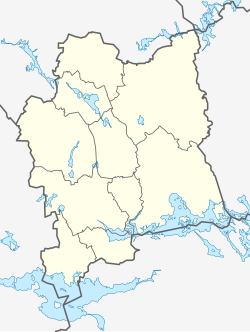
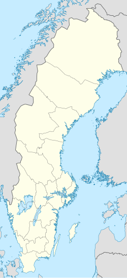
Norberg (Swedish pronunciation: [ˈnûːrbærj])[2] is a locality and the seat of Norberg Municipality in Västmanland County, Sweden with 4,518 inhabitants in 2010.[1] Best known for the Norbergfestival which is Scandinavias biggest electronic music festival, organized in an old iron ore mine. Norberg consists of two large parts, the actual Norberg in the south and Kärrgruvan (Marsh Mine) in the north, along with smaller settlements scattered around the area.
History
[edit]Iron-making in Norberg can be traced back to the 6th century, but the area has been populated since the Nordic Stone Age.
The blast furnace plant at Lapphyttan, probably originates from the 11–1200s (currently under reconstruction elsewhere), shows the beginning of the mining community that grew up in Bergslagen. In the Middle Ages, Norberg was a marketplace where mountain men in the surrounding districts gathered.
The oldest preserved buildings in Norberg are in Norbergsån, the area around Norberg church with farms that originate from the Middle Ages, while many current buildings are from the 18th century. The oldest parts of Norberg's church, including the vaults, date from the 13th century. The interior was changed after a big fire in 1727 and the church tower was rebuilt in 1904. In the cemetery is a bone chamber from the 18th century.
Despite an extensive fire in the mid-18th century, one can still see the original settlement pattern in central Norberg with booths, laundries and a wash-house along the river, while farm houses and residential buildings are nearby.
In the 1970s, raw molten iron was transported by rail from the blast furnaces at Spännarhyttan to the steelworks at Surahammar. Spännarhyttans blast furnace was shut down for good in 1981.
Landmarks
[edit]Elsa Andersons Konditori is a historic pastry shop. Formerly a hostelry, it was founded in 1916 and is located next to the square in Norberg. It has been awarded with a diploma from the Gastronomy Academy. On 21 August 2015 it was totally destroyed by a fire but it reopened in 2017.
See also
[edit]- Norbergite
- Engelsberg-Norberg Railway - Preserved railway run by enthusiasts, based in nearby Kärrgruvan with a station at Norberg
- Mas (Swedish term)
References
[edit]- ^ a b c "Tätorternas landareal, folkmängd och invånare per km2 2005 och 2010" (in Swedish). Statistics Sweden. 14 December 2011. Archived from the original on 27 January 2012. Retrieved 10 January 2012.
- ^ Jöran Sahlgren; Gösta Bergman (1979). Svenska ortnamn med uttalsuppgifter (in Swedish). p. 18.
Much of the information on this page has been translated from the Swedish Wikipedia page on Norberg: sv:Norberg


