Lagelu, Oyo: Difference between revisions
Updating Chairman |
Suntooooth (talk | contribs) Removed {{coord missing}} |
||
| (7 intermediate revisions by 3 users not shown) | |||
| Line 1: | Line 1: | ||
{{Use Nigerian English|date=January 2023}} |
|||
{{Infobox settlement |
{{Infobox settlement |
||
|official_name =Lagelu |
|official_name =Lagelu |
||
| Line 49: | Line 50: | ||
|utc_offset_DST = |
|utc_offset_DST = |
||
|coordinates = |
|coordinates = |
||
|module={{Infobox mapframe|wikidata=yes|zoom=8|marker=village|coord={{WikidataCoord|display=i}}}} |
|||
|elevation_footnotes = |
|elevation_footnotes = |
||
|elevation_m = |
|elevation_m = |
||
| Line 69: | Line 71: | ||
The [[postal code]] of the area is 200.<ref>{{cite web|title=Post Offices- with map of LGA |publisher=NIPOST |url=http://www.nipost.gov.ng/PostCode.aspx |accessdate=2009-10-20 |url-status=dead |archiveurl=https://web.archive.org/web/20121126042849/http://www.nipost.gov.ng/postcode.aspx |archivedate=2012-11-26 }}</ref> |
The [[postal code]] of the area is 200.<ref>{{cite web|title=Post Offices- with map of LGA |publisher=NIPOST |url=http://www.nipost.gov.ng/PostCode.aspx |accessdate=2009-10-20 |url-status=dead |archiveurl=https://web.archive.org/web/20121126042849/http://www.nipost.gov.ng/postcode.aspx |archivedate=2012-11-26 }}</ref> |
||
History |
|||
Lagelu Local Government Area was created in the year 1976.<ref name=":0" /> |
|||
== Geography == |
|||
Lagelu Local Government Area has an average [[temperature]] of 28 [[Celsius|degrees Celsius]] and a total area of 338 [[Square kilometre|square kilometers]]. The Local Government Area has an average [[humidity]] of sixty-three percent and an estimated annual [[precipitation]] of two thousand [[Millimetre|millimeters]].<ref name=":0">{{Cite web |title=Lagelu Local Government Area |url=https://www.manpower.com.ng/places/lga/688/lagelu |access-date=2024-02-17 |website=www.manpower.com.ng}}</ref> |
|||
== Economy == |
|||
A variety of commodities, including cassava, [[maize]], yam, [[Coconut|cocoa]], and kolanut, are grown in the raucous Lagelu Local Government Area's [[Agriculture|agricultural]] sector. With multiple markets, including the Lagelu main market, where a range of commodities are bought and sold, trade plays a significant role in the Lagelu LGA economy. In Lagelu LGA, other significant economic pursuits include hunting, root and herb processing, and textile weaving and dyeing.<ref name=":0" /><ref>{{Cite web |last=Awojoodu |first=Kazeem |date=2023-01-19 |title=We'll Localise Industries In Lagelu To Boost State's Economy - Makinde |url=https://independent.ng/well-localise-industries-in-lagelu-to-boost-states-economy-makinde/ |access-date=2024-02-17 |website=Independent Newspaper Nigeria |language=en-GB}}</ref> |
|||
==References== |
==References== |
||
{{Reflist}} |
{{Reflist}} |
||
{{coord missing|Nigeria}} |
|||
{{LGAs and communities of Oyo State}} |
{{LGAs and communities of Oyo State}} |
||
| ⚫ | |||
[[Category:Local Government Areas in Oyo State]] |
[[Category:Local Government Areas in Oyo State]] |
||
| Line 81: | Line 95: | ||
{{OyoNG-geo-stub}} |
{{OyoNG-geo-stub}} |
||
| ⚫ | |||
Latest revision as of 23:41, 4 September 2024
Lagelu | |
|---|---|
 | |
| Country | |
| State | Oyo State |
| Government | |
| • Local Government Chairman and the Head of the Local Government Council | Kazeem Gbadamosi (PDP) |
| Time zone | UTC+1 (WAT) |
 | |
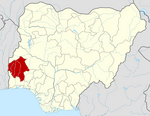
Lagelu is a Local Government Area in Oyo State, Nigeria. Its headquarters are in the town of Iyana Offa.
It has an area of 338 km2 and a population of 147,957 at the 2006 census.
Lagelu local government area is subdivided into 14 wards: Ajara/Opeodu, Apatere/Kuffi/Ogunbode/Ogo, Arulogun Ehin/Kelebe, Ejioku/Igbon/Ariku, Lagelu Market/Kajola/Gbena, Lagun, Lalupon I, Lalupon II, Lalupon III, Ofa-Igbo, Ogunjana/Olowode/Ogburo, Ogunremi/Ogunsina, Oyedeji/Olode/Kutayi, Sagbe/Pabiekun. The village called Eleruko also falls under this local government. The local government is governed by an elected chairman and 14 councillors, one elected from each ward.
The postal code of the area is 200.[1]
History
Lagelu Local Government Area was created in the year 1976.[2]
Geography
[edit]Lagelu Local Government Area has an average temperature of 28 degrees Celsius and a total area of 338 square kilometers. The Local Government Area has an average humidity of sixty-three percent and an estimated annual precipitation of two thousand millimeters.[2]
Economy
[edit]A variety of commodities, including cassava, maize, yam, cocoa, and kolanut, are grown in the raucous Lagelu Local Government Area's agricultural sector. With multiple markets, including the Lagelu main market, where a range of commodities are bought and sold, trade plays a significant role in the Lagelu LGA economy. In Lagelu LGA, other significant economic pursuits include hunting, root and herb processing, and textile weaving and dyeing.[2][3]
References
[edit]- ^ "Post Offices- with map of LGA". NIPOST. Archived from the original on 2012-11-26. Retrieved 2009-10-20.
- ^ a b c "Lagelu Local Government Area". www.manpower.com.ng. Retrieved 2024-02-17.
- ^ Awojoodu, Kazeem (2023-01-19). "We'll Localise Industries In Lagelu To Boost State's Economy - Makinde". Independent Newspaper Nigeria. Retrieved 2024-02-17.
Oyo:Agbegbe Ijoba Ibile Lagelu

