Pattani Airport: Difference between revisions
Appearance
Content deleted Content added
Category added |
No edit summary |
||
| (41 intermediate revisions by 28 users not shown) | |||
| Line 1: | Line 1: | ||
{{Short description|Airport in southern Thailand}} |
|||
| ⚫ | |||
{{Infobox airport |
|||
| name = {{nowrap|Pattani Airport}} |
|||
| ⚫ | |||
| image = <!--airport logo--> |
|||
| image-width = |
|||
| image2 = นายกรัฐมนตรี เป็นประธานพิธีเปิดการสัมมนาทางวิชาการนานา - Flickr - Abhisit Vejjajiva (32).jpg |
|||
| image2-width = |
|||
| caption = |
|||
| IATA = PAN |
|||
| ICAO = VTSK |
|||
| pushpin_map = Thailand |
|||
| pushpin_map_caption = Location of airport in Thailand |
|||
| mapframe = yes |
|||
| pushpin_label = PAN |
|||
| pushpin_label_position = right |
|||
| type = Public / Military |
|||
| owner = [[Royal Thai Army]] |
|||
| operator = [[Department of Airports (Thailand)|Department of Airports]] |
|||
| city-served = [[Pattani, Thailand|Pattani]] |
|||
| location = Bo Thong, [[Nong Chik district|Nong Chik]], [[Pattani province|Pattani]], [[Thailand]] |
|||
| opened = {{start date and age|1963|||df=yes|p=n|br=n}} |
|||
| elevation-f = 8 |
|||
| elevation-m = |
|||
| coordinates = {{coord|06|47|08|N|101|09|13|E|type:airport|display=inline,title}} |
|||
| website = |
|||
| r1-number = 08/26 |
|||
| r1-length-f = 4,593 |
|||
| r1-length-m = 1,400 |
|||
| r1-surface = [[Asphalt concrete|Asphalt]] |
|||
| footnotes = Sources: skyvector.com,<ref name="skyvector">{{cite web|url=http://skyvector.com/airport/VTSK/Pattani-Airport|title=VTSK - Pattani Airport|publisher=Skyvector.com|accessdate=7 April 2016}}</ref> iata.org<ref name="IATAsearch">{{cite web|url=http://www.iata.org/publications/Pages/code-search.aspx|title=Airline and Airport Code Search| publisher=[[International Air Transport Association|IATA]]|accessdate=7 April 2016}}</ref> |
|||
}} |
|||
| ⚫ | |||
{{coord|6.785458|N|101.153569|E|display=title|type:airport}} |
|||
Pattani airport receives flights from the [[Royal Thai Air Force]] supporting counter-[[South Thailand insurgency|insurgency]] operations in the Southern provinces. |
|||
| ⚫ | |||
| ⚫ | |||
==References== |
|||
{{Thailand-airport-stub}} |
|||
{{reflist}} |
|||
==External links== |
|||
| ⚫ | |||
*{{Wikivoyage-inline|Pattani}} |
|||
[[wuu:北大年机场]] |
|||
{{Airports in Thailand}} |
|||
{{authority control}} |
|||
| ⚫ | |||
| ⚫ | |||
[[Category:Airports established in 1963]] |
|||
Latest revision as of 00:50, 12 September 2024
Pattani Airport ท่าอากาศยานปัตตานี | |||||||||||
|---|---|---|---|---|---|---|---|---|---|---|---|
 | |||||||||||
| Summary | |||||||||||
| Airport type | Public / Military | ||||||||||
| Owner | Royal Thai Army | ||||||||||
| Operator | Department of Airports | ||||||||||
| Serves | Pattani | ||||||||||
| Location | Bo Thong, Nong Chik, Pattani, Thailand | ||||||||||
| Opened | 1963 | ||||||||||
| Elevation AMSL | 8 ft / 2 m | ||||||||||
| Coordinates | 06°47′08″N 101°09′13″E / 6.78556°N 101.15361°E | ||||||||||
| Maps | |||||||||||
 | |||||||||||
| Runways | |||||||||||
| |||||||||||
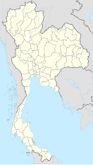
Pattani Airport (IATA: PAN, ICAO: VTSK) is in Bo Thong subdistrict, Nong Chik district, Pattani province in southern Thailand.
Pattani airport receives flights from the Royal Thai Air Force supporting counter-insurgency operations in the Southern provinces.
References
[edit]- ^ "VTSK - Pattani Airport". Skyvector.com. Retrieved 7 April 2016.
- ^ "Airline and Airport Code Search". IATA. Retrieved 7 April 2016.
External links
[edit] Pattani travel guide from Wikivoyage

