Hahnheim: Difference between revisions
→Municipal council: Grammar Tags: Mobile edit Mobile web edit Advanced mobile edit |
→Municipal council: updated as of 2024 elections |
||
| (2 intermediate revisions by one other user not shown) | |||
| Line 31: | Line 31: | ||
{| class="wikitable" |
{| class="wikitable" |
||
|- style="background:#ccc; text-align:center;" |
|- style="background:#ccc; text-align:center;" |
||
| || [[Christian Democratic Union of Germany|CDU]] || [[Social Democratic Party of Germany|SPD]] || |
| || [[Christian Democratic Union of Germany|CDU]] || [[Social Democratic Party of Germany|SPD]] || WGH || '''Total''' |
||
|- align="center" |
|- align="center" |
||
| |
| 2024 || 6 || 10 || 7 || 16 |
||
|} |
|} |
||
(as at the municipal election held on |
(as at the municipal election held on 9 June 2024) |
||
===Coat of arms=== |
===Coat of arms=== |
||
The municipality's [[Coat of arms|arms]] might be described thus: Per fess gules and argent, a cock repassant counterchanged. |
The municipality's [[Coat of arms|arms]] might be described as thus: Per fess gules and argent, a cock repassant counterchanged. |
||
==Culture and sightseeing== |
==Culture and sightseeing== |
||
Latest revision as of 06:31, 15 September 2024
Hahnheim | |
|---|---|
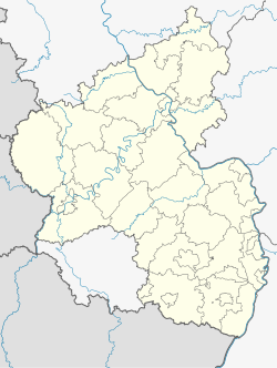
Location of Hahnheim within Mainz-Bingen district  | |
| Coordinates: 49°51′38″N 8°14′12″E / 49.86056°N 8.23667°E | |
| Country | Germany |
| State | Rhineland-Palatinate |
| District | Mainz-Bingen |
| Municipal assoc. | Rhein-Selz |
| Government | |
| • Mayor (2019–24) | Werner Kalbfuß[1] (SPD) |
| Area | |
• Total | 6.39 km2 (2.47 sq mi) |
| Elevation | 124 m (407 ft) |
| Population (2022-12-31)[2] | |
• Total | 1,555 |
| • Density | 240/km2 (630/sq mi) |
| Time zone | UTC+01:00 (CET) |
| • Summer (DST) | UTC+02:00 (CEST) |
| Postal codes | 55278 |
| Dialling codes | 06737 |
| Vehicle registration | MZ |
| Website | www.hahnheim.de |
Hahnheim is an Ortsgemeinde – a municipality belonging to a Verbandsgemeinde, a kind of collective municipality – in the Mainz-Bingen district in Rhineland-Palatinate, Germany.
Geography
[edit]Location
[edit]Hahnheim lies between Mainz and Worms on the river Selz. The winegrowing centre belongs to the Verbandsgemeinde Rhein-Selz, whose seat is in Oppenheim.
Politics
[edit]Municipal council
[edit]The council is made up of 17 council members, counting the part-time mayor, with seats apportioned thus:
| CDU | SPD | WGH | Total | |
| 2024 | 6 | 10 | 7 | 16 |
(as at the municipal election held on 9 June 2024)
Coat of arms
[edit]The municipality's arms might be described as thus: Per fess gules and argent, a cock repassant counterchanged.
Culture and sightseeing
[edit]Jewish graveyard
[edit]In the countryside towards Köngernheim on the highway going towards Bundesstraße 420 is an old Jewish graveyard.
Biotopes
[edit]In the countryside, especially along the Selz and on the former Alzey–Bodenheim railway right-of-way – the “Amiche” – several biotopes have been established.
Economy and infrastructure
[edit]Transport
[edit]The municipality is crossed by the L 432 state road. Bundesstraße 420 lies 2 km to the south. The A 60 and A 63 autobahns can be reached by car in 20 and 10 minutes respectively.
References
[edit]- ^ Direktwahlen 2019, Landkreis Mainz-Bingen, Landeswahlleiter Rheinland-Pfalz, accessed 4 August 2021.
- ^ "Bevölkerungsstand 2022, Kreise, Gemeinden, Verbandsgemeinden" (PDF) (in German). Statistisches Landesamt Rheinland-Pfalz. 2023.
External links
[edit]- Municipality’s official webpage (in German)


