Cocorote Municipality: Difference between revisions
Appearance
Content deleted Content added
GreenC bot (talk | contribs) m Rescued 1 archive link; reformat 1 link. Wayback Medic 2.1 |
No edit summary Tags: Mobile edit Mobile web edit |
||
| (7 intermediate revisions by 6 users not shown) | |||
| Line 1: | Line 1: | ||
{{Infobox settlement |
{{Infobox settlement |
||
|name= Cocorote |
| name = Cocorote Municipality |
||
| ⚫ | |||
| ⚫ | |||
| ⚫ | |||
|image_skyline =Alcaldía del municipio Cocorote.jpg |
|||
| |
| native_name = Municipio Cocorote |
||
| |
| native_name_lang = es |
||
| |
| nickname = |
||
| ⚫ | |||
|image_seal = |
|||
| |
| image_skyline = |
||
| ⚫ | |||
| ⚫ | |||
| image_flag = Flag of Cocorote municipality.webp{{#property:P41}} |
|||
| ⚫ | |||
| flag_size = 100px |
|||
|subdivision_type = Country |
|||
| |
| image_seal = {{#property:P94}} |
||
| seal_size = 100px |
|||
| ⚫ | |||
| image_map = {{#property:P242}} |
|||
|subdivision_name1=[[Yaracuy]] |
|||
| mapsize = 300px |
|||
|subdivision_type2=Capital |
|||
| ⚫ | |||
|subdivision_name2=[[Cocorote]] |
|||
| ⚫ | |||
|subdivision_type3= |
|||
| pushpin_label_position = |
|||
|subdivision_name3= |
|||
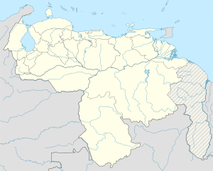
| pushpin_map_alt = Map showing the location of Cocorote Municipality within Venezuela |
|||
| ⚫ | |||
| |
| pushpin_mapsize = 300px |
||
| pushpin_map_caption = Location in Venezuela |
|||
|established_title = |
|||
| ⚫ | |||
|established_date = |
|||
| |
| subdivision_type = Country |
||
| subdivision_name = {{flag|Venezuela}} |
|||
|area_total_km2 = 135 |
|||
| ⚫ | |||
| ⚫ | |||
| |
| subdivision_name1 = [[Yaracuy]] |
||
| seat_type = [[Municipal seat]] |
|||
|population_as_of = 2001 |
|||
| seat = {{#invoke:Wikidata|getValue|P36|FETCH_WIKIDATA}} |
|||
|population_note = |
|||
| ⚫ | |||
| ⚫ | |||
| |
| leader_name = |
||
| ⚫ | |||
| ⚫ | |||
| |
| elevation_m = |
||
| area_total_km2 = {{#invoke:String|replace|{{#invoke:String|replace|{{#invoke:String|replace|{{#property:P2046}}|±0 |replace=}}|square kilometre|replace=}}|pattern=,|replace=}} |
|||
| ⚫ | |||
| |
| population_as_of = 2001 |
||
| |
| population_note = |
||
| ⚫ | |||
| ⚫ | |||
| population_footnotes = |
|||
| ⚫ | |||
| ⚫ | |||
| ⚫ | |||
| |
| established_title = Founded |
||
| |
| established_date = |
||
| established_title1 = Established |
|||
| ⚫ | |||
| |
| established_date1 = |
||
| established_title2 = Incorporated |
|||
| ⚫ | |||
| established_date2 = |
|||
| timezone = [[Venezuelan Standard Time Zone|VET]] |
|||
| ⚫ | |||
| area_code_type = [[Telephone numbers in Venezuela|Area code(s)]] |
|||
| area_code = |
|||
| postal_code_type = [[Postal code]](s) |
|||
| ⚫ | |||
| website = |
|||
| footnotes = {{main other|{{EditOnWikidata}}}} |
|||
}} |
}} |
||
'''Cocorote''' is one of the 14 municipalities of the state of [[Yaracuy]], [[Venezuela]]. The municipality is located in central Yaracuy, occupying an area of 135 km ² with a population of 35,668 inhabitants in 2001.<ref>[http://www.statoids.com/yve.html Statoids]</ref> The capital lies at [[Cocorote]]. |
'''Cocorote''' is one of the 14 municipalities of the state of [[Yaracuy]], [[Venezuela]]. The municipality is located in central Yaracuy, occupying an area of 135 km ² with a population of 35,668 inhabitants in 2001.<ref>[http://www.statoids.com/yve.html Statoids]</ref> The capital lies at [[Cocorote]]. |
||
| Line 50: | Line 59: | ||
==References== |
==References== |
||
{{reflist}} |
{{reflist}} |
||
==External links== |
|||
*[https://web.archive.org/web/20060222235238/http://cocorote-yaracuy.gob.ve/portal-alcaldias/ Official site] |
|||
| ⚫ | |||
[[Category:Municipalities of Yaracuy]] |
[[Category:Municipalities of Yaracuy]] |
||
| ⚫ | |||
Latest revision as of 13:06, 20 September 2024
Cocorote Municipality
Municipio Cocorote | |
|---|---|
 Location in Yaracuy | |
| Coordinates: 10°16′41″N 68°45′40″W / 10.2781°N 68.7611°W | |
| Country | |
| State | Yaracuy |
| Municipal seat | Cocorote |
| Area | |
• Total | 101.0 km2 (39.0 sq mi) |
| Population (2001) | |
• Total | 35,668 |
| • Density | 350/km2 (910/sq mi) |
| Time zone | UTC−4 (VET) |
Cocorote is one of the 14 municipalities of the state of Yaracuy, Venezuela. The municipality is located in central Yaracuy, occupying an area of 135 km ² with a population of 35,668 inhabitants in 2001.[1] The capital lies at Cocorote.
The economy is based essentially on agriculture. However, the town has been experiencing rapid growth for twenty years with increased commercial services.
References
[edit]


