Agordat Airport: Difference between revisions
Appearance
Content deleted Content added
format |
m –{{Eritrea-geo-stub}} using StubSorter |
||
| (7 intermediate revisions by 6 users not shown) | |||
| Line 32: | Line 32: | ||
| elevation-f = 2054 |
| elevation-f = 2054 |
||
| elevation-m = |
| elevation-m = |
||
| coordinates = |
| coordinates = {{coord|15|32|10|N|37|51|45|E|display=inline,title}} |
||
| latd = 15 | latm = 32 | lats = 10 | latNS = N |
|||
| longd= 37 | longm= 51 | longs= 45 | longEW= E |
|||
| coordinates_type = |
|||
| coordinates_region = |
|||
| coordinates_notitle = |
|||
| website = |
| website = |
||
| image_map = |
| image_map = |
||
| Line 45: | Line 40: | ||
| pushpin_map = Eritrea |
| pushpin_map = Eritrea |
||
| pushpin_label_position = |
| pushpin_label_position = |
||
| pushpin_label = ''' |
| pushpin_label = '''HHAG''' |
||
| pushpin_map_alt = |
| pushpin_map_alt = |
||
| pushpin_mapsize = |
| pushpin_mapsize = |
||
| Line 62: | Line 57: | ||
| stat1-data = <!-- up to stat4 --> |
| stat1-data = <!-- up to stat4 --> |
||
| stat-year = |
| stat-year = |
||
| footnotes = Source: Google Maps<ref>[ |
| footnotes = Source: Google Maps<ref>[https://maps.google.com/?ll=15.535988,37.864047&spn=0.010792,0.011201&t=h&z=17 Google Maps - Agordat]</ref> |
||
}} |
|||
'''Agordat Airport''' {{airport codes |
'''Agordat Airport''' {{airport codes|HHAG}} is an airstrip serving [[Agordat]], [[Eritrea]]. |
||
==See also== |
==See also== |
||
| Line 72: | Line 68: | ||
==References== |
==References== |
||
{{reflist}} |
{{reflist}} |
||
* |
*[http://www.gcmap.com/airport/HHAG Great Circle Mapper - Agordat] |
||
* |
*Google Earth |
||
{{authority control}} |
|||
==External links== |
|||
| ⚫ | |||
{{Eritrea-airport-stub}} |
|||
[[Category:Airports in Eritrea]] |
[[Category:Airports in Eritrea]] |
||
| ⚫ | |||
Latest revision as of 16:32, 20 September 2024
Agordat Airport | |||||||||||
|---|---|---|---|---|---|---|---|---|---|---|---|
| Summary | |||||||||||
| Airport type | Public | ||||||||||
| Serves | Agordat | ||||||||||
| Elevation AMSL | 2,054 ft / 626 m | ||||||||||
| Coordinates | 15°32′10″N 37°51′45″E / 15.53611°N 37.86250°E | ||||||||||
| Map | |||||||||||
 | |||||||||||
| Runways | |||||||||||
| |||||||||||
Source: Google Maps[1] | |||||||||||
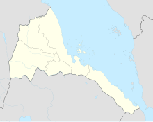
Agordat Airport (IATA: HHAG) is an airstrip serving Agordat, Eritrea.
See also
[edit]References
[edit]- Great Circle Mapper - Agordat
- Google Earth

