Southorpe: Difference between revisions
Appearance
Content deleted Content added
m robot Adding: pl:Southorpe |
population |
||
| (20 intermediate revisions by 16 users not shown) | |||
| Line 1: | Line 1: | ||
{{ |
{{about|the place in Cambridgeshire}} |
||
{{Use dmy dates|date=December 2016}} |
|||
| ⚫ | |||
{{Use British English|date=December 2016}} |
|||
| ⚫ | |||
{{Infobox UK place |
|||
| region= East of England |
|||
| ⚫ | |||
| ⚫ | |||
| |
| country = England |
||
| |
| region = East of England |
||
| ⚫ | |||
| ⚫ | |||
| coordinates = {{coord|52.6|-0.4|display=inline,title}} |
|||
| postcode_area= |
|||
| ⚫ | |||
| ⚫ | |||
| |
| postcode_area = PE |
||
| ⚫ | |||
| ⚫ | |||
| |
| dial_code = |
||
| ⚫ | |||
| ⚫ | |||
| unitary_england = [[City of Peterborough|Peterborough]] |
|||
| population= |
|||
| ⚫ | |||
| ⚫ | |||
| population_ref = (2021 census) |
|||
| static_image = Hall Farm, Southorpe - geograph.org.uk - 3019661.jpg |
|||
| static_image_caption= Hall Farm |
|||
}} |
}} |
||
'''Southorpe''' is a [[civil parishes in England|civil parish]] in |
'''Southorpe''' is a settlement and [[civil parishes in England|civil parish]] in [[Cambridgeshire]], England. It is now within the [[City of Peterborough|Peterborough]] [[Unitary authorities of England|unitary authority]] area of the ceremonial county of Cambridgeshire but it was part of the [[Soke of Peterborough]], an historic area that was traditionally associated with [[Northamptonshire]]. For electoral purposes it forms part of [[Barnack]] ward in [[North West Cambridgeshire (UK Parliament constituency)|North West Cambridgeshire]] constituency. The nearest town is [[Stamford, Lincolnshire|Stamford]] in Lincolnshire. In 2021 the parish had a population of 145. |
||
In the parish, towards Barnack, is the Grade I listed [[Walcot Hall]]. |
|||
==See also== |
==See also== |
||
*[[Southorpe Meadow]] |
*[[Southorpe Meadow]] |
||
*[[Southorpe Paddock]] |
*[[Southorpe Paddock]] |
||
| ⚫ | |||
*[[Ufford Bridge railway station]] |
|||
==External links== |
|||
{{Commons category-inline|Southorpe}} |
|||
{{Peterborough}} |
{{Peterborough}} |
||
[[Category: |
[[Category:Hamlets in Cambridgeshire]] |
||
[[Category:Peterborough]] |
[[Category:Geography of Peterborough]] |
||
[[Category:Civil parishes in Cambridgeshire]] |
[[Category:Civil parishes in Cambridgeshire]] |
||
{{Cambridgeshire-geo-stub}} |
{{Cambridgeshire-geo-stub}} |
||
| ⚫ | |||
[[pl:Southorpe]] |
|||
Latest revision as of 17:15, 20 September 2024
| Southorpe | |
|---|---|
 Hall Farm | |
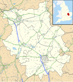
Location within Cambridgeshire | |
| Population | 145 (2021 census) |
| Unitary authority | |
| Ceremonial county | |
| Region | |
| Country | England |
| Sovereign state | United Kingdom |
| Post town | Stamford |
| Postcode district | PE9 |
| Police | Cambridgeshire |
| Fire | Cambridgeshire |
| Ambulance | East of England |
Southorpe is a settlement and civil parish in Cambridgeshire, England. It is now within the Peterborough unitary authority area of the ceremonial county of Cambridgeshire but it was part of the Soke of Peterborough, an historic area that was traditionally associated with Northamptonshire. For electoral purposes it forms part of Barnack ward in North West Cambridgeshire constituency. The nearest town is Stamford in Lincolnshire. In 2021 the parish had a population of 145.
In the parish, towards Barnack, is the Grade I listed Walcot Hall.
See also
[edit]External links
[edit]![]() Media related to Southorpe at Wikimedia Commons
Media related to Southorpe at Wikimedia Commons

