Moutamba District: Difference between revisions
Appearance
Content deleted Content added
District link |
Afus199620 (talk | contribs) No edit summary |
||
| (8 intermediate revisions by 5 users not shown) | |||
| Line 1: | Line 1: | ||
{{Infobox settlement |
{{Infobox settlement |
||
|name = |
|name = Moutamba |
||
|settlement_type =[[Districts of the Republic of the Congo|District]]<!--For Town or Village (Leave blank for the default City)--> |
|settlement_type =[[Districts of the Republic of the Congo|District]]<!--For Town or Village (Leave blank for the default City)--> |
||
|official_name = |
|official_name = |
||
| Line 18: | Line 18: | ||
|image_blank_emblem = |
|image_blank_emblem = |
||
|blank_emblem_size = |
|blank_emblem_size = |
||
|image_map = |
|image_map = |
||
|mapsize = |
|mapsize = |
||
|map_caption = |
|map_caption = |
||
|image_map1 = |
|image_map1 = |
||
|mapsize1 = |
|mapsize1 = |
||
| Line 44: | Line 44: | ||
|unit_pref =Imperial<!--Enter: Imperial, if Imperial (metric) is desired--> |
|unit_pref =Imperial<!--Enter: Imperial, if Imperial (metric) is desired--> |
||
|area_footnotes = |
|area_footnotes = |
||
|area_total_km2 = |
|area_total_km2 = 3,274 |
||
|area_land_km2 = |
|area_land_km2 = |
||
|area_water_km2 = |
|area_water_km2 = |
||
| Line 55: | Line 55: | ||
|area_metro_km2 = |
|area_metro_km2 = |
||
|area_metro_sq_mi = |
|area_metro_sq_mi = |
||
|population_as_of = |
|population_as_of = 2023 census |
||
|population_footnotes = <ref name="citypopulation">{{Cite web |title=Congo (Rep.): Administrative Division |url=https://www.citypopulation.de/en/congo/admin/ |access-date=2024-02-03 |website=www.citypopulation.de}}</ref> |
|||
|population_footnotes = |
|||
|population_note = |
|population_note = |
||
|population_total = |
|population_total = 22,936 |
||
|population_density_km2 = |
|population_density_km2 = auto |
||
|population_density_sq_mi = |
|population_density_sq_mi = |
||
|population_metro = |
|population_metro = |
||
| Line 83: | Line 83: | ||
}} |
}} |
||
''' |
'''Moutamba''' (can also be written as ''Mutamba'') is a [[Districts of the Republic of the Congo|district]] in the [[Niari Region]] of south-western [[Republic of the Congo]]. The capital lies at [[Mossendjo]]. |
||
The district was created from Mossendjo District in 1984.<ref>{{cite web|url=http://www.republique-congo.com/geo/cdregeo2|title=Découpage administratif|accessdate=29 January 2019}}</ref> |
|||
==Towns and villages== |
==Towns and villages== |
||
*[[Mossendjo]] |
|||
*[[Moutamba]] |
|||
==References== |
|||
{{Ref-list}} |
|||
{{Districts of the Republic of the Congo}} |
{{Districts of the Republic of the Congo}} |
||
| Line 92: | Line 99: | ||
[[Category:Districts of the Republic of the Congo]] |
[[Category:Districts of the Republic of the Congo]] |
||
{{RCongo-geo-stub}} |
{{RCongo-geo-stub}} |
||
Latest revision as of 15:36, 5 October 2024
Moutamba | |
|---|---|
 | |
| Country | |
| Region | Niari Region |
| Area | |
• Total | 1,264 sq mi (3,274 km2) |
| Population (2023 census)[1] | |
• Total | 22,936 |
| • Density | 18/sq mi (7.0/km2) |
| Time zone | UTC+1 (GMT +1) |
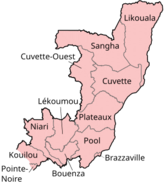
Moutamba (can also be written as Mutamba) is a district in the Niari Region of south-western Republic of the Congo. The capital lies at Mossendjo.
The district was created from Mossendjo District in 1984.[2]
Towns and villages
[edit]References
[edit]- ^ "Congo (Rep.): Administrative Division". www.citypopulation.de. Retrieved 2024-02-03.
- ^ "Découpage administratif". Retrieved 29 January 2019.

