Nokaneng Airport: Difference between revisions
Appearance
Content deleted Content added
Undid revision 904005636 by 51.7.229.207 (talk)revert WP:DE, WP:NOTHERE |
Adding short description: "Airport in Botswana", overriding automatically generated description |
||
| (6 intermediate revisions by 5 users not shown) | |||
| Line 1: | Line 1: | ||
{{Short description|Airport in Botswana}} |
|||
{{Use dmy dates|date=April 2022}} |
|||
{{Infobox airport |
{{Infobox airport |
||
| name = Nokaneng Airport |
| name = Nokaneng Airport |
||
| nativename = |
| nativename = |
||
| nativename-a = |
| nativename-a = |
||
| nativename-r = |
| nativename-r = |
||
| image = |
| image = |
||
| image-width = <!-- if less than 200 --> |
| image-width = <!-- if less than 200 --> |
||
| caption = |
| caption = |
||
| image2 = |
| image2 = |
||
| image2-width = <!-- if less than 200 --> |
| image2-width = <!-- if less than 200 --> |
||
| caption2 = |
| caption2 = |
||
| IATA = |
| IATA = |
||
| ICAO = FBNN |
| ICAO = FBNN |
||
| FAA = |
| FAA = |
||
| TC = |
| TC = |
||
| LID = |
| LID = |
||
| GPS = |
| GPS = |
||
| WMO = |
| WMO = |
||
| type = |
| type = |
||
| owner-oper = |
| owner-oper = |
||
| owner = |
| owner = |
||
| operator = |
| operator = [[Civil Aviation Authority of Botswana]] |
||
| city-served = [[Nokaneng]], [[Botswana]] |
| city-served = [[Nokaneng]], [[Botswana]] |
||
| location = |
| location = |
||
| hub = |
| hub = |
||
| built = <!-- military airports --> |
| built = <!-- military airports --> |
||
| used = <!-- military airports --> |
| used = <!-- military airports --> |
||
| commander = <!-- military airports --> |
| commander = <!-- military airports --> |
||
| occupants = <!-- military airports --> |
| occupants = <!-- military airports --> |
||
| metric-elev = |
| metric-elev = |
||
| elevation-f = 3145 |
| elevation-f = 3145 |
||
| elevation-m = |
| elevation-m = |
||
| coordinates = {{coord|19|40|50|S|22|11|57|E|type:airport_region:BW|display=inline,title}} |
| coordinates = {{coord|19|40|50|S|22|11|57|E|type:airport_region:BW|display=inline,title}} |
||
| website |
| website = |
||
| image_map |
| image_map = |
||
| image_mapsize |
| image_mapsize = |
||
| image_map_alt |
| image_map_alt = |
||
| image_map_caption |
| image_map_caption = |
||
| pushpin_map |
| pushpin_map = Botswana |
||
| pushpin_label_position = |
| pushpin_label_position = |
||
| pushpin_label |
| pushpin_label = '''FBNN''' |
||
| pushpin_map_alt |
| pushpin_map_alt = |
||
| pushpin_mapsize |
| pushpin_mapsize = |
||
| pushpin_image |
| pushpin_image = |
||
| pushpin_map_caption |
| pushpin_map_caption = Location of airport in Botswana |
||
| r1-number = 04/22 |
| r1-number = 04/22 |
||
| r1-length-f = |
| r1-length-f = |
||
| r1-length-m = 840 |
| r1-length-m = 840 |
||
| r1-surface = Grass |
| r1-surface = Grass |
||
| metric-rwy = y |
| metric-rwy = y |
||
| footnotes = Source: GCM<ref name="GCM">{{GCM|FBNN|Nokaneng Airport}}</ref> Google Maps<ref>[https://www.google.com/maps/@-19.6805008,22.1989654,2942m/data=!3m1!1e3 Google Maps - Nokaneng]</ref> |
| footnotes = Source: GCM<ref name="GCM">{{GCM|FBNN|Nokaneng Airport}}</ref> Google Maps<ref>[https://www.google.com/maps/@-19.6805008,22.1989654,2942m/data=!3m1!1e3 Google Maps - Nokaneng]</ref> |
||
}} |
}} |
||
| Line 55: | Line 57: | ||
==See also== |
==See also== |
||
*{{portal-inline|Botswana}} |
|||
*{{portal-inline|Aviation}} |
*{{portal-inline|Aviation}} |
||
*[[Transport in Botswana]] |
*[[Transport in Botswana]] |
||
| Line 64: | Line 65: | ||
==External links== |
==External links== |
||
*[https://www.openstreetmap.org/#map=13/-19.6908/22.2031 OpenStreetMap - Nokaneng] |
|||
*[http://ourairports.com/airports/FBNN/pilot-info.html#general OurAirports - Nokaneng] |
*[http://ourairports.com/airports/FBNN/pilot-info.html#general OurAirports - Nokaneng] |
||
*[http://www.fallingrain.com/icao/FBNN.html Fallingrain - Nokaneng Airport] |
*[http://www.fallingrain.com/icao/FBNN.html Fallingrain - Nokaneng Airport] |
||
| Line 70: | Line 70: | ||
{{Airports in Botswana|state=collapsed}} |
{{Airports in Botswana|state=collapsed}} |
||
{{authority control}} |
|||
[[Category:Airports in Botswana]] |
[[Category:Airports in Botswana]] |
||
[[Category:North-West District (Botswana)]] |
[[Category:North-West District (Botswana)]] |
||
{{Botswana-airport-stub}} |
|||
Latest revision as of 22:42, 11 October 2024
Nokaneng Airport | |||||||||||
|---|---|---|---|---|---|---|---|---|---|---|---|
| Summary | |||||||||||
| Operator | Civil Aviation Authority of Botswana | ||||||||||
| Serves | Nokaneng, Botswana | ||||||||||
| Elevation AMSL | 3,145 ft / 959 m | ||||||||||
| Coordinates | 19°40′50″S 22°11′57″E / 19.68056°S 22.19917°E | ||||||||||
| Map | |||||||||||
 | |||||||||||
| Runways | |||||||||||
| |||||||||||
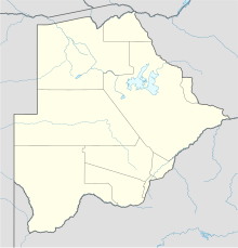
Nokaneng Airport (ICAO: FBNN) is an airport serving the village of Nokaneng on the western edge of the Okavango Delta in Botswana. The runway is 2 kilometres (1.2 mi) southeast of the village.
See also
[edit]References
[edit]- ^ Airport information for Nokaneng Airport at Great Circle Mapper.
- ^ Google Maps - Nokaneng
External links
[edit]- OurAirports - Nokaneng
- Fallingrain - Nokaneng Airport
- Accident history for Nokaneng Airport at Aviation Safety Network

