Romsey (UK Parliament constituency): Difference between revisions
m add {{Use dmy dates}} |
Entranced98 (talk | contribs) Adding local short description: "Former parliamentary constituency in the United Kingdom", overriding Wikidata description "Parliamentary constituency in the United Kingdom, 1983-2010" |
||
| (3 intermediate revisions by 2 users not shown) | |||
| Line 1: | Line 1: | ||
{{Short description|Former parliamentary constituency in the United Kingdom}} |
|||
{{Use dmy dates|date=April 2022}} |
{{Use dmy dates|date=April 2022}} |
||
{{More citations needed|date=December 2009}} |
{{More citations needed|date=December 2009}} |
||
| Line 384: | Line 385: | ||
{{Election box candidate with party link| |
{{Election box candidate with party link| |
||
|party = Labour Party (UK) |
|party = Labour Party (UK) |
||
|candidate = |
|candidate = Matthew Knight |
||
|votes = 6,604 |
|votes = 6,604 |
||
|percentage = 12.3 |
|percentage = 12.3 |
||
| Line 409: | Line 410: | ||
== Notes and references == |
== Notes and references == |
||
{{reflist}} |
{{reflist}} |
||
==External links== |
|||
*[https://mapit.mysociety.org/area/13323.html Romsey UK Parliament constituency] (boundaries April 1997 – April 2010) at ''MapIt UK'' |
|||
{{Constituencies in South East England}} |
{{Constituencies in South East England}} |
||
{{DEFAULTSORT:Romsey (Uk Parliament Constituency)}} |
|||
[[Category:Constituencies of the Parliament of the United Kingdom established in 1983]] |
[[Category:Constituencies of the Parliament of the United Kingdom established in 1983]] |
||
[[Category:Constituencies of the Parliament of the United Kingdom disestablished in 2010]] |
[[Category:Constituencies of the Parliament of the United Kingdom disestablished in 2010]] |
||
Latest revision as of 15:14, 12 October 2024
This article needs additional citations for verification. (December 2009) |
51°00′14″N 1°29′28″W / 51.004°N 1.491°W
| Romsey | |
|---|---|
| Former county constituency for the House of Commons | |
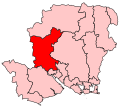
 Boundary of Romsey in Hampshire for the 2005 general election | |
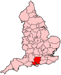
 Location of Hampshire within England | |
| County | Hampshire |
| 1983–2010 | |
| Seats | One |
| Created from | Eastleigh (fraction of), New Forest (fraction of) |
| Replaced by | Romsey and Southampton North |
Romsey was a seat of the House of Commons of the UK Parliament 1983–2010 which accordingly (as with all seats since 1950) elected one Member of Parliament (MP) by the first past the post system of election. It is virtually tantamount to its replacement Romsey and Southampton North which takes in two typical-size local government wards of the United Kingdom named after and approximate to the Bassett and Swaythling parts of Southampton.
Boundaries
[edit]
1983–1997: The Borough of Test Valley wards of Abbey, Blackwater, Chilworth and Nursling, Cuppernham, Field, North Baddesley, Romsey Extra, and Tadburn, and the District of New Forest wards of Blackfield and Langley, Colbury, Dibden and Hythe North, Dibden Purlieu, Fawley Holbury, Hythe South, Marchwood, Netley Marsh, Totton Central, Totton North, and Totton South.
1997–2010: The Borough of Test Valley wards of Abbey, Blackwater, Chilworth and Nursling, Cuppernham, Dun Valley, Field, Harewood, Kings Somborne and Michelmersh, Nether Wallop and Broughton, North Baddesley, Over Wallop, Romsey Extra, Stockbridge, and Tadburn, the Borough of Eastleigh wards of Chandler's Ford, Hiltingbury East, and Hiltingbury West, and the City of Southampton ward of Bassett.
The constituency was approximate to the Test Valley district of Hampshire and covered a smaller area as parts of the north of Test Valley fell into part of the North West Hampshire seat to roughly ensure equal size electorates (low malapportionment). The main town within the constituency was Romsey.
History
[edit]The constituency was created in 1983 from parts of the seats of Eastleigh and New Forest. It was originally named Romsey and Waterside and included areas such as Hythe and Fawley on the west side of Southampton Water. In 1997 it lost the Waterside area and gained the Bassett Ward of the City of Southampton, and new territory in the north of the Test Valley district, and was consequently renamed to just Romsey. The first MP, Michael Colvin, held the constituency from its creation until his death in 2000. This led to a by-election, which was won by Liberal Democrat Sandra Gidley, who held the seat in the two subsequent General Elections.
Following their review of parliamentary representation in Hampshire, the Boundary Commission for England created a modified Romsey constituency called Romsey and Southampton North, to reflect the fact that two wards of Southampton form part of the constituency (though one ward had in fact formed part of the constituency since 1997).
Sandra Gidley lost to the Conservatives in the 2010 general election when she contested the new seat. She was succeeded by Caroline Nokes.
Members of Parliament
[edit]| Election | Member [1] | Party | Notes | |
|---|---|---|---|---|
| 1983 | Michael Colvin | Conservative | constituency created as Romsey and Waterside, renamed Romsey in 1997 | |
| 2000 by-election | Sandra Gidley | Liberal Democrats | ||
| 2010 | constituency abolished: see Romsey and Southampton North | |||
Elections
[edit]Elections in the 2000s
[edit]| Party | Candidate | Votes | % | ±% | |
|---|---|---|---|---|---|
| Liberal Democrats | Sandra Gidley | 22,465 | 44.7 | −2.3 | |
| Conservative | Caroline Nokes | 22,340 | 44.4 | +2.3 | |
| Labour | Matthew Stevens | 4,430 | 8.8 | +0.6 | |
| UKIP | Michael Wigley | 1,076 | 2.1 | +0.6 | |
| Majority | 125 | 0.3 | −4.6 | ||
| Turnout | 50,311 | 69.7 | +2.5 | ||
| Liberal Democrats hold | Swing | −2.3 | |||
| Party | Candidate | Votes | % | ±% | |
|---|---|---|---|---|---|
| Liberal Democrats | Sandra Gidley | 22,756 | 47.0 | +17.6 | |
| Conservative | Paul Raynes | 20,386 | 42.1 | −3.9 | |
| Labour | Stephen Roberts | 3,986 | 8.2 | −10.4 | |
| UKIP | Anthony McCabe | 730 | 1.5 | −2.0 | |
| Legalise Cannabis | Derrick Large | 601 | 1.2 | New | |
| Majority | 2,370 | 4.9 | N/A | ||
| Turnout | 48,459 | 67.2 | −9.2 | ||
| Liberal Democrats gain from Conservative | Swing | ||||
| Party | Candidate | Votes | % | ±% | |
|---|---|---|---|---|---|
| Liberal Democrats | Sandra Gidley | 19,571 | 50.6 | +21.2 | |
| Conservative | Tim Palmer | 16,260 | 42.0 | −4.0 | |
| Labour | Andy Howard | 1,451 | 3.7 | −14.9 | |
| UKIP | Garry Rankin-Moore | 901 | 2.3 | −1.2 | |
| Legalise Cannabis | Derrick Large | 417 | 1.1 | New | |
| Independent | Thomas Lamont | 109 | 0.3 | New | |
| Majority | 3,311 | 8.6 | N/A | ||
| Turnout | 38,709 | 55.4 | −21.0 | ||
| Liberal Democrats gain from Conservative | Swing | ||||
Elections in the 1990s
[edit]| Party | Candidate | Votes | % | ±% | |
|---|---|---|---|---|---|
| Conservative | Michael Colvin | 23,834 | 46.0 | −17.2 | |
| Liberal Democrats | Mark G. Cooper | 15,249 | 29.4 | +6.3 | |
| Labour | Joanne V. Ford | 9,623 | 18.6 | +5.7 | |
| UKIP | Alan Sked | 1,824 | 3.5 | New | |
| Referendum | Michael J.L. Wigley | 1,291 | 2.5 | New | |
| Majority | 8,585 | 16.57 | −23.5 | ||
| Turnout | 51,821 | 76.4 | −6.8 | ||
| Conservative hold | Swing | ||||
| Party | Candidate | Votes | % | ±% | |
|---|---|---|---|---|---|
| Conservative | Michael Colvin | 37,375 | 54.4 | −2.0 | |
| Liberal Democrats | George Dawson | 22,071 | 32.1 | +0.1 | |
| Labour | Angela Mawle | 8,688 | 12.6 | +1.1 | |
| Green | John C.T. Spottiswood | 577 | 0.8 | New | |
| Majority | 15,304 | 22.3 | −2.2 | ||
| Turnout | 68,711 | 83.16 | +4.2 | ||
| Conservative hold | Swing | ||||
Elections in the 1980s
[edit]| Party | Candidate | Votes | % | ±% | |
|---|---|---|---|---|---|
| Conservative | Michael Colvin | 35,303 | 56.4 | −0.2 | |
| SDP | Alan Bloss | 20,031 | 32.0 | +0.9 | |
| Labour | Stephen Roberts | 7,213 | 11.5 | −0.8 | |
| Majority | 15,272 | 24.5 | −1.0 | ||
| Turnout | 62,547 | 79.0 | +3.2 | ||
| Conservative hold | Swing | ||||
| Party | Candidate | Votes | % | ±% | |
|---|---|---|---|---|---|
| Conservative | Michael Colvin | 30,361 | 56.6 | ||
| SDP | Alan Bloss | 16,671 | 31.1 | ||
| Labour | Matthew Knight | 6,604 | 12.3 | ||
| Majority | 13,690 | 25.5 | |||
| Turnout | 53,636 | 75.8 | |||
| Conservative win (new seat) | |||||
See also
[edit]Notes and references
[edit]- ^ Leigh Rayment's Historical List of MPs – Constituencies beginning with "R" (part 2)
- ^ "Election Data 2005". Electoral Calculus. Archived from the original on 15 October 2011. Retrieved 18 October 2015.
- ^ "Election Data 2001". Electoral Calculus. Archived from the original on 15 October 2011. Retrieved 18 October 2015.
- ^ "Election Data 1997". Electoral Calculus. Archived from the original on 15 October 2011. Retrieved 18 October 2015.
- ^ "Election Data 1992". Electoral Calculus. Archived from the original on 15 October 2011. Retrieved 18 October 2015.
- ^ "Election Data 1987". Electoral Calculus. Archived from the original on 15 October 2011. Retrieved 18 October 2015.
- ^ "Election Data 1983". Electoral Calculus. Archived from the original on 15 October 2011. Retrieved 18 October 2015.
External links
[edit]- Romsey UK Parliament constituency (boundaries April 1997 – April 2010) at MapIt UK
