Muduuma: Difference between revisions
Appearance
Content deleted Content added
→Location: new referenced data |
Removed image(s) not related to the article, and those that were wrongly placed images in the article or many images that were added as part of the Wikipedia Pages Wanting Photos (WPWP) campaign images. This is part of the WPWP clean up 2024 #WPWPUGCleanUp #WCUG2024CleanUp Tags: Manual revert Contest or editathon Visual edit |
||
| (7 intermediate revisions by 4 users not shown) | |||
| Line 1: | Line 1: | ||
{{inuse}} |
|||
{{Infobox settlement |
{{Infobox settlement |
||
|official_name = Muduuma |
|official_name = Muduuma |
||
| Line 12: | Line 10: | ||
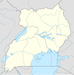
|pushpin_map_caption = Map of Uganda showing the location of Muduuma |
|pushpin_map_caption = Map of Uganda showing the location of Muduuma |
||
|pushpin_map = Uganda |
|pushpin_map = Uganda |
||
|coordinates_region = UG |
|||
|subdivision_type = Country |
|subdivision_type = Country |
||
|subdivision_name = {{flag|Uganda}} |
|subdivision_name = {{flag|Uganda}} |
||
| Line 36: | Line 33: | ||
|timezone = [[East Africa Time|EAT]] |
|timezone = [[East Africa Time|EAT]] |
||
|utc_offset = +3 |
|utc_offset = +3 |
||
|coordinates = {{coord|00|20|48|N|32|18|28|E|region:UG|display=inline}} |
|||
|latd=00|latm=20|lats=48|latNS=N |
|||
|longd=32|longm=18|longs=28|longEW=E |
|||
|elevation_m = |
|elevation_m = |
||
|latitude = |
|latitude = |
||
| Line 59: | Line 55: | ||
* The offices of Muduuma Town Council |
* The offices of Muduuma Town Council |
||
* Muduuma Central Market |
* Muduuma Central Market |
||
* Muduuma Health Centre III<ref>{{cite web| accessdate=14 October 2016| url=http://www.observer.ug/lifestyle/44409-muduuma-health-centre-choking-with-bushes | title=Muduuma health centre choking with bushes | date=25 May 2016| |
* Muduuma Health Centre III<ref>{{cite web| accessdate=14 October 2016| url=http://www.observer.ug/lifestyle/44409-muduuma-health-centre-choking-with-bushes | title=Muduuma health centre choking with bushes | date=25 May 2016|first=Alfred | last=Ochwo | newspaper=[[The Observer (Uganda)]] | location=Kampala}}</ref> |
||
* Headquarters of Muduuma sub-county<ref>{{cite web|date=14 October 2016| url=http://www.lcmt.org/uganda/mpigi/muduma |accessdate=14 October 2016| title=Muduuma Subcounty: Parishes in Muduma Subcounty |author=LCMT | publisher=Lcmt.org (LCMT)}}</ref> |
|||
first=Alfred | last=Ochwo | newspaper=[[The Observer (Uganda)]] | location=Kampala}}</ref> |
|||
==External links== |
|||
==See also== |
|||
==References== |
==References== |
||
| Line 75: | Line 65: | ||
{{coord|00|20|48|N|32|18|28|E|display=title}} |
{{coord|00|20|48|N|32|18|28|E|display=title}} |
||
[[Category:Populated places in Uganda]] |
[[Category:Populated places in Central Region, Uganda]] |
||
[[Category:Cities in the Great Rift Valley]] |
[[Category:Cities in the Great Rift Valley]] |
||
[[Category:Central Region, Uganda]] |
|||
[[Category:Mpigi District]] |
[[Category:Mpigi District]] |
||
Latest revision as of 14:21, 18 October 2024
Muduuma | |
|---|---|
| Coordinates: 00°20′48″N 32°18′28″E / 0.34667°N 32.30778°E | |
| Country | |
| Region | Central Uganda |
| District | Mpigi District |
| Constituency | Mawokota County North |
| Government | |
| • Member of Parliament | Amelia Kyambadde |
| Time zone | UTC+3 (EAT) |
Muduuma is a town in central Uganda. It is one of the urban centers in Mpigi District.
Location
[edit]The town is situated along the Kampala–Mityana Road, approximately 40 kilometres (25 mi), west of Kampala, Uganda's capital and largest city.[1] The coordinates of Muduuma are: 0°20'48.0"N, 32°18'28.0"E (Latitude:0.346680; Longitude:32.307766).[2]
Overview
[edit]Muduuma is a small urban center, surrounded by a rural agricultural community.[3]
Points of interest
[edit]The following points of interest lie within the town limits or close to the edges of town:
- The offices of Muduuma Town Council
- Muduuma Central Market
- Muduuma Health Centre III[4]
- Headquarters of Muduuma sub-county[5]
References
[edit]- ^ Globefeed.com (14 October 2016). "Distance between Post Office Building, Kampala Road, Kampala, Uganda and Muduuma Health Center III, Mawokota, Central Region, Uganda". Globefeed.com. Retrieved 14 October 2016.
- ^ "Location of Muduuma, Mpigi District, Uganda" (Map). Google Maps. Retrieved 14 October 2016.
- ^ Richard Kavuma (8 March 2013). "International women's day: a voice from Mawokota County North, Uganda". The Guardian. London. Retrieved 14 October 2016.
- ^ Ochwo, Alfred (25 May 2016). "Muduuma health centre choking with bushes". The Observer (Uganda). Kampala. Retrieved 14 October 2016.
- ^ LCMT (14 October 2016). "Muduuma Subcounty: Parishes in Muduma Subcounty". Lcmt.org (LCMT). Retrieved 14 October 2016.


