Jõelähtme: Difference between revisions
Appearance
Content deleted Content added
No edit summary |
|||
| (22 intermediate revisions by 12 users not shown) | |||
| Line 1: | Line 1: | ||
{{Short description|Village in Estonia}} |
|||
{{Infobox settlement |
{{Infobox settlement |
||
|official_name = Jõelähtme |
|official_name = Jõelähtme |
||
| Line 4: | Line 5: | ||
|settlement_type = Village |
|settlement_type = Village |
||
|motto = |
|motto = |
||
|image_skyline = |
|image_skyline =Jõelähtme kirik2.jpg |
||
|imagesize = |
|imagesize = |
||
|image_caption = Jõelähtme church |
|image_caption = Jõelähtme church |
||
| Line 12: | Line 13: | ||
|seal_size = |
|seal_size = |
||
|image_map = |
|image_map = |
||
| ⚫ | |||
|map_caption = |
|map_caption = |
||
|pushpin_map = |
|pushpin_map = |
||
|mapsize = |
|mapsize = |
||
|coordinates_display = inline,title |
|||
|coordinates_region = EE |
|||
|subdivision_type = Country |
|subdivision_type = Country |
||
|subdivision_name = {{flag|Estonia}} |
|subdivision_name = {{flag|Estonia}} |
||
| Line 30: | Line 28: | ||
|area_total_km2 = |
|area_total_km2 = |
||
|area_footnotes = |
|area_footnotes = |
||
|population_as_of = |
|population_as_of = [[2011 Estonia Census|2011]] |
||
|population_total = |
|population_total = 120 |
||
|population_density_km2 = |
|population_density_km2 = |
||
|timezone =[[Eastern European Time|EET]] |
|timezone =[[Eastern European Time|EET]] |
||
| Line 37: | Line 35: | ||
|timezone_DST = [[Eastern European Summer Time|EEST]] |
|timezone_DST = [[Eastern European Summer Time|EEST]] |
||
|utc_offset_DST = +3 |
|utc_offset_DST = +3 |
||
| ⚫ | |||
|latd=|latm=|lats= |latNS=N |
|||
|longd=|longm= |longs=|longEW=E |
|||
|area_code = |
|area_code = |
||
|website = |
|website = |
||
}} |
}} |
||
'''Jõelähtme''' is a village in [[Jõelähtme Parish]], [[Harju County]], northern [[Estonia]]. |
'''Jõelähtme''' ({{langx|de|Jegelecht}}) is a village in [[Jõelähtme Parish]], [[Harju County]], northern [[Estonia]].<ref>{{EHAK|2234}} (retrieved 27 July 2021)</ref> |
||
==Gallery== |
|||
<gallery mode="packed" heights="150"> |
|||
File:Jõelähtme postijaama peahoone1.jpg|Post office |
|||
File:Jõelähtme rahvamaja juulis 2018.jpg|Community centre |
|||
File:Vabadussõja mälestussammas Jõelähtmes.jpg|[[Estonian War of Independence]] memorial |
|||
</gallery> |
|||
==References== |
|||
{{Reflist}} |
|||
{{coord|59|26.5|N|25|08|E|region:EE_type:city|display=title}} |
{{coord|59|26.5|N|25|08|E|region:EE_type:city|display=title}} |
||
| Line 50: | Line 57: | ||
{{DEFAULTSORT:Joelahtme}} |
{{DEFAULTSORT:Joelahtme}} |
||
[[Category:Villages in |
[[Category:Villages in Harju County]] |
||
[[Category:Kreis Harrien]] |
|||
{{Harju-geo-stub}} |
{{Harju-geo-stub}} |
||
[[cs:Jõelähtme]] |
|||
[[et:Jõelähtme]] |
|||
[[fr:Jõelähtme]] |
|||
[[pl:Jõelähtme]] |
|||
[[vo:Jõelähtme]] |
|||
Latest revision as of 07:26, 21 October 2024
Jõelähtme | |
|---|---|
Village | |
 Jõelähtme church | |
 | |
| Country | |
| County | Harju County |
| Parish | Jõelähtme Parish |
| Population (2011) | |
• Total | 120 |
| Time zone | UTC+2 (EET) |
| • Summer (DST) | UTC+3 (EEST) |
Jõelähtme (German: Jegelecht) is a village in Jõelähtme Parish, Harju County, northern Estonia.[1]
Gallery
[edit]-
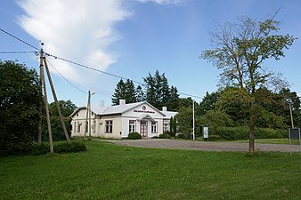
Post office
-
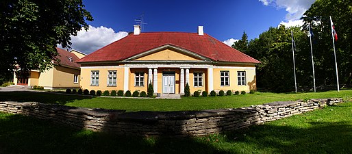
Community centre
-
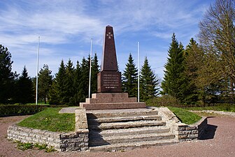
Estonian War of Independence memorial
References
[edit]- ^ Classification of Estonian administrative units and settlements 2014[dead link] (retrieved 27 July 2021)
59°26.5′N 25°08′E / 59.4417°N 25.133°E


