St. Margaret, Belize: Difference between revisions
Appearance
Content deleted Content added
Slowking Man (talk | contribs) m Fixed National Park |
ChiefNubNub (talk | contribs) mNo edit summary |
||
| (40 intermediate revisions by 29 users not shown) | |||
| Line 1: | Line 1: | ||
{{Unreferenced|date=December 2009}} |
|||
| ⚫ | '''St. |
||
{{Infobox settlement |
|||
|official_name = St. Margaret |
|||
|image_skyline = |
|||
|imagesize = |
|||
|image_caption = |
|||
|image_flag = |
|||
|image_seal = |
|||
|pushpin_map = Belize |
|||
|pushpin_mapsize = 300 |
|||
|map_caption = |
|||
|subdivision_type = [[List of sovereign states|Country]] |
|||
|subdivision_name = {{Flag|Belize}} |
|||
|subdivision_type1 = [[Districts of Belize|District]] |
|||
|subdivision_name1 = [[Cayo District]] |
|||
|subdivision_type2 = [[Constituencies of Belize|Constituency]] |
|||
|subdivision_name2 = [[Cayo South]] |
|||
|leader_title = |
|||
|leader_name = |
|||
|established_title = |
|||
|established_date = |
|||
|area_magnitude = |
|||
|area_total_km2 = |
|||
|area_total_sq_mi = |
|||
|area_land_km2 = |
|||
|area_land_sq_mi = |
|||
|area_water_km2 = |
|||
|area_water_sq_mi = |
|||
|area_water_percent = |
|||
|area_urban_km2 = |
|||
|area_urban_sq_mi = |
|||
|area_metro_km2 = |
|||
|area_metro_sq_mi = |
|||
|population_as_of = 2000 |
|||
|population_note = |
|||
|population_total = |
|||
|population_density_km2 = |
|||
|population_density_sq_mi = |
|||
|population_metro = |
|||
|population_density_metro_km2 = |
|||
|population_density_metro_sq_mi = |
|||
|population_urban = |
|||
|timezone = [[Central Time zone|Central]] |
|||
|utc_offset = -6 |
|||
|timezone_DST = |
|||
|utc_offset_DST = |
|||
|coordinates = {{coord|17|5|30|N|88|36|43|W|region:BZ|display=inline,title}} |
|||
|elevation_m = |
|||
|elevation_ft = |
|||
|website = |
|||
|footnotes = |
|||
}} |
|||
| ⚫ | '''St. Margaret''' (sometimes called '''St. Margaret's''') is a rural [[village]] in the [[Cayo District]] of [[Belize]], [[Central America]]. The settlement is located at mile 31 on the Hummingbird Highway, in the [[Maya Mountains]]. Hondurans, Guatemalans, Salvadorans, and native Belizeans populate the village. It is home to Five Blues Lake [[National park|National Park]]. The village has power, a police station, and cell service. The principal jobs are quarrying and refining [[limestone]] and agriculture. |
||
[[Category:Populated places in Cayo District]] |
|||
{{Belize-geo-stub}} |
|||
Latest revision as of 14:32, 21 October 2024
St. Margaret | |
|---|---|
| Coordinates: 17°5′30″N 88°36′43″W / 17.09167°N 88.61194°W | |
| Country | |
| District | Cayo District |
| Constituency | Cayo South |
| Time zone | UTC-6 (Central) |
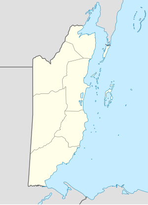
St. Margaret (sometimes called St. Margaret's) is a rural village in the Cayo District of Belize, Central America. The settlement is located at mile 31 on the Hummingbird Highway, in the Maya Mountains. Hondurans, Guatemalans, Salvadorans, and native Belizeans populate the village. It is home to Five Blues Lake National Park. The village has power, a police station, and cell service. The principal jobs are quarrying and refining limestone and agriculture.

