Labipur: Difference between revisions
Appearance
Content deleted Content added
Yamaguchi先生 (talk | contribs) |
|||
| (13 intermediate revisions by 12 users not shown) | |||
| Line 67: | Line 67: | ||
|footnotes = |
|footnotes = |
||
}} |
}} |
||
'''Labipur''' (a village) ({{ |
'''Labipur''' (a village) ({{langx|ne|लबिपुर}}) is a Tharu village located in the [[Itahari]] sub-metropolitan city of [[Sunsari District]] in the [[Koshi Zone]] of south-eastern [[Nepal]].<ref>{{Cite web| url=http://www.itaharimun.gov.np|title=Itahari Municipality}}</ref> |
||
Labipur was previously included in the village development committee known as Hansposha.<ref>{{Cite web| url=http://www.digitalhimalaya.com/collections/nepalcensus/output.php?selection=1|title=Nepal Census 2001|work=Nepal's Village Development Committees|publisher=[[Digital Himalaya]]|accessdate=2 December 2008}}</ref> |
Labipur was previously included in the village development committee known as Hansposha.<ref>{{Cite web| url=http://www.digitalhimalaya.com/collections/nepalcensus/output.php?selection=1|title=Nepal Census 2001|work=Nepal's Village Development Committees|publisher=[[Digital Himalaya]]|accessdate=2 December 2008}}</ref> |
||
Labipur chowk is the main bazar area of Labipur located in East-west Highway.<ref>{{cite web|url =http://www.anatravels.com/nepal_highways.php | title =Highways in Nepal | work = | first= | last= | publisher = |accessdate = }}</ref>{{not in source|date=August 2017}} |
|||
==References== |
==References== |
||
| Line 82: | Line 80: | ||
[[Category:Populated places in Sunsari District]] |
[[Category:Populated places in Sunsari District]] |
||
[[Category:Municipalities of Nepal]] |
|||
{{ |
{{Sunsari-geo-stub}} |
||
Latest revision as of 08:36, 23 October 2024
This article possibly contains original research. (August 2017) |
Labipur
लबिपुर जय थरूहट | |
|---|---|
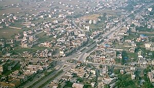
 Aerial view of Itahari | |
| Coordinates: 26°40′N 87°15′E / 26.667°N 87.250°E | |
| Country | |
| Zone | Koshi Zone |
| District | Sunsari District |
| Government | |
| • Type | Sub-metropolitan City |
| Area | |
• Total | 87.3301 km2 (33.7183 sq mi) |
| Time zone | UTC+5:45 (Nepal Time) |
| Postal Code | 56705 |
| Area code | 025 |
| Website | http://itaharimun.gov.np |
Labipur (a village) (Nepali: लबिपुर) is a Tharu village located in the Itahari sub-metropolitan city of Sunsari District in the Koshi Zone of south-eastern Nepal.[1]
Labipur was previously included in the village development committee known as Hansposha.[2]
References
[edit]- ^ "Itahari Municipality".
- ^ "Nepal Census 2001". Nepal's Village Development Committees. Digital Himalaya. Retrieved 2 December 2008.
External links
[edit]


