Kulkand: Difference between revisions
Appearance
Content deleted Content added
←Created page with '{{Infobox Settlement |name = Kulkand |native_name = |settlement_type=Town and Jamoat |image_skyline = |imagesize = |image_caption = |...' |
|||
| (16 intermediate revisions by 12 users not shown) | |||
| Line 1: | Line 1: | ||
{{Infobox |
{{Infobox settlement |
||
|name = Kulkand |
|name = Kulkand |
||
|native_name = {{langx|ru|Кулканд}} <br> {{langx|tg|Кӯлканд}} |
|||
|native_name = |
|||
|settlement_type= |
|settlement_type=[[jamoats of Tajikistan|Jamoat]] |
||
|image_skyline = |
|image_skyline = |
||
|imagesize = |
|imagesize = |
||
| Line 10: | Line 10: | ||
|image_map = |
|image_map = |
||
|map_caption = |
|map_caption = |
||
|pushpin_map = |
|pushpin_map = Tajikistan |
||
|pushpin_label_position =bottom |
|pushpin_label_position =bottom |
||
|pushpin_mapsize = |
|pushpin_mapsize = |
||
|pushpin_map_caption =Location in Tajikistan |
|pushpin_map_caption =Location in Tajikistan |
||
|subdivision_type = [[Countries of the world|Country]] |
|subdivision_type = [[Countries of the world|Country]] |
||
|subdivision_name = {{flag|Tajikistan}} |
|subdivision_name = {{flag|Tajikistan}} |
||
|subdivision_type1 = [[ |
|subdivision_type1 = [[Regions of Tajikistan|Region]] |
||
|subdivision_name1 = [[Sughd]] |
|subdivision_name1 = [[Sughd Region]] |
||
|subdivision_type2 = |
|subdivision_type2 = City |
||
|subdivision_name2 = [[Isfara |
|subdivision_name2 = [[Isfara]] |
||
|established_title = |
|established_title = |
||
|established_date = |
|established_date = |
||
| Line 34: | Line 34: | ||
|area_metro_km2 = |
|area_metro_km2 = |
||
|area_metro_sq_mi = |
|area_metro_sq_mi = |
||
|population_as_of= |
|population_as_of=2015 |
||
|population_footnotes = |
|population_footnotes = |
||
|population_total = |
|population_total = 22731 |
||
|population_urban = |
|population_urban = |
||
|population_metro = |
|population_metro = |
||
| Line 45: | Line 45: | ||
|timezone_DST = |
|timezone_DST = |
||
|utc_offset_DST = |
|utc_offset_DST = |
||
|coordinates = {{coord|40|09|N|70|42|E|display=it|region:TJ_type:city_source:GNS-enwiki}} |
|||
|latd=|latm=|lats=|latNS=N |
|||
|longd=|longm=|longs=|longEW=E |
|||
|elevation_footnotes= |
|elevation_footnotes= |
||
|elevation_m = |
|elevation_m = |
||
| Line 57: | Line 56: | ||
}} |
}} |
||
'''Kulkand''' |
'''Kulkand''' ({{langx|ru|Кулканд}}; [[Tajik language|Tajik]]: Кӯлканд/کولکند) is a village and [[Jamoats of Tajikistan|jamoat]] in northern [[Tajikistan]]. It is part of the city of [[Isfara]] in [[Sughd Region]]. The jamoat has a total population of 22,731 (2015).<ref name=jambi>[http://untj.org/jambi-project/index.php/maps-statistics/demography Jamoat-level basic indicators], United Nations Development Programme in Tajikistan, accessed 2 October 2020</ref> |
||
==References== |
==References== |
||
{{reflist}} |
{{reflist}} |
||
| ⚫ | |||
{{Districts of Sughd}} |
{{Districts of Sughd}} |
||
{{coord missing|Tajikistan}} |
|||
| ⚫ | |||
| ⚫ | |||
[[Category:Jamoats of Tajikistan]] |
[[Category:Jamoats of Tajikistan]] |
||
| ⚫ | |||
Latest revision as of 00:47, 25 October 2024
Kulkand
| |
|---|---|
| Coordinates: 40°09′N 70°42′E / 40.150°N 70.700°E | |
| Country | |
| Region | Sughd Region |
| City | Isfara |
| Population (2015) | |
• Total | 22,731 |
| Time zone | UTC+5 (TJT) |
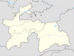
Kulkand (Russian: Кулканд; Tajik: Кӯлканд/کولکند) is a village and jamoat in northern Tajikistan. It is part of the city of Isfara in Sughd Region. The jamoat has a total population of 22,731 (2015).[1]
References
[edit]- ^ Jamoat-level basic indicators, United Nations Development Programme in Tajikistan, accessed 2 October 2020


