Benito Salas Airport: Difference between revisions
Appearance
Content deleted Content added
m –{{Colombia-stub}} using StubSorter |
|||
| Line 26: | Line 26: | ||
}} |
}} |
||
'''Benito Salas Airport''' ({{ |
'''Benito Salas Airport''' ({{langx|es|Aeropuerto Benito Salas}}, {{airport codes|NVA|SKNV|p=n}}) is an [[airport]] that serves the city of [[Neiva, Colombia|Neiva]], the capital of the [[Huila Department]] in [[Colombia]]. It was named after [[Benito Salas Vargas]], a military and social leader during Colombia's (then known as [[United Provinces of New Granada|New Granada]]) [[Spanish American wars of independence|independence war]] (1810–1819). |
||
The airport is in a rebuilding process that includes a new control tower and a new building with garages.<ref>[http://www.bnamericas.com/en/news/infrastructure/colombia-to-invest-us37mn-in-benito-salas-airport BNAmericas - Airport upgrades]</ref> It was formerly known as "La Manguita airport" because it is placed in an old ranch with that name; even today people call it "La Manguita". |
The airport is in a rebuilding process that includes a new control tower and a new building with garages.<ref>[http://www.bnamericas.com/en/news/infrastructure/colombia-to-invest-us37mn-in-benito-salas-airport BNAmericas - Airport upgrades]</ref> It was formerly known as "La Manguita airport" because it is placed in an old ranch with that name; even today people call it "La Manguita". |
||
Latest revision as of 09:15, 25 October 2024
Benito Salas Airport Aeropuerto Benito Salas | |||||||||||
|---|---|---|---|---|---|---|---|---|---|---|---|
 | |||||||||||
| Summary | |||||||||||
| Airport type | Public | ||||||||||
| Operator | Government | ||||||||||
| Serves | Neiva, Colombia | ||||||||||
| Elevation AMSL | 1,482 ft / 452 m | ||||||||||
| Coordinates | 2°57′00″N 75°17′39″W / 2.95000°N 75.29417°W | ||||||||||
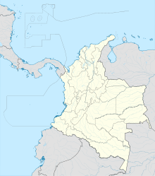
| Map | |||||||||||
 | |||||||||||
| Runways | |||||||||||
| |||||||||||
Benito Salas Airport (Spanish: Aeropuerto Benito Salas, IATA: NVA, ICAO: SKNV) is an airport that serves the city of Neiva, the capital of the Huila Department in Colombia. It was named after Benito Salas Vargas, a military and social leader during Colombia's (then known as New Granada) independence war (1810–1819).
The airport is in a rebuilding process that includes a new control tower and a new building with garages.[3] It was formerly known as "La Manguita airport" because it is placed in an old ranch with that name; even today people call it "La Manguita".
Airlines and destinations
[edit]| Airlines | Destinations |
|---|---|
| Avianca | Bogotá |
| Clic | Bogotá, Cali |
| LATAM Colombia | Bogotá[4] |
| SATENA | Cali,[5] San Vicente del Caguan[5] |
Accidents and incidents
[edit]- On 8 January 1975, Douglas DC-3 FAC-688 of SATENA crashed shortly after take-off on a flight to Gustavo Artunduaga Paredes Airport, Florencia. All 30 people on board died.[6]
See also
[edit]References
[edit]- ^ "Airport information for SKNV". World Aero Data. Archived from the original on 2019-03-05.
{{cite web}}: CS1 maint: unfit URL (link) Data current as of October 2006. - ^ Airport information for NVA at Great Circle Mapper.
- ^ BNAmericas - Airport upgrades
- ^ "LATAM Airlines inicia venta de su nueva ruta entre Bogotá y Neiva". 8 November 2021. Archived from the original on 9 November 2021. Retrieved 9 November 2021.
- ^ a b "SATENA late-Sep/Oct 2024 New Routes Addition". Aeroroutes. Retrieved 9 September 2024.
- ^ "Accident description". Aviation Safety Network. Retrieved 17 August 2010.
External links
[edit]- Benito Salas Airport at OurAirports
- Aeronautical chart and airport information for Benito Salas Airport at SkyVector
- Accident history for NVA at Aviation Safety Network

