Ržiše: Difference between revisions
Appearance
Content deleted Content added
updated link |
|||
| (6 intermediate revisions by 3 users not shown) | |||
| Line 31: | Line 31: | ||
|pushpin_label_position = bottom |
|pushpin_label_position = bottom |
||
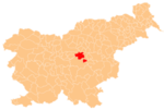
|pushpin_map_caption = Location in Slovenia |
|pushpin_map_caption = Location in Slovenia |
||
|coordinates_display = inline,title |
|||
|coordinates_region = SI |
|||
|subdivision_type = Country |
|subdivision_type = Country |
||
|subdivision_name = [[Image:Flag of Slovenia.svg|25px]] [[Slovenia]] |
|subdivision_name = [[Image:Flag of Slovenia.svg|25px]] [[Slovenia]] |
||
| Line 40: | Line 38: | ||
|subdivision_name2 = [[Central Sava Statistical Region|Central Sava]] |
|subdivision_name2 = [[Central Sava Statistical Region|Central Sava]] |
||
|subdivision_type3 = [[Municipalities of Slovenia|Municipality]] |
|subdivision_type3 = [[Municipalities of Slovenia|Municipality]] |
||
|subdivision_name3 = [[Zagorje ob Savi]] |
|subdivision_name3 = [[Municipality of Zagorje ob Savi|Zagorje ob Savi]] |
||
|subdivision_type4 = |
|subdivision_type4 = |
||
|subdivision_name4 = |
|subdivision_name4 = |
||
| Line 97: | Line 95: | ||
|timezone_DST = |
|timezone_DST = |
||
|utc_offset_DST = |
|utc_offset_DST = |
||
|coordinates = {{coord|46|9|58.88|N|14|57|36.88|E|region:SI|display=inline,title}} |
|||
|latd=46 |latm=9 |lats=58.88 |latNS=N |
|||
|longd=14 |longm=57 |longs=36.88 |longEW=E |
|||
|elevation_footnotes = |
|elevation_footnotes = |
||
|elevation_m = 562.5 |
|elevation_m = 562.5 |
||
| Line 112: | Line 109: | ||
|footnotes = <ref>[http://www.stat.si/eng/index.asp Statistical Office of the Republic of Slovenia]</ref>}} |
|footnotes = <ref>[http://www.stat.si/eng/index.asp Statistical Office of the Republic of Slovenia]</ref>}} |
||
'''Ržiše''' (in older sources also ''Režišče'',<ref name="Leksikon">''Leksikon občin kraljestev in dežel zastopanih v državnem zboru,'' vol. 6: ''Kranjsko''. 1906. Vienna: C. Kr. Dvorna in Državna Tiskarna, |
'''Ržiše''' ({{IPA|sl|əɾˈʒiːʃɛ|pron}}; in older sources also ''Režišče'',<ref name="Leksikon">''Leksikon občin kraljestev in dežel zastopanih v državnem zboru,'' vol. 6: ''Kranjsko''. 1906. Vienna: C. Kr. Dvorna in Državna Tiskarna, pp. 94–95.</ref> {{langx|de|Arschische}}<ref name="Leksikon"/>) is a settlement in the hills northeast of [[Izlake]] in the [[Municipality of Zagorje ob Savi]] in central [[Slovenia]]. The area is part of the traditional region of [[Lower Carniola]]. It is now included with the rest of the municipality in the [[Central Sava Statistical Region]].<ref>[http://www.zagorje.si Zagorje ob Savi municipal site]</ref> It includes the hamlet of Gamberk ({{langx|de|Gallenberg}}).<ref name="Leksikon"/> |
||
==References== |
==References== |
||
| Line 118: | Line 115: | ||
==External links== |
==External links== |
||
*[ |
*[https://www.geopedia.world/#T12_L362_F2473:2316_x1665576.2914870633_y5806849.5180399995_s15_b2345 Ržiše on Geopedia] |
||
{{Zagorje ob Savi}} |
{{Zagorje ob Savi}} |
||
Latest revision as of 12:59, 27 October 2024
Ržiše | |
|---|---|
 | |
| Coordinates: 46°9′58.88″N 14°57′36.88″E / 46.1663556°N 14.9602444°E | |
| Country | |
| Traditional region | Lower Carniola |
| Statistical region | Central Sava |
| Municipality | Zagorje ob Savi |
| Area | |
• Total | 1.88 km2 (0.73 sq mi) |
| Elevation | 562.5 m (1,845.5 ft) |
| Population (2002) | |
• Total | 99 |
| [1] | |
Ržiše (pronounced [əɾˈʒiːʃɛ]; in older sources also Režišče,[2] German: Arschische[2]) is a settlement in the hills northeast of Izlake in the Municipality of Zagorje ob Savi in central Slovenia. The area is part of the traditional region of Lower Carniola. It is now included with the rest of the municipality in the Central Sava Statistical Region.[3] It includes the hamlet of Gamberk (German: Gallenberg).[2]
References
[edit]- ^ Statistical Office of the Republic of Slovenia
- ^ a b c Leksikon občin kraljestev in dežel zastopanih v državnem zboru, vol. 6: Kranjsko. 1906. Vienna: C. Kr. Dvorna in Državna Tiskarna, pp. 94–95.
- ^ Zagorje ob Savi municipal site
External links
[edit]


