Frayssinet-le-Gélat: Difference between revisions
RodRabelo7 (talk | contribs) |
|||
| Line 23: | Line 23: | ||
}} |
}} |
||
'''Frayssinet-le-Gélat''' ({{IPA|fr|fʁɛsinɛ lə ʒela}}; {{ |
'''Frayssinet-le-Gélat''' ({{IPA|fr|fʁɛsinɛ lə ʒela}}; {{langx|oc|Fraissinet lo Gelat}}) is a [[Communes of France|commune]] in the [[Lot (department)|Lot]] [[Departments of France|department]] in south-western [[France]]. |
||
==History== |
==History== |
||
Latest revision as of 14:39, 27 October 2024
Frayssinet-le-Gélat | |
|---|---|
 The town hall in Frayssinet-le-Gélat | |
| Coordinates: 44°35′00″N 1°09′53″E / 44.5833°N 1.1647°E | |
| Country | France |
| Region | Occitania |
| Department | Lot |
| Arrondissement | Gourdon |
| Canton | Puy-l'Évêque |
| Intercommunality | Cazals-Salviac |
| Government | |
| • Mayor (2020–2026) | Nadège Gomez[1] |
Area 1 | 23.14 km2 (8.93 sq mi) |
| Population (2021)[2] | 370 |
| • Density | 16/km2 (41/sq mi) |
| Time zone | UTC+01:00 (CET) |
| • Summer (DST) | UTC+02:00 (CEST) |
| INSEE/Postal code | 46114 /46250 |
| Elevation | 160–286 m (525–938 ft) (avg. 200 m or 660 ft) |
| 1 French Land Register data, which excludes lakes, ponds, glaciers > 1 km2 (0.386 sq mi or 247 acres) and river estuaries. | |
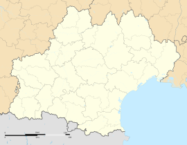
Frayssinet-le-Gélat (French pronunciation: [fʁɛsinɛ lə ʒela]; Occitan: Fraissinet lo Gelat) is a commune in the Lot department in south-western France.
History
[edit]In Frayssinet-le-Gélat, members of the French underground shot and killed a German officer. For this crime, 15 hostages were taken and assassinated by the SS. Ten were young males from one-child families and five were young women. This was to prevent any further family line of descent. The schoolmaster tried to escape but was shot outside the school. Each May 21, villagers gather outside the church for an act of remembrance. Outside the church is a small monument mounted with a stone cross, and a plaque bearing the names of the victims. Another monument to the 15th victim stands where he was shot.
See also
[edit]References
[edit]- ^ "Répertoire national des élus: les maires". data.gouv.fr, Plateforme ouverte des données publiques françaises (in French). 2 December 2020.
- ^ "Populations légales 2021" (in French). The National Institute of Statistics and Economic Studies. 28 December 2023.


