Tayru: Difference between revisions
Appearance
Content deleted Content added
initial create stub |
|||
| (28 intermediate revisions by 17 users not shown) | |||
| Line 1: | Line 1: | ||
{{Infobox settlement |
|||
'''Ţayrū''' is a populated place in the [[Tartus Governate]] of [[Syria]]. |
|||
|official_name = Tayru |
|||
|native_name = طيرو |
|||
{{coor title dms|35|11|45|N|35|59|15|E}} |
|||
|image_skyline = |
|||
{{syria-geo-stub}} |
|||
|imagesize = |
|||
|image_caption = |
|||
|pushpin_map =Syria |
|||
|pushpin_mapsize =250 |
|||
|subdivision_type = [[Countries of the world|Country]] |
|||
|subdivision_name = {{Flag|Syria}} |
|||
|subdivision_type1 = [[Governorates of Syria|Governorate]] |
|||
|subdivision_name1 = [[Tartus Governorate|Tartus]] |
|||
|subdivision_type2 = [[Districts of Syria|District]] |
|||
|subdivision_name2 = [[Baniyas District|Baniyas]] |
|||
|subdivision_type3 = [[Nahiyah|Subdistrict]] |
|||
|subdivision_name3 = [[Baniyas]] |
|||
|settlement_type = Village<!--For Town or Village (Leave blank for the default City)--> |
|||
|government_type = |
|||
|leader_title = |
|||
|leader_name = |
|||
|established_title = <!-- Settled --> |
|||
|established_date = |
|||
|established_title2 = <!-- Incorporated (town) --> |
|||
|established_date2 = |
|||
|established_title3 = <!-- Incorporated (city) --> |
|||
|established_date3 = |
|||
|area_magnitude = |
|||
|unit_pref = Metric <!--Enter: Imperial, if Imperial (metric) is desired--> |
|||
|area_footnotes = |
|||
|area_total_km2 = |
|||
|area_land_km2 = |
|||
|area_water_km2 = |
|||
|area_total_sq_mi = |
|||
|area_land_sq_mi = |
|||
|area_water_sq_mi = |
|||
|area_water_percent = |
|||
|area_urban_km2 = |
|||
|area_urban_sq_mi = |
|||
|area_metro_km2 = |
|||
|area_metro_sq_mi = |
|||
|population_as_of = 2004 census |
|||
|population_note = |
|||
|population_total = 838 |
|||
|population_footnotes = <ref name="CBS"/> |
|||
|timezone = [[Eastern European Time|EET]] |
|||
|utc_offset = +2 |
|||
|timezone_DST = [[Eastern European Summer Time|EEST]] |
|||
|utc_offset_DST = +3 |
|||
|coordinates = {{coord|35|11|45|N|35|59|15|E|region:SY|display=inline}} |
|||
|elevation_footnotes = <!--for references: use <ref> </ref> tags--> |
|||
|elevation_m = |
|||
|postal_code_type = <!-- enter ZIP code, Postcode, Post code, Postal code... --> |
|||
|postal_code = |
|||
|area_code = |
|||
|website = |
|||
|footnotes = |
|||
}} |
|||
'''Tayru''' ({{langx|ar|طيرو}}) is a village in northwestern [[Syria]], administratively part of the [[Tartus Governorate]], located northeast of [[Tartus]] and just east of the [[Mediterranean Sea|Mediterranean]] town of [[Baniyas]]. Nearby localities include [[Bustan al-Hamam]] and [[al-Annazeh]] to the east, [[al-Qadmus]] and [[Kaff al-Jaa]] to the southeast, [[al-Qamsiyah]], [[al-Baydah]] and [[Maten al-Sahel]] to the south. According to the [[Central Bureau of Statistics (Syria)|Syria Central Bureau of Statistics]], Tayru had a population of 838 in the 2004 census.<ref name="CBS">[http://www.cbssyr.org/new%20web%20site/General_census/census_2004/NH/TAB10-8-2004.htm General Census of Population and Housing 2004] {{webarchive|url=https://archive.today/20130112123732/http://www.cbssyr.org/new%20web%20site/General_census/census_2004/NH/TAB10-8-2004.htm |date=2013-01-12 }}. [[Central Bureau of Statistics (Syria)|Syria Central Bureau of Statistics]] (CBS). Tartus Governorate. {{in lang|ar}}</ref> Its inhabitants are predominantly [[Alawites]].<ref name="Balanche">{{cite book|first=Fabrice|last=Balanche|title=La région alaouite et le pouvoir syrien|url=http://tel.archives-ouvertes.fr/docs/00/06/30/97/PDF/Les_Alaouites_l_espace_et_le_pouvoir.pdf|publisher=Karthala Editions|year=2006|isbn=2845868189|language=French|author-link=Fabrice Balanche}}</ref> |
|||
==References== |
==References== |
||
{{reflist}} |
|||
*[http://gnswww.nga.mil/geonames/Gazetteer/Search/Results.jsp?Feature__Unique_Feature_ID=-3848324&Diacritics=Yes&reload=1 Ţayrū at Geonet Names server] |
|||
{{Tartus Governorate|baniyas}} |
|||
[[Category:Populated places in Baniyas District]] |
|||
[[Category:Alawite communities in Syria]] |
|||
Latest revision as of 08:37, 28 October 2024
Tayru
طيرو | |
|---|---|
Village | |
| Coordinates: 35°11′45″N 35°59′15″E / 35.19583°N 35.98750°E | |
| Country | |
| Governorate | Tartus |
| District | Baniyas |
| Subdistrict | Baniyas |
| Population (2004 census)[1] | |
• Total | 838 |
| Time zone | UTC+2 (EET) |
| • Summer (DST) | UTC+3 (EEST) |
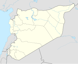
Tayru (Arabic: طيرو) is a village in northwestern Syria, administratively part of the Tartus Governorate, located northeast of Tartus and just east of the Mediterranean town of Baniyas. Nearby localities include Bustan al-Hamam and al-Annazeh to the east, al-Qadmus and Kaff al-Jaa to the southeast, al-Qamsiyah, al-Baydah and Maten al-Sahel to the south. According to the Syria Central Bureau of Statistics, Tayru had a population of 838 in the 2004 census.[1] Its inhabitants are predominantly Alawites.[2]
References
[edit]- ^ a b General Census of Population and Housing 2004 Archived 2013-01-12 at archive.today. Syria Central Bureau of Statistics (CBS). Tartus Governorate. (in Arabic)
- ^ Balanche, Fabrice (2006). La région alaouite et le pouvoir syrien (PDF) (in French). Karthala Editions. ISBN 2845868189.


