Yekateringofsky Municipal Okrug: Difference between revisions
Appearance
Content deleted Content added
m terminology |
|||
| (23 intermediate revisions by 14 users not shown) | |||
| Line 1: | Line 1: | ||
{{Coord|59|52|45|N|30|13|20|E|source:kolossus-frwiki|display=title}} |
|||
[[ |
[[File:Spb adm 6th.svg|thumb|Yekateringofsky Municipal Okrug on the older map of St. Petersburg]] |
||
'''Municipal Okrug #6''' ({{lang |
'''Yekateringofsky Municipal Okrug''' ({{langx|ru|Екатеринго́фский муниципа́льный о́круг}}, known as '''Municipal Okrug #6''' ({{lang|ru|муниципа́льный о́круг № 6}}) until 2011, is a [[administrative divisions of Saint Petersburg|municipal okrug]] of [[Admiralteysky District]] of the [[federal cities of Russia|federal city]] of [[Saint Petersburg|St. Petersburg]], [[Russia]]. Population: {{ru-census2010|24,038|;}} {{ru-census2002|31,570|.}} |
||
[[File:Flag of Yekateringofsky.png|thumb|left|The flag of Yekateringofsky]] |
|||
| ⚫ | |||
| ⚫ | |||
| ⚫ | |||
==References== |
|||
[[ru:6 муниципальный округ Санкт-Петербурга]] |
|||
{{Reflist}} |
|||
{{Administrative_divisions_of_Saint_Petersburg}} |
|||
{{Use mdy dates|date=April 2013}} |
|||
| ⚫ | |||
| ⚫ | |||
| ⚫ | |||
Latest revision as of 18:53, 28 October 2024
59°52′45″N 30°13′20″E / 59.87917°N 30.22222°E

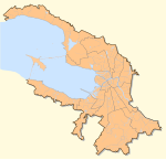
Yekateringofsky Municipal Okrug (Russian: Екатеринго́фский муниципа́льный о́круг, known as Municipal Okrug #6 (муниципа́льный о́круг № 6) until 2011, is a municipal okrug of Admiralteysky District of the federal city of St. Petersburg, Russia. Population: 24,038 (2010 Census);[1] 31,570 (2002 Census).[2]

It borders Fontanka in the north, Lermontovsky Avenue in the east, Obvodny Canal in the south, and Yekateringofka River in the west.
References
[edit]- ^ Russian Federal State Statistics Service (2011). Всероссийская перепись населения 2010 года. Том 1 [2010 All-Russian Population Census, vol. 1]. Всероссийская перепись населения 2010 года [2010 All-Russia Population Census] (in Russian). Federal State Statistics Service.
- ^ Federal State Statistics Service (May 21, 2004). Численность населения России, субъектов Российской Федерации в составе федеральных округов, районов, городских поселений, сельских населённых пунктов – районных центров и сельских населённых пунктов с населением 3 тысячи и более человек [Population of Russia, Its Federal Districts, Federal Subjects, Districts, Urban Localities, Rural Localities—Administrative Centers, and Rural Localities with Population of Over 3,000] (XLS). Всероссийская перепись населения 2002 года [All-Russia Population Census of 2002] (in Russian).

