Cupidstown Hill: Difference between revisions
Appearance
Content deleted Content added
map & ref |
Infobox: use native_name parameter; "County Kildare" per MOS:IRISHCOUNTIES |
||
| (22 intermediate revisions by 12 users not shown) | |||
| Line 1: | Line 1: | ||
{{short description|Hill in County Kildare, Ireland}} |
|||
{{Use dmy dates|date=December 2021}} |
|||
{{Use Irish English|date=December 2021}} |
|||
{{Infobox mountain |
{{Infobox mountain |
||
| name = Cupidstown Hill |
| name = Cupidstown Hill |
||
| |
| native_name = {{Native name|ga|Cnoc Bhaile Cupid|paren=omit}} |
||
| photo = Trig point at summit of Cupidstown Hill - geograph.org.uk - 223982.jpg |
| photo = Trig point at summit of Cupidstown Hill - geograph.org.uk - 223982.jpg |
||
| photo_caption = |
| photo_caption = Cupidstown Hill, looking north-east towards [[Red Gap|Saggart Hill]] |
||
| elevation_m = 379 |
| elevation_m = 379 |
||
| elevation_ref =<ref> |
| elevation_ref =<ref name=mw>Cupidstown Hill, [http://mountainviews.ie/summit/1051/?PHPSESSID=uv3oiho1na73sss12a8l20a1b5 mountainviews.ie]</ref> |
||
| |
| prominence_m = 54 |
||
| prominence_ref = <ref name=mw /> |
|||
| translation = Hill of Cupidstown |
|||
| ⚫ | |||
| language = [[Irish language|Irish]] |
| language = [[Irish language|Irish]] |
||
| location = [[County |
| location = [[County Kildare]], Ireland |
||
| range = [[Wicklow Mountains]] |
| range = [[Wicklow Mountains]] |
||
| map = Ireland |
| map = Ireland |
||
| range_coordinates = |
|||
| map_caption = Ireland |
| map_caption = Ireland |
||
| label_position = right |
| label_position = right |
||
| map_size = 240 |
| map_size = 240 |
||
| coordinates = {{coord|53|13|33.57|N|6|29|32.84|W|type:mountain_region:IE_scale:100000|format=dms|display=inline,title}} |
|||
| lat_d =53 |lat_m =13|lat_s =33.57|lat_NS =N |
|||
| long_d= 6 |long_m=29 |long_s=32.84 |long_EW=W |
|||
| grid_ref_Ireland = |
| grid_ref_Ireland = |
||
| topo = [[Ordnance Survey of Ireland|OSi]] ''Discovery'' 50 |
| topo = [[Ordnance Survey of Ireland|OSi]] ''Discovery'' 50 |
||
}} |
}} |
||
| ⚫ | |||
==Naming== |
|||
| ⚫ | |||
The origin of the name is uncertain; "Cupid" may have originally been [[Cuthbert (given name)|Cuthbert]], Cudlipp or [[Copse|coppis]].<ref>{{cite web| url = https://www.logainm.ie/en/25937?s=Cupidstown| title = Baile Cupid/Cupidstown {{!}} Logainm.ie}} </ref> |
|||
== Geography == |
== Geography == |
||
At 379 metres it is the [[List of Irish counties by highest point|highest summit in Kildare]], almost twice as high as the [[Hill of Allen]]. But Cupidstown Hill is lesser known than other summits in Kildare as it is dwarfed by nearby mountains such as [[Kippure]]. It is just above the village of [[Kilteel]], and is the 872nd highest summit in Ireland. |
At 379 metres it is the [[List of Irish counties by highest point|highest summit in Kildare]], almost twice as high as the [[Hill of Allen]]. But Cupidstown Hill is lesser known than other summits in Kildare as it is dwarfed by nearby mountains such as [[Kippure]]. It is just above the village of [[Kilteel]], and is the 872nd highest summit in Ireland. |
||
| ⚫ | |||
| ⚫ | |||
*[[List of Irish counties by highest point]] |
|||
*[[List of mountains of the British Isles by height]] |
|||
*[[List of Marilyns in the British Isles]] |
|||
== References == |
== References == |
||
<references /> |
<references /> |
||
{{Mountains of Great Britain and Ireland|}} |
|||
| ⚫ | |||
| ⚫ | |||
| ⚫ | |||
| ⚫ | |||
{{Mountains and hills of Leinster}} |
{{Mountains and hills of Leinster}} |
||
| ⚫ | |||
[[Category:Mountains and hills of County Kildare]] |
[[Category:Mountains and hills of County Kildare]] |
||
Latest revision as of 05:03, 29 October 2024
| Cupidstown Hill | |
|---|---|
 Cupidstown Hill, looking north-east towards Saggart Hill | |
| Highest point | |
| Elevation | 379 m (1,243 ft)[1] |
| Prominence | 54 m (177 ft)[1] |
| Listing | County top (Kildare) |
| Coordinates | 53°13′33.57″N 6°29′32.84″W / 53.2259917°N 6.4924556°W |
| Naming | |
| Native name | Cnoc Bhaile Cupid |
| English translation | Hill of Cupidstown |
| Geography | |
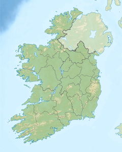
| Location | County Kildare, Ireland |
| Parent range | Wicklow Mountains |
| Topo map | OSi Discovery 50 |
Cupidstown Hill (from Irish Cnoc Bhaile Cupid 'hill of Cupidstown'), at 379 metres (1,243 ft), is the highest point in County Kildare, Ireland, and lies on the fringes of the Wicklow Mountains, 11.6 kilometres (7.2 mi) east of Naas.
Naming
[edit]The origin of the name is uncertain; "Cupid" may have originally been Cuthbert, Cudlipp or coppis.[2]
Geography
[edit]At 379 metres it is the highest summit in Kildare, almost twice as high as the Hill of Allen. But Cupidstown Hill is lesser known than other summits in Kildare as it is dwarfed by nearby mountains such as Kippure. It is just above the village of Kilteel, and is the 872nd highest summit in Ireland.
See also
[edit]- Lists of mountains in Ireland
- List of Irish counties by highest point
- List of mountains of the British Isles by height
- List of Marilyns in the British Isles
References
[edit]- ^ a b Cupidstown Hill, mountainviews.ie
- ^ "Baile Cupid/Cupidstown | Logainm.ie".


