Spangereid: Difference between revisions
update name, add mayor list, misc cleanup |
|||
| (3 intermediate revisions by 3 users not shown) | |||
| Line 38: | Line 38: | ||
}} |
}} |
||
'''Spangereid''' is a [[List of former municipalities of Norway|former municipality]] that was located in the old [[Vest-Agder]] county in [[Norway]]. The {{convert|63|km2|adj=on}} municipality<ref name="NLF">{{Cite book |last=Helland |first=Amund |url= |
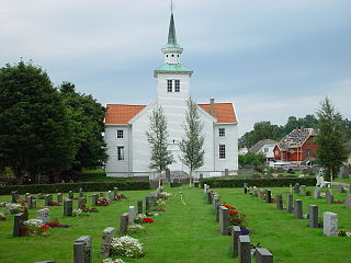
'''Spangereid''' is a [[List of former municipalities of Norway|former municipality]] that was located in the old [[Vest-Agder]] county in [[Norway]]. The {{convert|63|km2|adj=on}} municipality<ref name="NLF">{{Cite book |last=Helland |first=Amund |url=https://runeberg.org/norgeslof/10-2/0394.html |title=X Lister og Mandals amt. Anden del |publisher=H. Aschehoug & Company |year=1903 |series=Norges land og folk |location=Kristiania, Norway |page=379 |language=Norwegian |chapter=Spangereid herred |access-date=2022-07-03}}</ref> existed from 1889 until its dissolution in 1964. The municipality was located in the southwestern part of the present-day municipality of [[Lindesnes]] in [[Agder]] county. The municipality included the whole Lindesnes peninsula, plus part of the mainland adjacent to the narrow [[isthmus]] which connects the peninsula to the mainland. The [[administrative centre]] was the village of [[Høllen, Lindesnes|Høllen]] where the [[Spangereid Church]] is located.<ref name="snl">{{Cite news |last=Store norske leksikon |author-link=Store norske leksikon |title=Spangereid – tidligere kommune |language=Norwegian |work=Store Norske Leksikon |url=https://snl.no/Spangereid/tidligere_kommune |access-date=2016-12-08}}</ref> |
||
The area is one of [[Norway]]'s richest [[archaeological]] sites. The abundant remnants from the [[Bronze Age]] and [[Viking Age]] show the Spangereid was a very important place at that time. Spangereid is strategically connected at the [[Lindesnes]] peninsula, Norway's southernmost point, where the east coast meets the west coast. |
The area is one of [[Norway]]'s richest [[archaeological]] sites. The abundant remnants from the [[Bronze Age]] and [[Viking Age]] show the Spangereid was a very important place at that time. Spangereid is strategically connected at the [[Lindesnes]] peninsula, Norway's southernmost point, where the east coast meets the west coast. |
||
| Line 45: | Line 45: | ||
[[File:Spangereid fra lufta.jpg|thumb|left|Aerial view of Spangereid]] |
[[File:Spangereid fra lufta.jpg|thumb|left|Aerial view of Spangereid]] |
||
[[File:Spangereid02.svg|thumb|left|Map of the Spangereid area, showing the Spangereid canal]] |
[[File:Spangereid02.svg|thumb|left|Map of the Spangereid area, showing the Spangereid canal]] |
||
The municipality of Spangereid was established on 1 January 1899 when it was separated from the municipality of [[Sør-Audnedal|Sør-Undal]]. The initial population of the new municipality was 1,734. During the 1960s, there were many municipal mergers across Norway due to the work of the [[Schei Committee]]. On 1 January 1963, the Gitlevåg area (population: 103) of Spangereid was transferred to the neighboring municipality of [[Lyngdal]]. On 1 January 1964, Spangereid (population: 899) was merged with [[Sør-Audnedal]] and [[Vigmostad]] to form the new municipality of [[Lindesnes]].<ref name="Dag">{{Cite |
The municipality of Spangereid was established on 1 January 1899 when it was separated from the municipality of [[Sør-Audnedal|Sør-Undal]]. The initial population of the new municipality was 1,734. During the 1960s, there were many municipal mergers across Norway due to the work of the [[Schei Committee]]. On 1 January 1963, the Gitlevåg area (population: 103) of Spangereid was transferred to the neighboring municipality of [[Lyngdal]]. On 1 January 1964, Spangereid (population: 899) was merged with [[Sør-Audnedal]] and [[Vigmostad]] to form the new municipality of [[Lindesnes]].<ref name="Dag">{{Cite book |last=Jukvam |first=Dag |year=1999 |title=Historisk oversikt over endringer i kommune- og fylkesinndelingen |url=http://www.ssb.no/emner/00/90/rapp_9913/rapp_9913.pdf |publisher=[[Statistics Norway|Statistisk sentralbyrå]] |language=no |isbn=9788253746845}}</ref> |
||
===Name=== |
===Name=== |
||
The municipality (originally the [[prestegjeld|parish]]) is named after a local [[isthmus]] called ''Spangereid'' ({{ |
The municipality (originally the [[prestegjeld|parish]]) is named after a local [[isthmus]] called ''Spangereid'' ({{langx|non|Spangarheið}}) since it connected the mainland to the large [[Lindesnes]] [[headland|peninsula]] and the local [[Spangereid Church]] is located upon it. The first element is {{lang|non|spǫng}} which means "small piece of land". The last element is {{wikt-lang|non|eið}} which means "[[isthmus]]".<ref>{{Cite book |last=Rygh |first=Oluf |url=https://books.google.com/books?id=Mt1LAQAAIAAJ |title=Norske gaardnavne: Lister og Mandals amt |date=1912 |publisher=W. C. Fabritius & sønners bogtrikkeri |edition=9 |location=Kristiania, Norge |page=173 |language=no |authorlink=Oluf Rygh}}</ref><ref name="snl" /> |
||
==Government== |
==Government== |
||
| Line 54: | Line 54: | ||
===Mayors=== |
===Mayors=== |
||
The [[Mayor#Scandinavia|mayors]] ({{ |
The [[Mayor#Scandinavia|mayors]] ({{langx|no|ordfører}}) of Spangereid: |
||
{{div col|colwidth=20em}} |
{{div col|colwidth=20em}} |
||
*1899–1912: I.P. Solaas<ref>{{Cite web |title=I. P. Solaas, ordfører Spangereid 1899 - 1912 |url=https://www.flickr.com/photos/kulturtorvet/3661647391/in/photolist-6zCZS7-6zyUcz-6zCZSE-6zyUdZ-6zCZVb-6zyUep-6zDzZW-27eCjT-6zySQr |access-date=2018-02-05 |website=Flickr}}</ref> |
*1899–1912: I.P. Solaas<ref>{{Cite web |title=I. P. Solaas, ordfører Spangereid 1899 - 1912 |url=https://www.flickr.com/photos/kulturtorvet/3661647391/in/photolist-6zCZS7-6zyUcz-6zCZSE-6zyUdZ-6zCZVb-6zyUep-6zDzZW-27eCjT-6zySQr |access-date=2018-02-05 |website=Flickr}}</ref> |
||
| Line 158: | Line 158: | ||
==External links== |
==External links== |
||
*{{Wikivoyage-inline|Vest-Agder}} |
*{{Wikivoyage-inline|Vest-Agder}} |
||
*[http://www.spangereid.no/ Informational |
*[http://www.spangereid.no/ Informational website about Spangereid] {{in lang|no}} |
||
{{Agder}} |
{{Agder}} |
||
Latest revision as of 11:35, 29 October 2024
Spangereid Municipality
Spangereid herred | |
|---|---|
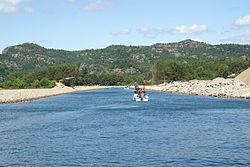 View of the Spangereid canal | |
 Vest-Agder within Norway | |
 Spangereid within Vest-Agder | |
| Coordinates: 58°02′42″N 07°08′34″E / 58.04500°N 7.14278°E | |
| Country | Norway |
| County | Vest-Agder |
| District | Sørlandet |
| Established | 1 Jan 1889 |
| • Preceded by | Sør-Undal Municipality |
| Disestablished | 1 Jan 1964 |
| • Succeeded by | Lindesnes Municipality |
| Administrative centre | Høllen |
| Area (upon dissolution) | |
• Total | 63 km2 (24 sq mi) |
| Population (1964) | |
• Total | 899 |
| • Density | 14/km2 (37/sq mi) |
| Time zone | UTC+01:00 (CET) |
| • Summer (DST) | UTC+02:00 (CEST) |
| ISO 3166 code | NO-1030[1] |
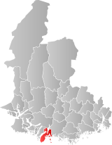
Spangereid is a former municipality that was located in the old Vest-Agder county in Norway. The 63-square-kilometre (24 sq mi) municipality[2] existed from 1889 until its dissolution in 1964. The municipality was located in the southwestern part of the present-day municipality of Lindesnes in Agder county. The municipality included the whole Lindesnes peninsula, plus part of the mainland adjacent to the narrow isthmus which connects the peninsula to the mainland. The administrative centre was the village of Høllen where the Spangereid Church is located.[3]
The area is one of Norway's richest archaeological sites. The abundant remnants from the Bronze Age and Viking Age show the Spangereid was a very important place at that time. Spangereid is strategically connected at the Lindesnes peninsula, Norway's southernmost point, where the east coast meets the west coast.
History
[edit]

The municipality of Spangereid was established on 1 January 1899 when it was separated from the municipality of Sør-Undal. The initial population of the new municipality was 1,734. During the 1960s, there were many municipal mergers across Norway due to the work of the Schei Committee. On 1 January 1963, the Gitlevåg area (population: 103) of Spangereid was transferred to the neighboring municipality of Lyngdal. On 1 January 1964, Spangereid (population: 899) was merged with Sør-Audnedal and Vigmostad to form the new municipality of Lindesnes.[4]
Name
[edit]The municipality (originally the parish) is named after a local isthmus called Spangereid (Old Norse: Spangarheið) since it connected the mainland to the large Lindesnes peninsula and the local Spangereid Church is located upon it. The first element is spǫng which means "small piece of land". The last element is eið which means "isthmus".[5][3]
Government
[edit]While it existed, this municipality was responsible for primary education (through 10th grade), outpatient health services, senior citizen services, unemployment, social services, zoning, economic development, and municipal roads. During its existence, this municipality was governed by a municipal council of directly elected representatives. The mayor was indirectly elected by a vote of the municipal council.[6]
Mayors
[edit]The mayors (Norwegian: ordfører) of Spangereid:
Municipal council
[edit]The municipal council (Herredsstyre) of Spangereid was made up of representatives that were elected to four year terms. The tables below show the historical composition of the council by political party.
| Party name (in Norwegian) | Number of representatives | |
|---|---|---|
| Labour Party (Arbeiderpartiet) | 2 | |
| Conservative Party (Høyre) | 2 | |
| Centre Party (Senterpartiet) | 4 | |
| Liberal Party (Venstre) | 5 | |
| Total number of members: | 13 | |
| Party name (in Norwegian) | Number of representatives | |
|---|---|---|
| Labour Party (Arbeiderpartiet) | 3 | |
| Conservative Party (Høyre) | 1 | |
| Farmers' Party (Bondepartiet) | 2 | |
| Liberal Party (Venstre) | 7 | |
| Total number of members: | 13 | |
| Party name (in Norwegian) | Number of representatives | |
|---|---|---|
| Labour Party (Arbeiderpartiet) | 2 | |
| Conservative Party (Høyre) | 1 | |
| Liberal Party (Venstre) | 7 | |
| Local List(s) (Lokale lister) | 2 | |
| Total number of members: | 12 | |
| Party name (in Norwegian) | Number of representatives | |
|---|---|---|
| Labour Party (Arbeiderpartiet) | 3 | |
| Conservative Party (Høyre) | 2 | |
| Joint list of the Liberal Party (Venstre) and the Radical People's Party (Radikale Folkepartiet) | 7 | |
| Total number of members: | 12 | |
| Party name (in Norwegian) | Number of representatives | |
|---|---|---|
| Labour Party (Arbeiderpartiet) | 1 | |
| Joint List(s) of Non-Socialist Parties (Borgerlige Felleslister) | 4 | |
| Local List(s) (Lokale lister) | 7 | |
| Total number of members: | 12 | |
| Party name (in Norwegian) | Number of representatives | |
|---|---|---|
| Labour Party (Arbeiderpartiet) | 2 | |
| Liberal Party (Venstre) | 7 | |
| Joint List(s) of Non-Socialist Parties (Borgerlige Felleslister) | 3 | |
| Total number of members: | 12 | |
| Note: Due to the German occupation of Norway during World War II, no elections were held for new municipal councils until after the war ended in 1945. | ||
Media gallery
[edit]-
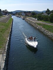
Spangereid Canal
-
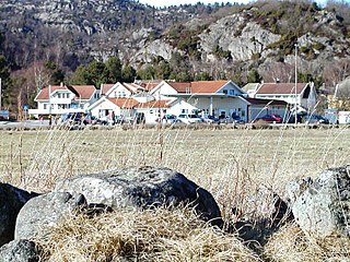
Central part of Høllen
See also
[edit]References
[edit]- ^ Bolstad, Erik; Thorsnæs, Geir, eds. (26 January 2023). "Kommunenummer". Store norske leksikon (in Norwegian). Kunnskapsforlaget.
- ^ Helland, Amund (1903). "Spangereid herred". X Lister og Mandals amt. Anden del. Norges land og folk (in Norwegian). Kristiania, Norway: H. Aschehoug & Company. p. 379. Retrieved 3 July 2022.
- ^ a b Store norske leksikon. "Spangereid – tidligere kommune". Store Norske Leksikon (in Norwegian). Retrieved 8 December 2016.
- ^ Jukvam, Dag (1999). Historisk oversikt over endringer i kommune- og fylkesinndelingen (PDF) (in Norwegian). Statistisk sentralbyrå. ISBN 9788253746845.
- ^ Rygh, Oluf (1912). Norske gaardnavne: Lister og Mandals amt (in Norwegian) (9 ed.). Kristiania, Norge: W. C. Fabritius & sønners bogtrikkeri. p. 173.
- ^ Hansen, Tore; Vabo, Signy Irene, eds. (20 September 2022). "kommunestyre". Store norske leksikon (in Norwegian). Kunnskapsforlaget. Retrieved 3 August 2023.
- ^ "I. P. Solaas, ordfører Spangereid 1899 - 1912". Flickr. Retrieved 5 February 2018.
- ^ "Hans Daland - ordfører Spangereid 1929-1931". Flickr. Retrieved 5 February 2018.
- ^ "L. Aanensen - ordfører Spangereid 1932-1934". Flickr. Retrieved 5 February 2018.
- ^ "August E. Fjeldskaar - ordfører Spangereid 1938 - 1940". Flickr. Retrieved 5 February 2018.
- ^ "Gunnar Gulli - ordfører Spangereid 1946-1948". Flickr. Retrieved 5 February 2018.
- ^ "Abraham Lindland - ordfører Spangereid 1960-1963". Flickr. Retrieved 5 February 2018.
- ^ "Kommunevalgene og Ordførervalgene 1959" (PDF) (in Norwegian). Oslo: Statistisk sentralbyrå. 1960. Retrieved 22 November 2020.
- ^ "Kommunevalgene og Ordførervalgene 1955" (PDF) (in Norwegian). Oslo: Statistisk sentralbyrå. 1957. Retrieved 22 November 2020.
- ^ "Kommunevalgene og Ordførervalgene 1951" (PDF) (in Norwegian). Oslo: Statistisk sentralbyrå. 1952. Retrieved 22 November 2020.
- ^ "Kommunevalgene og Ordførervalgene 1947" (PDF) (in Norwegian). Oslo: Statistisk sentralbyrå. 1948. Retrieved 22 November 2020.
- ^ "Kommunevalgene og Ordførervalgene 1945" (PDF) (in Norwegian). Oslo: Statistisk sentralbyrå. 1947. Retrieved 22 November 2020.
- ^ "Kommunevalgene og Ordførervalgene 1937" (PDF) (in Norwegian). Oslo: Statistisk sentralbyrå. 1938. Retrieved 22 November 2020.
External links
[edit] Vest-Agder travel guide from Wikivoyage
- Informational website about Spangereid (in Norwegian)

