Kelermesskaya: Difference between revisions
Appearance
Content deleted Content added
No edit summary |
|||
| (7 intermediate revisions by 7 users not shown) | |||
| Line 2: | Line 2: | ||
|official_name = Kelermesskaya |
|official_name = Kelermesskaya |
||
|other_name = |
|other_name = |
||
|native_name = Келермесская |
|native_name = Келермесская <br> Къэлэрмэз |
||
|nickname = |
|nickname = |
||
|settlement_type = Stanitsa |
|settlement_type = Stanitsa |
||
|image_skyline = |
|image_skyline = Келермесская.jpg |
||
|image_caption = |
|image_caption = |
||
|image_flag = Flag of Kelermesskoe (Adygeya).png |
|||
|pushpin_map = Russia Adygea#Russia |
|pushpin_map = Russia Adygea#Russia |
||
|pushpin_label_position = |
|pushpin_label_position = |
||
|pushpin_mapsize = |
|pushpin_mapsize = |
||
|pushpin_map_caption = |
|pushpin_map_caption = |
||
|pushpin_relief = 1 |
|||
|subdivision_type = Country |
|subdivision_type = Country |
||
|subdivision_name = [[Russia]] |
|subdivision_name = [[Russia]] |
||
| Line 31: | Line 33: | ||
|coordinates = {{coord|44|47|N|40|07|E|display=inline}}<ref>[https://mapdata.ru/adigeya/giaginskiy-rayon/kelermesskaya-stanica/ Карта станицы Келермесская в республике Адыгея]</ref> |
|coordinates = {{coord|44|47|N|40|07|E|display=inline}}<ref>[https://mapdata.ru/adigeya/giaginskiy-rayon/kelermesskaya-stanica/ Карта станицы Келермесская в республике Адыгея]</ref> |
||
}} |
}} |
||
'''Kelermesskaya''' ({{ |
'''Kelermesskaya''' ({{langx|ru|Келермесская}}; {{langx|ady|Къэлэрмэз}}) is a [[types of inhabited localities in Russia|rural locality]] (a [[Village#Russia|stanitsa]]) and the administrative center of Kelermesskoye Rural Settlement of [[Giaginsky District]], Adygea, Russia. The population was 2844 as of 2018.<ref>{{Cite web |url=http://krsdstat.gks.ru/wps/wcm/connect/rosstat_ts/krsdstat/resources/3ca4e38044dfe71585cbafde4cdebdf4/%D0%A7%D0%B8%D1%81%D0%BB%D0%B5%D0%BD%D0%BD%D0%BE%D1%81%D1%82%D1%8C+%D0%BF%D0%BE%D1%81%D1%82%D0%BE%D1%8F%D0%BD%D0%BD%D0%BE%D0%B3%D0%BE+%D0%BD%D0%B0%D1%81%D0%B5%D0%BB%D0%B5%D0%BD%D0%B8%D1%8F+%D0%BF%D0%BE+%D0%9C%D0%9E+%D0%B8+%D0%BD%D0%B0%D1%81%D0%B5%D0%BB%D0%B5%D0%BD%D0%BD%D1%8B%D0%BC+%D0%BF%D1%83%D0%BD%D0%BA%D1%82%D0%B0%D0%BC+%D0%A0%D0%B5%D1%81%D0%BF%D1%83%D0%B1%D0%BB%D0%B8%D0%BA%D0%B8+%D0%90%D0%B4%D1%8B%D0%B3%D0%B5%D1%8F+%D0%BF%D0%BE+%D1%81%D0%BE%D1%81%D1%82%D0%BE%D1%8F%D0%BD%D0%B8%D1%8E+%D0%BD%D0%B0+1+%D1%8F%D0%BD%D0%B2%D0%B0%D1%80%D1%8F+2018+%D0%B3%D0%BE%D0%B4%D0%B0.doc |title=Численность постоянного населения по МО и населенным пунктам Республики Адыгея по состоянию на 1 января 2018 года |access-date=2018-09-05 |archive-url=https://web.archive.org/web/20180801125531/http://krsdstat.gks.ru/wps/wcm/connect/rosstat_ts/krsdstat/resources/3ca4e38044dfe71585cbafde4cdebdf4/%D0%A7%D0%B8%D1%81%D0%BB%D0%B5%D0%BD%D0%BD%D0%BE%D1%81%D1%82%D1%8C+%D0%BF%D0%BE%D1%81%D1%82%D0%BE%D1%8F%D0%BD%D0%BD%D0%BE%D0%B3%D0%BE+%D0%BD%D0%B0%D1%81%D0%B5%D0%BB%D0%B5%D0%BD%D0%B8%D1%8F+%D0%BF%D0%BE+%D0%9C%D0%9E+%D0%B8+%D0%BD%D0%B0%D1%81%D0%B5%D0%BB%D0%B5%D0%BD%D0%BD%D1%8B%D0%BC+%D0%BF%D1%83%D0%BD%D0%BA%D1%82%D0%B0%D0%BC+%D0%A0%D0%B5%D1%81%D0%BF%D1%83%D0%B1%D0%BB%D0%B8%D0%BA%D0%B8+%D0%90%D0%B4%D1%8B%D0%B3%D0%B5%D1%8F+%D0%BF%D0%BE+%D1%81%D0%BE%D1%81%D1%82%D0%BE%D1%8F%D0%BD%D0%B8%D1%8E+%D0%BD%D0%B0+1+%D1%8F%D0%BD%D0%B2%D0%B0%D1%80%D1%8F+2018+%D0%B3%D0%BE%D0%B4%D0%B0.doc |archive-date=2018-08-01 |url-status=dead }}</ref> There are 26 streets. |
||
== Geography == |
== Geography == |
||
The stanitsa is located in the steppe zone, 12 km southeast of [[Giaginskaya]] (the district's administrative centre) by road. |
The stanitsa is located in the steppe zone, 12 km southeast of [[Giaginskaya]] (the district's administrative centre) by road. Lesnoy is the nearest rural locality.<ref>[http://allroutes.ru/rasstoyanie_kelermesskaja_giaginskaja Расстояние от Келермесской до Гиагинской]</ref> |
||
== References == |
== References == |
||
| Line 43: | Line 45: | ||
[[Category:Rural localities in Giaginsky District]] |
[[Category:Rural localities in Giaginsky District]] |
||
{{Adygea-geo-stub}} |
{{Adygea-geo-stub}} |
||
Latest revision as of 11:25, 1 November 2024
Kelermesskaya
Келермесская Къэлэрмэз | |
|---|---|
Stanitsa | |
 | |
| Coordinates: 44°47′N 40°07′E / 44.783°N 40.117°E[1] | |
| Country | Russia |
| Region | Adygea |
| District | Giaginsky District |
| Time zone | UTC+3:00 |
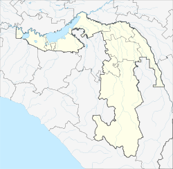
Kelermesskaya (Russian: Келермесская; Adyghe: Къэлэрмэз) is a rural locality (a stanitsa) and the administrative center of Kelermesskoye Rural Settlement of Giaginsky District, Adygea, Russia. The population was 2844 as of 2018.[2] There are 26 streets.
Geography
[edit]The stanitsa is located in the steppe zone, 12 km southeast of Giaginskaya (the district's administrative centre) by road. Lesnoy is the nearest rural locality.[3]
References
[edit]- ^ Карта станицы Келермесская в республике Адыгея
- ^ "Численность постоянного населения по МО и населенным пунктам Республики Адыгея по состоянию на 1 января 2018 года". Archived from the original on 2018-08-01. Retrieved 2018-09-05.
- ^ Расстояние от Келермесской до Гиагинской


