Isla Santa Inés: Difference between revisions
Appearance
Content deleted Content added
mNo edit summary Tags: Mobile edit Mobile app edit iOS app edit |
Removing notice of move discussion |
||
| (8 intermediate revisions by 5 users not shown) | |||
| Line 1: | Line 1: | ||
{{Short description|Island in the Gulf of California}} |
{{Short description|Island in the Gulf of California}} |
||
{{Infobox islands |
{{Infobox islands |
||
|name = Isla Santa Inés |
|||
| image_name = Islas Santa Inez, Baja California Sul, Mexico.jpg |
|||
| ⚫ | |||
| |
| image_size = 250px |
||
| ⚫ | |||
| ⚫ | |||
| ⚫ | |||
| ⚫ | |||
| ⚫ | |||
| ⚫ | |||
| ⚫ | |||
| ⚫ | |||
| ⚫ | |||
| ⚫ | |||
| ⚫ | |||
| ⚫ | |||
| ⚫ | |||
| ⚫ | |||
| country = Mexico |
|||
| ⚫ | |||
| ⚫ | |||
| ⚫ | |||
| ⚫ | |||
| ⚫ | |||
}} |
}} |
||
'''Isla Santa Inés''' is an [[island]] in the [[Gulf of California]] east of the [[Baja California Peninsula]]. The island is uninhabited and is part of the [[Mulegé Municipality]] in the Mexican state of [[Baja California Sur]].<ref>{{cite book |url=https://datos.abiertos.inecc.gob.mx/Datos_abiertos_INECC/CGACC/DocumentosRIslasMarias/Eje2_InstrumentosDelTerritorioInsularMexicano/CatalogoInsularDelTerritorioMexicano.pdf |title=Catálogo Insular del territorio insular mexicano |language=Spanish |page=91 |publisher= INEGI}}</ref> |
'''Isla Santa Inés''' is an [[island]] group in the [[Gulf of California]] east of the [[Baja California Peninsula]]. The island is uninhabited and is part of the [[Mulegé Municipality]] in the Mexican state of [[Baja California Sur]].<ref>{{cite book |url=https://datos.abiertos.inecc.gob.mx/Datos_abiertos_INECC/CGACC/DocumentosRIslasMarias/Eje2_InstrumentosDelTerritorioInsularMexicano/CatalogoInsularDelTerritorioMexicano.pdf |title=Catálogo Insular del territorio insular mexicano |language=Spanish |page=91 |publisher= INEGI}}</ref> |
||
==Biology== |
==Biology== |
||
Latest revision as of 03:53, 2 November 2024
 Aerial view of Isla Santa Inés | |
| Geography | |
|---|---|
| Location | Gulf of California |
| Coordinates | 27°02′15.22″N 111°54′45.63″W / 27.0375611°N 111.9126750°W |
| Highest elevation | 20 m (70 ft) |
| Administration | |
Mexico | |
| State | Baja California Sur |
| Demographics | |
| Population | Uninhabited |
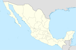
Isla Santa Inés is an island group in the Gulf of California east of the Baja California Peninsula. The island is uninhabited and is part of the Mulegé Municipality in the Mexican state of Baja California Sur.[1]
Biology
[edit]Isla Santa Inés has two species of reptiles: Callisaurus draconoides (zebra-tailed lizard) and Coleonyx variegatus (western banded gecko).[2]
References
[edit]- ^ Catálogo Insular del territorio insular mexicano (PDF) (in Spanish). INEGI. p. 91.
- ^ "theNAT :: Amphibian and Reptile Atlas of Peninsular California". herpatlas.sdnhm.org. Retrieved 2021-01-11.
Further reading
[edit]- Williams, J.H. (August 1996). Baja Boaters Guide II: Sea of Cortez. H.J. Williams Publications. p. 169. ISBN 0-9616843-8-0.

