Pushpagiri Wildlife Sanctuary: Difference between revisions
Remove superlatives, promotional language and links. |
No edit summary |
||
| (60 intermediate revisions by 40 users not shown) | |||
| Line 1: | Line 1: | ||
{{Short description|Wildlife sanctuary in India}} |
|||
| ⚫ | |||
{{Use dmy dates|date=July 2019}} |
|||
{{Use Indian English|date=July 2019}} |
|||
{{refimprove|date=December 2015}} |
|||
{{Infobox protected area |
|||
| name = Pushpagiri Wildlife Sanctuary |
|||
| photo = Mandalpatti_Hills.jpg |
|||
| photo_caption = Landscape of Shola Forests,Pushpagiri WLS |
|||
| photo_width = |
|||
| location = [[Somwarpet]], [[Kodagu]] district, [[Karnataka]], [[India]] |
|||
| nearest_city = [[Somwarpet]] |
|||
| coords = {{coord|12|35|0|N|75|40|0|E|format=dms|display=inline,title}} |
|||
| map = India Karnataka |
|||
| coords_ref = |
|||
| area = 102 km<sup>2</sup> |
|||
| established = 1987{{cn|date=December 2015}} |
|||
| governing_body = Karnataka Forest Department |
|||
}} |
|||
| ⚫ | |||
This sanctuary is located in |
This sanctuary is located in [[Somwarpet]] taluk of the [[Kodagu district]]. It is home to rare and endangered birdlife.<ref>{{cite web |
||
| ⚫ | |||
|title=BirdLife IBA Factsheet - Pushpagiri Wildlife Sanctuary |
|||
|access-date=2007-02-01 |
|||
| ⚫ | |||
Mandalpatti peak, Kote betta and Makkalagudi betta are mountains fall in the sanctuary. [[Mallalli falls]] and Kote abbe [[waterfalls]] (also called as Mukkodlu falls) are located inside the sanctuary. The Pushpagiri Wildlife Sancutuary has been proposed as one of the [[World Heritage Site]].<ref>{{cite web |
|||
The rich Kadamakkal reserve forest is a part of the sanctuary. [[Pushpagiri]] is the highest peak in it. Kumaraparvat (Kumaraparvatha) is the other peak that lies within it. |
|||
| ⚫ | |||
|title=Western Ghats—Talacauvery Sub-Cluster (with Six Site Elements) |
|||
|access-date=2007-02-01 |
|||
}}</ref> |
|||
== Mandalpatti == |
|||
| ⚫ | |||
Also called as "Mugilu Pete", this view point is one of the hotspots of tourist destination in Kodagu. It is located 18 kms north of Madikeri. The peak is at an elevation of 1250 metres above MSL. Rented 4×4 vehicles can be used to get to the peak. |
|||
== |
==References== |
||
{{reflist}} |
|||
| ⚫ | |||
| ⚫ | |||
<br /> |
|||
> [http://www.flickr.com/photos/epharaoh/172075979/ Link to a map of Pushpagiri Sanctuary and surrounding terrain from google maps] <br /> |
|||
> [http://www.flickr.com/search/?q=pushpagiri&w=88563023%40N00 Some images from Pushpagiri Sanctuary] <br /> |
|||
==External links== |
|||
| ⚫ | |||
{{commonscat}} |
|||
{{Wikivoyage}} |
|||
* [https://whc.unesco.org/en/tentativelists/2103/ Western Ghats UNESCO World Heritage Centre] |
|||
* [http://www.birdlife.org/datazone/sites/index.html?action=SitHTMDetails.asp&sid=18228&m=0 Important Bird Areas in India - Pushpagiri Wildlife Sanctuary] |
|||
* [https://youtube.com/shorts/obtAbNOakaU?feature=share Mandalpatti Videos] |
|||
{{Kodagu (Coorg) topics}} |
|||
{{Protected areas of Karnataka}} |
|||
{{Western Ghats}} |
|||
[[Category:1987 establishments in Karnataka]] |
|||
[[Category:North Western Ghats montane rain forests]] |
|||
[[Category:Wildlife sanctuaries of the Western Ghats]] |
|||
[[Category:South Western Ghats montane rain forests]] |
|||
[[Category:Tourist attractions in Kodagu district]] |
|||
| ⚫ | |||
Latest revision as of 11:25, 2 November 2024
This article needs additional citations for verification. (December 2015) |
| Pushpagiri Wildlife Sanctuary | |
|---|---|
 Landscape of Shola Forests,Pushpagiri WLS | |
| Location | Somwarpet, Kodagu district, Karnataka, India |
| Nearest city | Somwarpet |
| Coordinates | 12°35′0″N 75°40′0″E / 12.58333°N 75.66667°E |
| Area | 102 km2 |
| Established | 1987[citation needed] |
| Governing body | Karnataka Forest Department |
Pushpagiri Wildlife Sanctuary is one of the 21 Wildlife Sanctuaries in Karnataka, India.
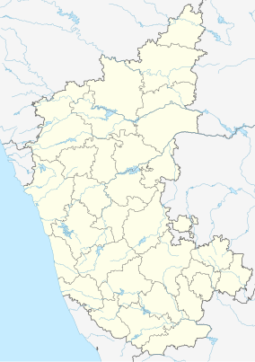
This sanctuary is located in Somwarpet taluk of the Kodagu district. It is home to rare and endangered birdlife.[1] The Kadamakkal reserve forest is a part of the sanctuary. Pushpagiri (Kumara Parvatha) is the highest peak in it. The sanctuary adjoins Bisle reserve forest to the north and Kukke Subramanya forest range to the west.
Mandalpatti peak, Kote betta and Makkalagudi betta are mountains fall in the sanctuary. Mallalli falls and Kote abbe waterfalls (also called as Mukkodlu falls) are located inside the sanctuary. The Pushpagiri Wildlife Sancutuary has been proposed as one of the World Heritage Site.[2]
Mandalpatti
[edit]Also called as "Mugilu Pete", this view point is one of the hotspots of tourist destination in Kodagu. It is located 18 kms north of Madikeri. The peak is at an elevation of 1250 metres above MSL. Rented 4×4 vehicles can be used to get to the peak.
References
[edit]- ^ "BirdLife IBA Factsheet - Pushpagiri Wildlife Sanctuary". Retrieved 1 February 2007.
- ^ "Western Ghats—Talacauvery Sub-Cluster (with Six Site Elements)". Retrieved 1 February 2007.

