Gelmets: Difference between revisions
Appearance
Content deleted Content added
added source |
|||
| (14 intermediate revisions by 5 users not shown) | |||
| Line 2: | Line 2: | ||
|official_name = Gelmets |
|official_name = Gelmets |
||
|other_name = |
|other_name = |
||
|native_name = Гельмец |
|native_name = Гельмец<br>Гелмец |
||
|native_name_lang = |
|native_name_lang = |
||
|nickname = |
|nickname = |
||
| Line 33: | Line 33: | ||
|elevation_m = |
|elevation_m = |
||
|elevation_footnotes = |
|elevation_footnotes = |
||
|coordinates = {{coord|41|37|N|47|10|E|display=inline}}<ref>[https://mapdata.ru/dagestan/rutulskiy-rayon/ |
|coordinates = {{coord|41|37|N|47|10|E|display=inline}}<ref>[https://mapdata.ru/dagestan/rutulskiy-rayon/selo-gelmec/ Село Гельмец на карте]</ref> |
||
}} |
}} |
||
'''Gelmets''' ({{ |
'''Gelmets''' ({{langx|ru|Гельмец}}; [[Tsakhur language|Tsakhur]]: Гелмец) is a [[types of inhabited localities in Russia|rural locality]] (a [[Village#Russia|selo]]) and the administrative centre of Gelmetsinskoye Rural Settlement, [[Rutulsky District]], [[Republic of Dagestan]], [[Russia]]. Population: {{ru-census|p2010=609|p2002=569|p1989=550}} There are 3 streets.<ref>[https://mapdata.ru/dagestan/rutulskiy-rayon/selo-gelmec/ Село Гельмец на карте]</ref> |
||
== Geography == |
== Geography == |
||
Gelmets is located at the foot of the Gelmets-Akhtynsky ridge. It is located 31 km northwest of [[Rutul (rural locality)|Rutul]] (the district's administrative centre) by road. Mikik and Tsakhur are the nearest rural localities.<ref>[https://all-routes.ru/rasstoyanie-gelmets_ru-rutul Расстояние от Гельмеца до Рутула 31 км]</ref> |
|||
== Nationalities == |
== Nationalities == |
||
| Line 46: | Line 46: | ||
{{reflist}} |
{{reflist}} |
||
{{Rural localities in Rutulsky District}} |
|||
{{Authority control}} |
{{Authority control}} |
||
[[Category:Rural localities in |
[[Category:Rural localities in Rutulsky District]] |
||
Latest revision as of 02:37, 3 November 2024
Gelmets
Гельмец Гелмец | |
|---|---|
Selo | |
| Coordinates: 41°37′N 47°10′E / 41.617°N 47.167°E[1] | |
| Country | Russia |
| Region | Republic of Dagestan |
| District | Rutulsky District |
| Time zone | UTC+3:00 |
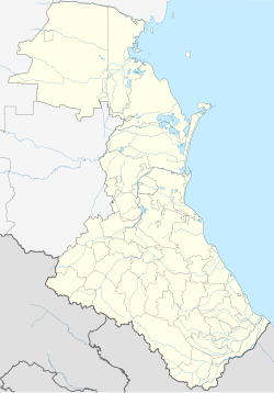
Gelmets (Russian: Гельмец; Tsakhur: Гелмец) is a rural locality (a selo) and the administrative centre of Gelmetsinskoye Rural Settlement, Rutulsky District, Republic of Dagestan, Russia. Population: 609 (2010 Census);[2] 569 (2002 Census);[3] 550 (1989 Soviet census).[4] There are 3 streets.[5]
Geography
[edit]Gelmets is located at the foot of the Gelmets-Akhtynsky ridge. It is located 31 km northwest of Rutul (the district's administrative centre) by road. Mikik and Tsakhur are the nearest rural localities.[6]
Nationalities
[edit]Tsakhur people live there.
References
[edit]- ^ Село Гельмец на карте
- ^ Russian Federal State Statistics Service (2011). Всероссийская перепись населения 2010 года. Том 1 [2010 All-Russian Population Census, vol. 1]. Всероссийская перепись населения 2010 года [2010 All-Russia Population Census] (in Russian). Federal State Statistics Service.
- ^ Federal State Statistics Service (21 May 2004). Численность населения России, субъектов Российской Федерации в составе федеральных округов, районов, городских поселений, сельских населённых пунктов – районных центров и сельских населённых пунктов с населением 3 тысячи и более человек [Population of Russia, Its Federal Districts, Federal Subjects, Districts, Urban Localities, Rural Localities—Administrative Centers, and Rural Localities with Population of Over 3,000] (XLS). Всероссийская перепись населения 2002 года [All-Russia Population Census of 2002] (in Russian).
- ^ Всесоюзная перепись населения 1989 г. Численность наличного населения союзных и автономных республик, автономных областей и округов, краёв, областей, районов, городских поселений и сёл-райцентров [All Union Population Census of 1989: Present Population of Union and Autonomous Republics, Autonomous Oblasts and Okrugs, Krais, Oblasts, Districts, Urban Settlements, and Villages Serving as District Administrative Centers]. Всесоюзная перепись населения 1989 года [All-Union Population Census of 1989] (in Russian). Институт демографии Национального исследовательского университета: Высшая школа экономики [Institute of Demography at the National Research University: Higher School of Economics]. 1989 – via Demoscope Weekly.
- ^ Село Гельмец на карте
- ^ Расстояние от Гельмеца до Рутула 31 км


