Road signs in Jamaica: Difference between revisions
Removed contents |
not this it's the Tags: Mobile edit Mobile web edit |
||
| (8 intermediate revisions by 5 users not shown) | |||
| Line 1: | Line 1: | ||
{{short description|none}} |
{{short description|none}} |
||
{{Use mdy dates|date=February 2024}} |
{{Use mdy dates|date=February 2024}} |
||
'''Road signs in [[Jamaica]]''' are standardized by the ''Traffic Control Devices Manual'' developed by the [[Ministry of Transport and Mining]] (formerly the Ministry of Transport and Works).<ref>{{Cite web |title=MANUAL ON TRAFFIC CONTROL DEVICES |url=http://www.mhtww.gov.jm/transport/policies/traffic%20control%20device%20manual.pdf |url-status=dead |archive-url=https://web.archive.org/web/20150922093725/www.mhtww.gov.jm/transport/policies/traffic%20control%20device%20manual.pdf |archive-date=2015-09-22 |access-date=2024-01-06 |website=mhtww.gov.jm}}</ref> They generally follow both US signs based on the [[Manual on Uniform Traffic Control Devices|MUTCD]],<ref>{{Cite web |date=2014-03-10 |title=ROADSTER “Paving the Way”. Volume 11, Issue 32, March 2014 |url=https://www.nwa.gov.jm/sites/default/files/publications/Newsletter%20March%202014.pdf |access-date=2024-01-06 |website=www.nwa.gov.jm |pages=13}}</ref> including diamond-shaped [[Warning sign|warning signs]], and European signs based on the [[Vienna Convention on Road Signs and Signals]]. |
'''Road signs in [[Jamaica]]''' are standardized by the ''Traffic Control Devices Manual'' developed by the [[Ministry of Transport and Mining]] (formerly the Ministry of Transport and Works).<ref>{{Cite web |title=MANUAL ON TRAFFIC CONTROL DEVICES |url=http://www.mhtww.gov.jm/transport/policies/traffic%20control%20device%20manual.pdf |url-status=dead |archive-url=https://web.archive.org/web/20150922093725/www.mhtww.gov.jm/transport/policies/traffic%20control%20device%20manual.pdf |archive-date=2015-09-22 |access-date=2024-01-06 |website=mhtww.gov.jm}}</ref> They generally follow both US signs based on the [[Manual on Uniform Traffic Control Devices|MUTCD]],<ref>{{Cite web |date=2014-03-10 |title=ROADSTER “Paving the Way”. Volume 11, Issue 32, March 2014 |url=https://www.nwa.gov.jm/sites/default/files/publications/Newsletter%20March%202014.pdf |access-date=2024-01-06 |website=www.nwa.gov.jm |pages=13}}</ref> including diamond-shaped [[Warning sign|warning signs]], and European signs based on the [[Vienna Convention on Road Signs and Signals]]. The symbols used in road signs are similar to [[Sweden|Swedish]] ones. Jamaica [[Left- and right-hand traffic|drives on the left]]. |
||
== Regulatory signs == |
== Regulatory signs == |
||
| Line 101: | Line 101: | ||
File:Jamaica road sign W5.svg|'''W5'''<br>Unprotected quay, ferry berth or river bank |
File:Jamaica road sign W5.svg|'''W5'''<br>Unprotected quay, ferry berth or river bank |
||
File:Jamaica road sign W6-1.svg|'''W6-1'''<br>Uneven road |
File:Jamaica road sign W6-1.svg|'''W6-1'''<br>Uneven road |
||
File:Jamaica road sign W6-2.svg|'''W6-2'''<br> |
File:Jamaica road sign W6-2.svg|'''W6-2'''<br>Bump or ramp |
||
File:Jamaica road sign W6-3.svg|'''W6-3'''<br>Dip (including fords, cross-drains |
File:Jamaica road sign W6-3.svg|'''W6-3'''<br>Dip (including fords, cross-drains, etc.) |
||
File:Jamaica road sign W6-3-1.svg|'''W6-3-1'''<br>Ford. The inscription "FORDING" is optional |
File:Jamaica road sign W6-3-1.svg|'''W6-3-1'''<br>Ford. The inscription "FORDING" is optional. |
||
File:Jamaica road sign W6-3-2.svg|'''W6-3-2'''<br>Cross-drain. The inscription "CROSS-DRAIN" is optional |
File:Jamaica road sign W6-3-2.svg|'''W6-3-2'''<br>Cross-drain. The inscription "CROSS-DRAIN" is optional. |
||
File:Jamaica road sign W6-3-3.svg|'''W6-3-3'''<br>Ford. The supplementary plate with the inscription "FORDING" is optional |
File:Jamaica road sign W6-3-3.svg|'''W6-3-3'''<br>Ford. The supplementary plate with the inscription "FORDING" is optional. |
||
File:Jamaica road sign W6-3-4.svg|'''W6-3-4'''<br>Cross-drain. The supplementary plate with the inscription "CROSS-DRAIN" is optional |
File:Jamaica road sign W6-3-4.svg|'''W6-3-4'''<br>Cross-drain. The supplementary plate with the inscription "CROSS-DRAIN" is optional. |
||
File:Jamaica road sign W7.svg|'''W7'''<br>Slippery road |
File:Jamaica road sign W7.svg|'''W7'''<br>Slippery road |
||
File:Jamaica road sign W8.svg|'''W8'''<br>Loose |
File:Jamaica road sign W8.svg|'''W8'''<br>Loose stones |
||
File:Jamaica road sign W9-1.svg|'''W9-1'''<br>Falling rocks from the left |
File:Jamaica road sign W9-1.svg|'''W9-1'''<br>Falling rocks from the left |
||
File:Jamaica road sign W9-2.svg|'''W9-2'''<br>Falling rocks from the right |
File:Jamaica road sign W9-2.svg|'''W9-2'''<br>Falling rocks from the right |
||
File:Jamaica road sign W10.svg|'''W10'''<br>Pedestrian crossing ahead |
File:Jamaica road sign W10.svg|'''W10'''<br>Pedestrian crossing ahead |
||
File:Jamaica road sign W10F.svg|'''W10F'''<br>Pedestrian crossing ahead. This fluorescent green version is unofficial |
File:Jamaica road sign W10F.svg|'''W10F'''<br>Pedestrian crossing ahead. This fluorescent green version is unofficial. |
||
File:Jamaica road sign W11.svg|'''W11'''<br>Children |
File:Jamaica road sign W11.svg|'''W11'''<br>Children |
||
File:Jamaica road sign W11-1.svg|'''W11-1'''<br>School zone |
File:Jamaica road sign W11-1.svg|'''W11-1'''<br>School zone |
||
File:Jamaica road sign W11-2.svg|'''W11-2'''<br>Playground |
File:Jamaica road sign W11-2.svg|'''W11-2'''<br>Playground |
||
File:Jamaica road sign W11-3.svg|'''W11-3'''<br>Sports ground |
File:Jamaica road sign W11-3.svg|'''W11-3'''<br>Sports ground |
||
File:Jamaica road sign W12.svg|'''W12'''<br>Cyclists |
File:Jamaica road sign W12.svg|'''W12'''<br>Cyclists crossing |
||
File:Jamaica road sign W13.svg|'''W13''' |
File:Jamaica road sign W13.svg|'''W13''' Cattle |
||
File:Jamaica road sign W16.svg|'''W16'''<br>Airfield |
File:Jamaica road sign W16.svg|'''W16'''<br>Airfield |
||
File:Jamaica road sign W17-1.svg|'''W17-1'''<br>Strong crosswinds from the left |
File:Jamaica road sign W17-1.svg|'''W17-1'''<br>Strong crosswinds from the left |
||
| Line 125: | Line 125: | ||
File:Jamaica road sign W19.svg|'''W19'''<br>Tunnel |
File:Jamaica road sign W19.svg|'''W19'''<br>Tunnel |
||
File:Jamaica road sign W20.svg|'''W20'''<br>Railway crossing ahead |
File:Jamaica road sign W20.svg|'''W20'''<br>Railway crossing ahead |
||
File:Jamaica road sign W23.svg|'''W23'''<br> |
File:Jamaica road sign W23.svg|'''W23'''<br>Railway crossing |
||
File:Jamaica road sign W28.svg|'''W28'''<br> |
File:Jamaica road sign W28.svg|'''W28'''<br>General warning |
||
File:Jamaica road sign W30-1.svg|'''W30-1'''<br>Dual carriageway ahead |
File:Jamaica road sign W30-1.svg|'''W30-1'''<br>Dual carriageway ahead |
||
File:Jamaica road sign W30-2.svg|'''W30-2'''<br>Dual carriageway ends ahead |
File:Jamaica road sign W30-2.svg|'''W30-2'''<br>Dual carriageway ends ahead |
||
File:Jamaica road sign W31- |
File:Jamaica road sign W31-2.svg|'''W31-2'''<br>No through road ahead |
||
File:Jamaica road sign W31-2.svg|'''W31-2'''<br>No through road (experimental) |
|||
</gallery> |
</gallery> |
||
Latest revision as of 15:32, 3 November 2024
Road signs in Jamaica are standardized by the Traffic Control Devices Manual developed by the Ministry of Transport and Mining (formerly the Ministry of Transport and Works).[1] They generally follow both US signs based on the MUTCD,[2] including diamond-shaped warning signs, and European signs based on the Vienna Convention on Road Signs and Signals. The symbols used in road signs are similar to Swedish ones. Jamaica drives on the left.
Regulatory signs
[edit]Regulatory signs are used to inform the road users of various restrictions. Unless otherwise is indicated on an additional panel, the restriction starts to apply at the point the sign is erected.
Priority signs
[edit]-
R1
Give way -
R1-1
Give way (with inscription)
Prohibitory signs
[edit]-
R7
Closed to all vehicles in both directions -
R8
No entry -
R9
No motor vehicles -
R10
No motor vehicles, except for two-wheeled motorcycles without side-car -
R11
No motorcycles -
R12
No pedal cycles -
R13
No mopeds -
R14
No goods vehicles -
R15
No vehicles pulling a trailer, except for semi-trailers or single axle trailers -
R16
No vehicles pulling a trailer -
R17
No pedestrians -
R18
No animal-drawn vehicles -
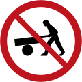
R19
No handcarts -
R20
No agricultural vehicles -
R21
No vehicles exceeding 2.2 metres in width -
R22
No vehicles exceeding 3.5 metres in height -
R23
No vehicles exceeding 12 tonnes -
R24
No vehicles exceeding 6 tonnes per axle -
R25
No vehicles exceeding 12 metres in length -
R26
No right turn -
R27
No left turn -
R28
No U-turn -
R29
No overtaking -
R30
No overtaking by goods vehicles -
R31
End of the overtaking prohibition -
R32
End of the overtaking prohibition for goods vehicles -
R33
Speed limit (20 km/h) -
R33
Speed limit (30 km/h) -
R33
Speed limit (40 km/h) -
R33
Speed limit (50 km/h) -
R33
Speed limit (60 km/h) -
R33
Speed limit (70 km/h) -
R33
Speed limit (80 km/h) -
R33
Speed limit (90 km/h) -
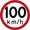
R33
Speed limit (100 km/h) -
R33
Speed limit (110 km/h) -
R34-1
Use of audible warning devices prohibited -
R34-2
Silence zone -
U1-1
One-way road (left) -
U1-2
One-way road (right)
Mandatory signs
[edit]-
R35-1
Turn right -
R35-2
Turn left -
R35-3
Proceed straight ahead -
R35-4
Turn right ahead -
R35-5
Turn left ahead -
R35-6
Proceed straight or turn right ahead -
R35-7
Proceed straight or turn left ahead -
R35-8
Turn left or right ahead -
R36-1
Keep left -
R36-2
Keep right -
R36-3
Pass on either side -
R37
Roundabout -
R38
Cycle path -
R39
Footpath -
R40
Horse riding path
Parking and stopping signs
[edit]-
R41
No parking -
R42
No stopping
Warning signs
[edit]Warning signs are used to give warning of possible road hazards that are difficult for a driver proceeding at a normal pace to perceive in time.
Warning of roadway conditions
[edit]-
W1-1
Bend to the right -
W1-2
Bend to the left -
W1-3
Double bend or series of bends, first to the right -
W1-4
Double bend or series of bends, first to the left -
W2-1
Steep descent -
W2-2
Steep ascent -
W3-1
Road narrows from both sides -
W3-2
Road narrows from the right side -
W3-3
Road narrows from the left side -
W3-4
Narrow bridge -
W3-4-1
Single lane bridge -
W4
Opening bridge -
W5
Unprotected quay, ferry berth or river bank -
W6-1
Uneven road -
W6-2
Bump or ramp -
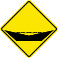
W6-3
Dip (including fords, cross-drains, etc.) -
W6-3-1
Ford. The inscription "FORDING" is optional. -
W6-3-2
Cross-drain. The inscription "CROSS-DRAIN" is optional. -
W6-3-3
Ford. The supplementary plate with the inscription "FORDING" is optional. -
W6-3-4
Cross-drain. The supplementary plate with the inscription "CROSS-DRAIN" is optional. -
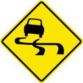
W7
Slippery road -
W8
Loose stones -
W9-1
Falling rocks from the left -
W9-2
Falling rocks from the right -
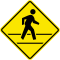
W10
Pedestrian crossing ahead -
W10F
Pedestrian crossing ahead. This fluorescent green version is unofficial. -
W11
Children -
W11-1
School zone -
W11-2
Playground -
W11-3
Sports ground -
W12
Cyclists crossing -
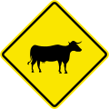
W13 Cattle
-
W16
Airfield -
W17-1
Strong crosswinds from the left -
W17-2
Strong crosswinds from the right -
W18
Two-way traffic -
W19
Tunnel -
W20
Railway crossing ahead -
W23
Railway crossing -
W28
General warning -
W30-1
Dual carriageway ahead -
W30-2
Dual carriageway ends ahead -
W31-2
No through road ahead
Warning at intersections
[edit]-
W15
Traffic signals ahead -
W24-1
4-leg intersection -
W24-2
3-leg intersection to the left -
W24-2
3-leg intersection to the right -
W24-3
T-intersection -
W25
Priority intersection -
W26
Roundabout -
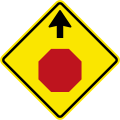
W27
Stop ahead -
W29
Give way ahead
Construction signs
[edit]-
W14
Roadworks -
U6
End of road work
Advisory signs
[edit]Advisory signs are part of the broader category of informative signs, which provide information to drivers about the destinations and types of facilities along the roadway, as well as general information about how to use the road.
-
I15
Pedestrian crossing -
U2
No through road -
U2-1
No through road -
U2-2
No through road -
U3
Hospital
Service facility signs
[edit]-
F8
First aid station
References
[edit]- ^ "MANUAL ON TRAFFIC CONTROL DEVICES" (PDF). mhtww.gov.jm. Archived from the original (PDF) on September 22, 2015. Retrieved January 6, 2024.
- ^ "ROADSTER "Paving the Way". Volume 11, Issue 32, March 2014" (PDF). www.nwa.gov.jm. March 10, 2014. p. 13. Retrieved January 6, 2024.
External links
[edit] Media related to Road signs in Jamaica at Wikimedia Commons


