Kedarkantha: Difference between revisions
Appearance
Content deleted Content added
GraziePrego (talk | contribs) Adding short description: "Himalayan mountain" |
m added coordinates and maps |
||
| (2 intermediate revisions by 2 users not shown) | |||
| Line 19: | Line 19: | ||
| elevation_ft = 12,500 |
| elevation_ft = 12,500 |
||
| elevation_ref = |
| elevation_ref = |
||
| coordinates = {{coord|31.0225288|N|78.1718992|E|type:mountain_region:IN_scale:100000|format=dms|display=inline,title}} |
|||
| map = India Uttarakhand#India |
|||
}} |
}} |
||
Latest revision as of 15:39, 4 November 2024
| Kedarkantha | |
|---|---|
| केदारकंठ | |
 | |
| Highest point | |
| Elevation | 12,500 ft (3,800 m) |
| Coordinates | 31°01′21″N 78°10′19″E / 31.0225288°N 78.1718992°E |
| Geography | |
| Country | India |
| State | Uttarakhand |
| District | Uttarkashi |
| Parent range | Garhwal Himalaya |

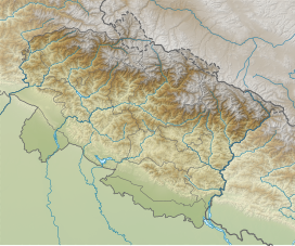
Kedarkantha (Hindi: केदारकंठ) is a mountain peak of the Himalayas in Uttarakhand, India. Its elevation is 12,500 ft (3,800 m).[1][2] Kedarkantha is located within Govind Wildlife Sanctuary in Uttarkashi district.[3]
A trek to the peak of Kedarkantha usually starts from Sankri, a small village, and takes four days to complete.
References
[edit]- ^ Shah, Sonali (6 November 2016). "Want to go trekking in the Himalayas? Here's a list recommended by experts". Hindustan Times. Retrieved 2 January 2017.
- ^ Duttagupta, Samonway (1 December 2015). "Best winter treks in India". India Today. Retrieved 2 January 2017.
- ^ Mishra, Gaurav K; Upreti, Dalip K (May 2015). "Altitudinal distribution of cetrarioid lichens in Govind Wildlife Sanctuary, Garhwal Himalaya, Uttarakhand, India". Geophytology. 45 (1): 9–19. ISSN 0376-5156.


