Am Dam: Difference between revisions
Appearance
Content deleted Content added
Fix BS coordinates |
|||
| (42 intermediate revisions by 26 users not shown) | |||
| Line 1: | Line 1: | ||
{{Infobox |
{{Infobox settlement |
||
<!--See the Table at Infobox Settlement for all fields and descriptions of usage--> |
<!--See the Table at Infobox Settlement for all fields and descriptions of usage--> |
||
<!-- Basic info ----------------> |official_name = Am |
<!-- Basic info ----------------> |official_name = Am Dam |
||
|other_name = |
|other_name = |
||
|native_name = {{lang|ar|أم دام}} |
|||
|native_name = <!-- for cities whose native name is not in English --> |
|||
|nickname = |
|nickname = |
||
|settlement_type = <!--For Town or Village (Leave blank for the default City)--> |
|settlement_type = <!--For Town or Village (Leave blank for the default City)--> |
||
| Line 32: | Line 32: | ||
|dot_y = |
|dot_y = |
||
|pushpin_map = Chad <!-- the name of a location map as per http://en.wikipedia.org/wiki/Template:Location_map --> |
|pushpin_map = Chad <!-- the name of a location map as per http://en.wikipedia.org/wiki/Template:Location_map --> |
||
|pushpin_mapsize= |
|pushpin_mapsize= |
||
|pushpin_label_position =bottom |
|pushpin_label_position =bottom |
||
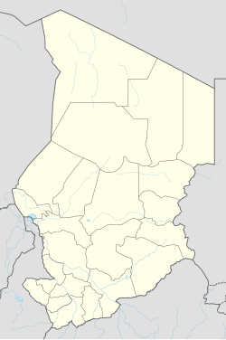
|pushpin_map_caption = Location in Chad |
|pushpin_map_caption = Location in Chad |
||
| Line 38: | Line 38: | ||
|subdivision_type = Country |
|subdivision_type = Country |
||
|subdivision_name = {{flag|Chad}} |
|subdivision_name = {{flag|Chad}} |
||
|subdivision_type1 = [[Regions of Chad]] |
|subdivision_type1 = [[Regions of Chad|Region]] |
||
|subdivision_name1 = [[ |
|subdivision_name1 = [[Sila Region|Sila]] |
||
|subdivision_type2 = [[Departments of Chad|Department]] |
|subdivision_type2 = [[Departments of Chad|Department]] |
||
|subdivision_name2 = [[Djourf Al Ahmar]] |
|subdivision_name2 = [[Djourf Al Ahmar]] |
||
|subdivision_type3 = |
|subdivision_type3 = [[Sub-prefectures of Chad|Sub-Prefecture]] |
||
|subdivision_name3 = |
|subdivision_name3 = Am Dam |
||
|subdivision_type4 = |
|subdivision_type4 = |
||
|subdivision_name4 = |
|subdivision_name4 = |
||
| Line 113: | Line 113: | ||
|timezone_DST = |
|timezone_DST = |
||
|utc_offset_DST = |
|utc_offset_DST = |
||
|coordinates = {{coord|12|45|44|N|20|28|13|E|region:TD|display=inline}} |
|||
|latd= 12 |
|||
|latm= 45 |
|||
|lats= 43.5 |
|||
|latNS=N |
|||
|longd= 20 |
|||
|longm= 28 |
|||
|longs= 13.9 |
|||
|longEW=E |
|||
|elevation_footnotes = |
|elevation_footnotes = |
||
<!--for references: use <ref> </ref> tags--> |
<!--for references: use <ref> </ref> tags--> |
||
|elevation_m = |
|elevation_m = 443 |
||
|elevation_ft = |
|elevation_ft = |
||
<!-- Area/postal codes & others --------> |
<!-- Area/postal codes & others --------> |
||
| Line 136: | Line 129: | ||
|website = |
|website = |
||
|footnotes = }} |
|footnotes = }} |
||
'''Am Dam''' is the capital of [[Djourf Al Ahmar]] [[Departments of Chad|Department]] in [[ |
'''Am Dam''' ({{langx|ar|أم دام}}) is the capital of [[Djourf Al Ahmar]] [[Departments of Chad|Department]] in [[Sila Region|Sila]] [[Regions of Chad|Region]], [[Chad]], located at an important crossroads in the [[Batha River]] valley. It is a small town about {{convert|120|km|mi|abbr=on}} northwest of Goz-Beida and {{convert|700|km|mi|abbr=on}} by road from the capital [[N'Djamena]].<ref>[http://www.alertnet.org/thenews/newsdesk/L15621394.htm Chad rebels say occupy town closer to capital] ''[[Reuters]]''</ref> Am Dam is also the name of the [[Sub-prefectures of Chad|Sub-Prefecture]] that the city is within. The population of the entire Am Dam Sub-Prefecture is 77,593.<ref>[http://www.statoids.com/ytd.html Statoids]</ref> |
||
The town is served by [[Am Dam Airport]]. |
|||
==History== |
|||
It was captured by rebels advancing on [[N'Djamena]] on June 15, 2008.<ref>[http://news.bbc.co.uk/2/hi/africa/7455949.stm Advancing Chad rebels take town] ''[[BBC News]]''</ref> A [[Battle of Am Dam|battle]] near the town stopped an attempted rebel offensive in May 2009 and put the town under Chadian government control again, with more than 200 reported deaths.<ref>{{cite web |url=http://www.france24.com/en/20090511-chad-rebels-retreat-sudan-bases |title=France24 - Chad rebels retreat to Sudan bases |website=www.france24.com |url-status=dead |archive-url=https://web.archive.org/web/20100605230431/http://www.france24.com/en/20090511-chad-rebels-retreat-sudan-bases |archive-date=2010-06-05}} </ref> |
|||
==References== |
==References== |
||
{{Reflist}} |
{{Reflist}} |
||
{{ |
{{coord|12|45|44|N|20|28|13|E|display=title}} |
||
[[Category:Sila Region]] |
|||
{{Chad-geo-stub}} |
|||
[[Category: |
[[Category:Populated places in Chad]] |
||
Latest revision as of 21:59, 4 November 2024
Am Dam
أم دام | |
|---|---|
| Coordinates: 12°45′44″N 20°28′13″E / 12.76222°N 20.47028°E | |
| Country | |
| Region | Sila |
| Department | Djourf Al Ahmar |
| Sub-Prefecture | Am Dam |
| Elevation | 1,453 ft (443 m) |
| Time zone | + 1 |
Am Dam (Arabic: أم دام) is the capital of Djourf Al Ahmar Department in Sila Region, Chad, located at an important crossroads in the Batha River valley. It is a small town about 120 km (75 mi) northwest of Goz-Beida and 700 km (430 mi) by road from the capital N'Djamena.[1] Am Dam is also the name of the Sub-Prefecture that the city is within. The population of the entire Am Dam Sub-Prefecture is 77,593.[2]
The town is served by Am Dam Airport.
History
[edit]It was captured by rebels advancing on N'Djamena on June 15, 2008.[3] A battle near the town stopped an attempted rebel offensive in May 2009 and put the town under Chadian government control again, with more than 200 reported deaths.[4]
References
[edit]- ^ Chad rebels say occupy town closer to capital Reuters
- ^ Statoids
- ^ Advancing Chad rebels take town BBC News
- ^ "France24 - Chad rebels retreat to Sudan bases". www.france24.com. Archived from the original on 2010-06-05.

