Smolensk Kremlin: Difference between revisions
m →History |
|||
| (15 intermediate revisions by 11 users not shown) | |||
| Line 1: | Line 1: | ||
{{Short description|Historic fortress in Smolensk, Russia}} |
|||
[[File:Smolensk kremlin.jpg|250px|right|thumb|1912 photo of the Smolensk Wall by [[Sergey Prokudin-Gorsky]].]] |
[[File:Smolensk kremlin.jpg|250px|right|thumb|1912 photo of the Smolensk Wall by [[Sergey Prokudin-Gorsky]].]] |
||
'''Smolensk Kremlin''' ({{ |
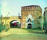
The '''Smolensk Kremlin''' ({{langx|ru|Смоленский кремль}}) is a fortified complex ([[kremlin (fortification)|kremlin]]) enclosing the center of the city of [[Smolensk]] in western [[Russia]]. The partially preserved fortress wall was built between 1595 and 1602, during the reigns of the tsars [[Feodor I of Russia|Feodor I]] and [[Boris Godunov]]. The length of the walls is about {{convert|6.5|km|mi}}, of which less than the half was preserved. The fortifications were built under the supervision of the architect [[Fyodor Kon]]. The Smolensk Kremlin is classified as an architectural monument protected at the federal level,<ref>{{cite web|url=http://kulturnoe-nasledie.ru/monuments.php?id=6710021000|script-title=ru:Крепостные стены и башни (Крепость Смоленская)|publisher=Russian Ministry of Culture|language=Russian|accessdate=5 August 2011|url-status=dead|archiveurl=https://web.archive.org/web/20120324150443/http://kulturnoe-nasledie.ru/monuments.php?id=6710021000|archivedate=24 March 2012|df=dmy-all}}</ref> and also has a great historical significance, in particular, as the fortress protecting the Russian state from the west over centuries. |
||
== History == |
== History == |
||
[[File: |
[[File:Smolemsk kreml.svg|thumb|Scheme of the Smolensk Kremlin, the remaining parts of the walls are shown in blue]] |
||
Smolensk historically had a great significance for the defence of Russia, and this is why Russian rulers paid considerable attention to its fortifications. In the spring of 1554, Tsar [[Ivan the Terrible]] ordered to build a new tall wooden fortress. After the development of [[artillery]], it became clear that a wooden fortress was no longer suitable for the defense, and at the end of the 16th century, it was decided to build a new stone fortress at the place of the old one. |
Smolensk historically had a great significance for the defence of Russia, and this is why Russian rulers paid considerable attention to its fortifications. In the spring of 1554, Tsar [[Ivan the Terrible]] ordered to build a new tall wooden fortress. After the development of [[artillery]], it became clear that a wooden fortress was no longer suitable for the defense, and at the end of the 16th century, it was decided to build a new stone fortress at the place of the old one. |
||
| Line 9: | Line 10: | ||
The construction of the new fortress used the old existing fortifications, in some places the new wall was built on top of them, and in certain areas, the new fortress extended beyond the limits set by the old one. |
The construction of the new fortress used the old existing fortifications, in some places the new wall was built on top of them, and in certain areas, the new fortress extended beyond the limits set by the old one. |
||
<!-- As a rule, she stood on the outside of the second shaft WHAT DOES THIS EVEN MEAN???--> |
<!-- As a rule, she stood on the outside of the second shaft WHAT DOES THIS EVEN MEAN???-->The construction started from the western side of the fortress. |
||
== Towers and walls== |
== Towers and walls== |
||
[[File:Федор Конь.jpg|thumb|left|Monument to Fyodor Kon, the architect of the Smolensk Kremlin]] |
|||
[[File:BD090090(2).jpg|250px|right|thumb|The walls of Smolensk in winter]] |
[[File:BD090090(2).jpg|250px|right|thumb|The walls of Smolensk in winter]] |
||
| ⚫ | |||
Several sections of the wall survived, the eastern section with nine towers, the south-western section with five towers, and the northern section with three towers. |
Several sections of the wall survived, the eastern section with nine towers, the south-western section with five towers, and the northern section with three towers. |
||
| Line 20: | Line 22: | ||
The Main Gate Tower was Frolovskaya (Dnieper Tower), through which was the exit to the capital of the Russian state. The second most important was Molohovskaya tower, opens the way to [[Kiev]], Krasny and [[Roslavl]]. |
The Main Gate Tower was Frolovskaya (Dnieper Tower), through which was the exit to the capital of the Russian state. The second most important was Molohovskaya tower, opens the way to [[Kiev]], Krasny and [[Roslavl]]. |
||
[[File:Smolemsk kreml.svg|thumb|Scheme of the Smolensk Kremlin, the remaining parts of the walls are shown in blue]] |
|||
===Remaining towers=== |
===Remaining towers=== |
||
| ⚫ | |||
*Pyatnitskaya (Water Tower) |
*Pyatnitskaya (Water Tower) |
||
*Volkova |
*Volkova |
||
| Line 39: | Line 41: | ||
*Bubleika |
*Bubleika |
||
*Kopytenskaya |
*Kopytenskaya |
||
<gallery widths=" |
<gallery widths="165" heights="150"> |
||
File:Башня Орел вечером.jpg|Oryol Tower |
File:Башня Орел вечером.jpg|Oryol Tower |
||
File:Долгочевская башня первая в ансамбле.jpg|Dolgochevskaya Tower |
File:Долгочевская башня первая в ансамбле.jpg|Dolgochevskaya Tower |
||
| Line 46: | Line 48: | ||
File:Bub.jpg|Bubleika Tower |
File:Bub.jpg|Bubleika Tower |
||
File:Gromovaya bashnya.jpg|Gromovaya Tower |
File:Gromovaya bashnya.jpg|Gromovaya Tower |
||
File:Kopytenskaya2.jpg|Kopytenskaya Tower |
|||
</gallery> |
</gallery> |
||
</center> |
|||
===Destroyed towers=== |
===Destroyed towers=== |
||
| Line 74: | Line 76: | ||
== External links == |
== External links == |
||
{{commons category|Smolensk Kremlin}} |
{{commons category|Smolensk Kremlin}} |
||
*[http://www.russiancity.ru/books/b16.htm Fortifications of Smolensk] {{ |
*[http://www.russiancity.ru/books/b16.htm Fortifications of Smolensk] {{in lang|ru}} |
||
{{coord|54|47|11|N|32|03|56|E|region:RU-SMO_type:landmark_source:kolossus-dewiki|display=title}} |
{{coord|54|47|11|N|32|03|56|E|region:RU-SMO_type:landmark_source:kolossus-dewiki|display=title}} |
||
| Line 83: | Line 85: | ||
[[Category:Buildings and structures in Smolensk Oblast]] |
[[Category:Buildings and structures in Smolensk Oblast]] |
||
[[Category:Tourist attractions in Smolensk Oblast]] |
[[Category:Tourist attractions in Smolensk Oblast]] |
||
[[Category:Cultural heritage monuments of federal significance in Smolensk Oblast]] |
|||
[[Category:Military history of Smolensk|Kremlin]] |
|||
Latest revision as of 05:56, 6 November 2024

The Smolensk Kremlin (Russian: Смоленский кремль) is a fortified complex (kremlin) enclosing the center of the city of Smolensk in western Russia. The partially preserved fortress wall was built between 1595 and 1602, during the reigns of the tsars Feodor I and Boris Godunov. The length of the walls is about 6.5 kilometres (4.0 mi), of which less than the half was preserved. The fortifications were built under the supervision of the architect Fyodor Kon. The Smolensk Kremlin is classified as an architectural monument protected at the federal level,[1] and also has a great historical significance, in particular, as the fortress protecting the Russian state from the west over centuries.
History
[edit]
Smolensk historically had a great significance for the defence of Russia, and this is why Russian rulers paid considerable attention to its fortifications. In the spring of 1554, Tsar Ivan the Terrible ordered to build a new tall wooden fortress. After the development of artillery, it became clear that a wooden fortress was no longer suitable for the defense, and at the end of the 16th century, it was decided to build a new stone fortress at the place of the old one.
In December 1595, the preparations for the construction started after the official decree was issued. The construction works were very intense and were performed daily from sunrise to sunset. The construction workers, however, lived in harsh conditions and revolted in 1599 because of hunger, cold, and diseases. In the summer of 1597 long and heavy rains flooded all the trenches and ditches, and the construction workers had to strengthen the landslide soil by piles. In 1600, because of the heat and heavy rains, a large number of crops was lost in Russia, causing a famine.
The construction of the new fortress used the old existing fortifications, in some places the new wall was built on top of them, and in certain areas, the new fortress extended beyond the limits set by the old one. The construction started from the western side of the fortress.
Towers and walls
[edit]

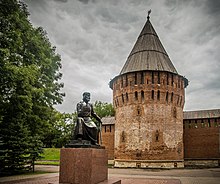
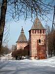
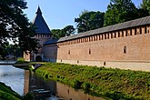
Several sections of the wall survived, the eastern section with nine towers, the south-western section with five towers, and the northern section with three towers.
The most famous remaining tower is the round-cornered tower named Veselukha. This name was given to it because of the nice view which opens from the tower. In the daytime, citizens lead their guests to see the beautiful suburbs. However, in the evening time and especially during the night it is a rather dangerous place and has a bad reputation. Brave hearts who dare to appear at this place told about horror phantoms and ghosts. Finally it was found the reasonable explanation to that awful fact. This place was used by the counterfeiters who printed out false money and scared people who tried to walk around.[citation needed]
The Main Gate Tower was Frolovskaya (Dnieper Tower), through which was the exit to the capital of the Russian state. The second most important was Molohovskaya tower, opens the way to Kiev, Krasny and Roslavl.
Remaining towers
[edit]
- Pyatnitskaya (Water Tower)
- Volkova
- Kostyrevskaya (Red Tower)
- Veselukha (Luchinskaya)
- Pozdnyakova (Rogovka)
- Oryol (Gorogetskaya)
- Avraamievskaya
- Zaaltarnaya (Belukha)
- Voronina
- Dolgochevskaya
- Zimbulka
- Nikolskaya
- Mokhovaya
- Donets
- Gromovaya
- Bubleika
- Kopytenskaya
-
Oryol Tower
-
Dolgochevskaya Tower
-
Volkova Tower
-
Nikolskaya Tower
-
Bubleika Tower
-
Gromovaya Tower
-
Kopytenskaya Tower
Destroyed towers
[edit]- Antifonovskaya
- Bogoslovskaya
- Ivorovskaya (Verzhenova)
- Pyatnitsa (Water Gate)
- Granovitaya (Faceted Tower)
- Gurkina
- Frolovskaya
- Evstafevskaya (Brikareva)
- Kassandalovskaya (Kozodavlevskaya, Artishevskaya)
- 2 unnamed round towers
- Krylosh Gate
- Lazarev Gate
- Molokhov Gate
- Mikulinskaya
- Stefanskaya
- Kolominskaya (Sheinova)
- Gorodetskaya (Semenovskaya)
- 3 unnamed quadrangular towers
References
[edit]- ^ Крепостные стены и башни (Крепость Смоленская) (in Russian). Russian Ministry of Culture. Archived from the original on 24 March 2012. Retrieved 5 August 2011.
External links
[edit]- Fortifications of Smolensk (in Russian)


