Fərzalı: Difference between revisions
Appearance
Content deleted Content added
m Robot: sorting stub (based on existing categorisation) |
|||
| (18 intermediate revisions by 12 users not shown) | |||
| Line 1: | Line 1: | ||
{{For|the village in Jalilabad District|Fərzili}} |
|||
{{ |
{{coord|40|38|16|N|45|27|22|E|display=title}} |
||
{{Infobox |
{{Infobox settlement |
||
|official_name =Fərzalı |
| official_name = {{langx|az|Fərzalı}} |
||
|native_name = |
|||
| |
| native_name = |
||
| |
| pushpin_map = Azerbaijan |
||
| |
| pushpin_mapsize = 300 |
||
| |
| subdivision_type = Country |
||
| subdivision_name = {{flag|Azerbaijan}} |
|||
|subdivision_type1 = [[Administrative divisions of Azerbaijan| |
| subdivision_type1 = [[Administrative divisions of Azerbaijan|District]] |
||
|subdivision_name1 =[[Gadabay |
| subdivision_name1 = [[Gadabay District|Gadabay]] |
||
| ⚫ | |||
| |
| subdivision_type2 = Municipality |
||
| subdivision_name2 = [[Arabaçı|Arabachy]] |
|||
|established_title = |
|||
| |
| leader_title = |
||
| |
| leader_name = |
||
| |
| established_title = |
||
| |
| established_date = |
||
| ⚫ | |||
|population_total = |
|||
| area_footnotes = |
|||
| ⚫ | |||
| population_as_of = |
|||
| ⚫ | |||
| |
| population_total = |
||
| ⚫ | |||
|timezone_DST =[[Azerbaijan Time|AZT]] |
|||
| |
| timezone = [[Azerbaijan Time|AZT]] |
||
| ⚫ | |||
|latd=40 |latm=38 |lats=16 |latNS=N |
|||
| ⚫ | |||
|longd=45|longm=27 |longs=22 |longEW=E |
|||
| |
| utc_offset_DST = +5 |
||
| coordinates = {{coord|40|38|16|N|45|27|22|E|region:AZ|display=inline}} |
|||
| ⚫ | |||
| |
| elevation_m = |
||
| area_code = |
|||
| website = |
|||
| name = Farzaly |
|||
}} |
}} |
||
'''Fərzalı''' (also, '''Farzaly''') is a village in the [[Gadabay District]] of [[Azerbaijan]]. The village forms part of the municipality of [[Arabaçı|Arabachy]].<ref>{{cite web|url=http://www.belediyye.org/index.php?con=qanun&bkod=3637 |title=Belediyye Informasiya Sistemi |archiveurl=https://web.archive.org/web/20080924083213/http://www.belediyye.org/index.php?con=qanun&bkod=3637 |archivedate=September 24, 2008 |language=Azerbaijani}}</ref> |
|||
'''Fərzalı''' (also, '''Farzaly''') is a village in the [[Gadabay Rayon]] of [[Azerbaijan]]. |
|||
== References == |
== References == |
||
{{reflist}} |
|||
*[[GEOnet Names Server]] |
|||
*{{GEOnet2|32FA8815151F3774E0440003BA962ED3}} |
|||
{{Gadabay District}} |
|||
[[Category:Cities, towns and villages in Azerbaijan]] |
|||
| ⚫ | |||
{{DEFAULTSORT:Farzaly}} |
|||
| ⚫ | |||
Latest revision as of 14:21, 7 November 2024
40°38′16″N 45°27′22″E / 40.63778°N 45.45611°E
Farzaly | |
|---|---|
| Azerbaijani: Fərzalı | |
| Coordinates: 40°38′16″N 45°27′22″E / 40.63778°N 45.45611°E | |
| Country | |
| District | Gadabay |
| Municipality | Arabachy |
| Time zone | UTC+4 (AZT) |
| • Summer (DST) | UTC+5 (AZT) |
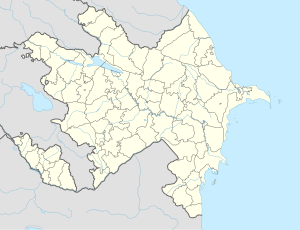
Fərzalı (also, Farzaly) is a village in the Gadabay District of Azerbaijan. The village forms part of the municipality of Arabachy.[1]
References
[edit]- ^ "Belediyye Informasiya Sistemi" (in Azerbaijani). Archived from the original on September 24, 2008.


