Hayya, Sudan: Difference between revisions
Appearance
Content deleted Content added
| (7 intermediate revisions by 5 users not shown) | |||
| Line 1: | Line 1: | ||
{{Infobox |
{{Infobox settlement |
||
<!--See the Table at Infobox Settlement for all fields and descriptions of usage--> |
<!--See the Table at Infobox Settlement for all fields and descriptions of usage--> |
||
<!-- Basic info ----------------> |
<!-- Basic info ----------------> |
||
|official_name = Hayya |
|official_name = Hayya |
||
|other_name = |
|other_name = |
||
|native_name = |
|native_name = {{Nobold|{{lang|ar|هيا}}}} |
||
|nickname = |
|nickname = |
||
|settlement_type = |
|settlement_type = Village |
||
|motto = |
|motto = |
||
<!-- images and maps -----------> |
<!-- images and maps -----------> |
||
| Line 37: | Line 37: | ||
|subdivision_type = Country |
|subdivision_type = Country |
||
|subdivision_name = [[Image:Flag of Sudan.svg|25px]] [[Sudan]] |
|subdivision_name = [[Image:Flag of Sudan.svg|25px]] [[Sudan]] |
||
|subdivision_type1 = |
|subdivision_type1 = [[States of Sudan|State]] |
||
|subdivision_name1 = [[Red Sea (state)]] |
|subdivision_name1 = [[Red Sea (state)]] |
||
<!-- Politics -----------------> |
<!-- Politics -----------------> |
||
| Line 70: | Line 70: | ||
<!-- Population -----------------------> |
<!-- Population -----------------------> |
||
|population_as_of = |
|population_as_of = |
||
|population_footnotes =<ref>http://www.collinsmaps.com/maps/Sudan/Red-Sea/Haiya/P485246.00.aspx |
|population_footnotes =<ref>{{cite web |url=http://www.collinsmaps.com/maps/Sudan/Red-Sea/Haiya/P485246.00.aspx |title= Map of Haiya, Sudan, Africa - Collins Maps|website=www.collinsmaps.com |archive-url=https://web.archive.org/web/20110708175833/http://www.collinsmaps.com/maps/Sudan/Red-Sea/Haiya/P485246.00.aspx |archive-date=July 8, 2011}}</ref> |
||
|population_note = |
|population_note = |
||
|pop_est_as_of = 2011 |
|pop_est_as_of = 2011 |
||
| Line 93: | Line 93: | ||
|timezone_DST = |
|timezone_DST = |
||
|utc_offset_DST = |
|utc_offset_DST = |
||
|coordinates = {{coord|18|20|46|N|36|23|49|E|display= |
|coordinates = {{coord|18|20|46|N|36|23|49|E|display=it}} |
||
|elevation_footnotes = <!--for references: use <ref> </ref> tags--> |
|elevation_footnotes = <!--for references: use <ref> </ref> tags--> |
||
|elevation_m = 662 |
|elevation_m = 662 |
||
| Line 108: | Line 108: | ||
|footnotes = |
|footnotes = |
||
}} |
}} |
||
| ⚫ | '''Hayya''' ({{langx|ar|هيا}}), also '''Haiya''', is a village <ref>{{cite web|url=http://www.pbase.com/bmcmorrow/tokassala&page=2 |title=Port Sudan to Kassala Photo Gallery by Brian McMorrow at |publisher=Pbase.com |date= |accessdate=2016-08-15}}</ref> in the [[Red Sea (state)|Red Sea State]] of [[Sudan]]. Hayya sits at the point where the railways and the roads which come from [[Atbara]] and [[Kassala]], meet, and continue towards [[Suakin]] and [[Port Sudan]]. It is also a junction station on the mainline of the Sudan railway network. |
||
| ⚫ | '''Hayya''' (also '''Haiya''' |
||
== See also == |
== See also == |
||
| Line 119: | Line 118: | ||
<references/> |
<references/> |
||
[[Category:Populated places in Red Sea |
[[Category:Populated places in Red Sea State]] |
||
Latest revision as of 16:22, 7 November 2024
Hayya
هيا | |
|---|---|
Village | |
| Coordinates: 18°20′46″N 36°23′49″E / 18.34611°N 36.39694°E | |
| Country | |
| State | Red Sea (state) |
| Elevation | 2,172 ft (662 m) |
| Population | |
• Estimate (2011) | less than 1,000 |
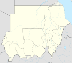
Hayya (Arabic: هيا), also Haiya, is a village [2] in the Red Sea State of Sudan. Hayya sits at the point where the railways and the roads which come from Atbara and Kassala, meet, and continue towards Suakin and Port Sudan. It is also a junction station on the mainline of the Sudan railway network.
See also
[edit]Notes
[edit]- ^ "Map of Haiya, Sudan, Africa - Collins Maps". www.collinsmaps.com. Archived from the original on July 8, 2011.
- ^ "Port Sudan to Kassala Photo Gallery by Brian McMorrow at". Pbase.com. Retrieved 2016-08-15.

