Kitadaito Airport: Difference between revisions
Appearance
Content deleted Content added
added Category:Daitō Islands using HotCat |
No edit summary |
||
| (23 intermediate revisions by 13 users not shown) | |||
| Line 4: | Line 4: | ||
| nativename-a = 北大東空港 |
| nativename-a = 北大東空港 |
||
| nativename-r = Kitadaitō Kūkō |
| nativename-r = Kitadaitō Kūkō |
||
| image = |
| image =Ktd.jpg |
||
| image-width = 300 |
|||
| IATA = KTD |
| IATA = KTD |
||
| ICAO = RORK |
| ICAO = RORK |
||
| Line 13: | Line 14: | ||
| location = [[Kitadaitō, Okinawa|Kitadaitō]], [[Japan]] |
| location = [[Kitadaitō, Okinawa|Kitadaitō]], [[Japan]] |
||
| elevation-f = 71 |
| elevation-f = 71 |
||
| coordinates = {{coord|25|56|41|N|131|19|37|E|region:JP|display=inline,title}} |
|||
| latd = 25 | latm = 56 | lats = 41 | latNS = N |
|||
| ⚫ | |||
| longd= 131 | longm= 19 | longs= 37 | longEW= E |
|||
| coordinates_region = JP |
|||
| ⚫ | |||
| pushpin_label = RORK |
| pushpin_label = RORK |
||
| pushpin_map_caption = Location in Japan |
| pushpin_map_caption = Location in Japan |
||
| Line 24: | Line 23: | ||
| r1-length-m = 1,500 |
| r1-length-m = 1,500 |
||
| r1-surface = [[Asphalt concrete]] |
| r1-surface = [[Asphalt concrete]] |
||
| stat-year = 2015 |
|||
| footnotes = Source: Japanese [[Aeronautical Information Publication|AIP]] at [[Aeronautical Information Service|AIS Japan]]<ref name="AIP">[https://aisjapan.mlit.go.jp/ AIS Japan]</ref> |
|||
| stat1-header = Passengers |
|||
| stat1-data = 17,208 |
|||
| stat2-header = Cargo (metric tonnes) |
|||
| stat2-data = 67 |
|||
| stat3-header = Aircraft movement |
|||
| stat3-data = 770 |
|||
| footnotes = Source: Japanese [[Ministry of Land, Infrastructure, Transport and Tourism]]<ref>{{cite web|title=Kita Daito Airport|url=http://www.mlit.go.jp/common/001141840.pdf|publisher=Japanese [[Ministry of Land, Infrastructure, Transport and Tourism]]|access-date=7 January 2017|url-status=dead|archive-url=https://web.archive.org/web/20161021205147/http://www.mlit.go.jp/common/001141840.pdf|archive-date=21 October 2016}}</ref> |
|||
}} |
}} |
||
{{nihongo|''' |
{{nihongo|'''Kitadaitō Airport'''|北大東空港|''Kitadaitō Kūkō''|{{airport codes|KTD|RORK}}}} is located on the island of [[Kitadaitōjima]] in the village of [[Kitadaitō, Okinawa|Kitadaitō]], [[Shimajiri District]], [[Okinawa Prefecture]], [[Japan]]. |
||
The prefecture operates the airport, which is classified as a [[List of airports in Japan|third class airport]]. |
The prefecture operates the airport, which is classified as a [[List of airports in Japan|third class airport]]. |
||
Only a flight from [[Naha Airport|Naha]] to Kitadaitō is operated every day.<ref name="Shortest">{{cite web |title=JAL Group Discontinues Shortest Domestic Japan Route in 3Q24 |url=https://www.aeroroutes.com/eng/240131-jlaug24oka |website=Aeroroutes |access-date=31 January 2024}}</ref> |
|||
Only a round flight from [[Naha Airport|Naha]], to Kitadaito and [[Minami-Daito Airport|Minami-Daito]], back to Naha is operated everyday. The route differs on the day of the week. Flight from Kitadaito to Minami-Daito is the shortest flight in Japan, costs [[Japanese yen|JPY¥]]7,600, and is only {{convert|12|km|abbr=on}} long, takes 3 minutes in the air.{{citation needed|date=November 2010}} |
|||
== |
==History== |
||
Kitadaito Airport was opened in 1971 as an emergency 760 meter airstrip, constructed of crushed coral by the [[United States Civil Administration of the Ryukyu Islands]]. The runway was paved and extended to 800 meters in 1978, when scheduled passenger services commenced. The runway was extended to 1500 meters in 1997. At present, there is only one scheduled flight per day. |
|||
==Airlines and destinations== |
|||
{{Airport-dest-list |
{{Airport-dest-list |
||
| |
| [[Ryukyu Air Commuter]] | [[Naha Airport|Naha]] |
||
}} |
}} |
||
| Line 42: | Line 51: | ||
==External links== |
==External links== |
||
{{commons category}} |
|||
{{ |
{{Portal|Japan|Aviation}} |
||
* [http://www.pref.okinawa.jp/airport/index/kt/kitadaito00-e.htm Kitadaito Airport] |
* [http://www.pref.okinawa.jp/airport/index/kt/kitadaito00-e.htm Kitadaito Airport] |
||
* [http://www.jal.co.jp/en/dom/airport/japan/ktd/ktd_00.html Kitadaito Airport Guide] from ''[[Japan Airlines]]'' |
* [http://www.jal.co.jp/en/dom/airport/japan/ktd/ktd_00.html Kitadaito Airport Guide] from ''[[Japan Airlines]]'' |
||
Latest revision as of 18:50, 8 November 2024
This article needs additional citations for verification. (May 2013) |
Kitadaito Airport 北大東空港 Kitadaitō Kūkō | |||||||||||
|---|---|---|---|---|---|---|---|---|---|---|---|
 | |||||||||||
| Summary | |||||||||||
| Airport type | Public | ||||||||||
| Operator | Okinawa Prefecture | ||||||||||
| Location | Kitadaitō, Japan | ||||||||||
| Elevation AMSL | 71 ft / 22 m | ||||||||||
| Coordinates | 25°56′41″N 131°19′37″E / 25.94472°N 131.32694°E | ||||||||||
| Map | |||||||||||
 | |||||||||||
| Runways | |||||||||||
| |||||||||||
| Statistics (2015) | |||||||||||
| |||||||||||
Source: Japanese Ministry of Land, Infrastructure, Transport and Tourism[1] | |||||||||||
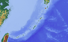
Kitadaitō Airport (北大東空港, Kitadaitō Kūkō, (IATA: KTD, ICAO: RORK)) is located on the island of Kitadaitōjima in the village of Kitadaitō, Shimajiri District, Okinawa Prefecture, Japan.
The prefecture operates the airport, which is classified as a third class airport.
Only a flight from Naha to Kitadaitō is operated every day.[2]
History
[edit]Kitadaito Airport was opened in 1971 as an emergency 760 meter airstrip, constructed of crushed coral by the United States Civil Administration of the Ryukyu Islands. The runway was paved and extended to 800 meters in 1978, when scheduled passenger services commenced. The runway was extended to 1500 meters in 1997. At present, there is only one scheduled flight per day.
Airlines and destinations
[edit]| Airlines | Destinations |
|---|---|
| Ryukyu Air Commuter | Naha |
References
[edit]- ^ "Kita Daito Airport" (PDF). Japanese Ministry of Land, Infrastructure, Transport and Tourism. Archived from the original (PDF) on 21 October 2016. Retrieved 7 January 2017.
- ^ "JAL Group Discontinues Shortest Domestic Japan Route in 3Q24". Aeroroutes. Retrieved 31 January 2024.
External links
[edit]Wikimedia Commons has media related to Kitadaito Airport.


