Chalkuyruk: Difference between revisions
Appearance
Content deleted Content added
m Bot) Add coordinates_region and/or _display parameters (report errors? |
|||
| (9 intermediate revisions by 6 users not shown) | |||
| Line 1: | Line 1: | ||
{{Infobox |
{{Infobox river |
||
| ⚫ | |||
|official_name = Chalkuyruk |
|||
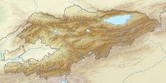
|pushpin_map_caption=Location in Kyrgyzstan |
|||
|native_name = |
|||
| ⚫ | |||
| ⚫ | |||
| ⚫ | |||
|mapsize =200px |
|||
|subdivision_type2=Region |
|||
|coordinates_display = inline,title |
|||
|subdivision_name2=[[Osh Region|Osh]] |
|||
|coordinates_region = KG |
|||
|mouth_coordinates={{coord|39.9795|73.0043|display=it}} |
|||
|subdivision_type = Country |
|||
|mouth=[[Ak-Buura]] |
|||
|subdivision_name = [[Kyrgyzstan]] |
|||
| ⚫ | |||
| ⚫ | |||
|leader_title = |
|||
|leader_name = |
|||
|established_title = |
|||
|established_date = |
|||
|area_total_km2 = |
|||
|area_footnotes = |
|||
|population_as_of = |
|||
|population_total = |
|||
|population_density_km2 = |
|||
|timezone =UTC +5 |
|||
|utc_offset = |
|||
|timezone_DST = |
|||
|utc_offset_DST = |
|||
|latd=39 |latm=58 |lats=48 |latNS=N |
|||
|longd=73|longm= 0|longs=36 |longEW=E |
|||
|elevation_m = 2386 |
|||
|area_code = |
|||
|website = |
|||
}} |
}} |
||
'''Chalkuyruk''' is a [[ |
The '''Chalkuyruk''' ({{langx|ky|Чалкуйрук}}) is a [[river]] in [[Osh Region]] of [[Kyrgyzstan]]. It is a right tributary of the [[Ak-Buura]].<ref>Soviet military map [https://maps.vlasenko.net/smtm200/j-43-02.jpg J-43-02] (1:200,000)</ref> |
||
== References == |
|||
Nearby towns and villages include [[Kyzyl-Tala]] (3 miles), [[Kodzhokël']] (6 miles) and [[Kichik-Alay]] (6 miles). |
|||
{{reflist}} |
|||
== External links == |
|||
*[http://www.fallingrain.com/world/KG/a/C/ Places in Kyrgyzstan] – Fallingrain.com |
|||
*[http://www.maplandia.com/kyrgyzstan/osh/chalkuyruk-39-59-0-n-73-1-0-e/ Satellite map at Maplandia.com] |
|||
{{Rivers of Kyrgyzstan}} |
|||
[[Category:Populated places in Osh Province]] |
|||
[[Category:Rivers of Kyrgyzstan]] |
|||
| ⚫ | |||
[[roa-rup:Chalkuyruk]] |
|||
| ⚫ | |||
Latest revision as of 19:29, 8 November 2024
| Chalkuyruk | |
|---|---|
| Location | |
| Country | Kyrgyzstan |
| Region | Osh |
| Physical characteristics | |
| Mouth | Ak-Buura |
• coordinates | 39°58′46″N 73°00′15″E / 39.9795°N 73.0043°E |
The Chalkuyruk (Kyrgyz: Чалкуйрук) is a river in Osh Region of Kyrgyzstan. It is a right tributary of the Ak-Buura.[1]
References
[edit]

