Moskva District, Kyrgyzstan: Difference between revisions
| (4 intermediate revisions by 3 users not shown) | |||
| Line 73: | Line 73: | ||
}} |
}} |
||
'''Moskva''' ({{ |
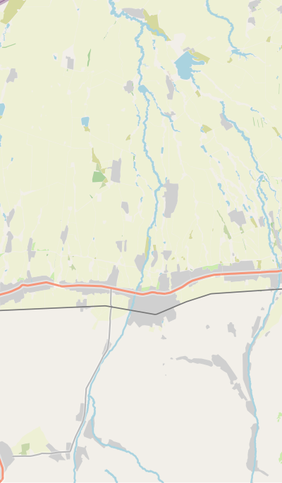
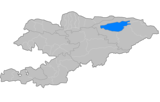
'''Moskva''' ({{langx|ky|Москва району}}) is a [[Districts of Kyrgyzstan|district]] of [[Chüy Region]] in northern [[Kyrgyzstan]]. Its area is {{convert|2056|km2}},<ref name=census09>{{cite Kyrgyzstan census 2009|Chüy|13, 16, 271–273}}</ref> and its resident population was 103,007 in 2021.<ref name=pop21>{{cite Kyrgyzstan population 2021}}</ref> The administrative seat lies at [[Belovodskoye]].<ref name=class>{{cite web|url=https://stat.gov.kg/media/files/21f93e4d-9418-433e-aed9-ecb28d70ef5a.doc|title=Classification system of territorial units of the Kyrgyz Republic|language=ky|date=May 2021|publisher=National Statistics Committee of the Kyrgyz Republic|pages=75–76}}</ref> |
||
==History== |
==History== |
||
| Line 112: | Line 112: | ||
{{bar percent|[[Kurds]]|yellow|1.4}} |
{{bar percent|[[Kurds]]|yellow|1.4}} |
||
{{bar percent|[[Uyghur people|Uyghurs]]|turquoise|1.1}} |
{{bar percent|[[Uyghur people|Uyghurs]]|turquoise|1.1}} |
||
{{bar percent|[[Kazakh |
{{bar percent|[[Kazakh people|Kazakhs]]|Kazakhs|0.9}}}} |
||
==Rural communities and villages== |
==Rural communities and villages== |
||
| Line 176: | Line 176: | ||
{{reflist}} |
{{reflist}} |
||
{{Districts of Kyrgyzstan}} |
{{Districts of Kyrgyzstan}} |
||
{{Geographic Location |
|||
| Center = Moskva District |
|||
| North = [[Kazakhstan]] |
|||
| Northeast = |
|||
| East = [[Sokuluk District]], [[Chüy Region]] |
|||
| Southeast = |
|||
| South = [[Panfilov District, Kyrgyzstan|Panfilov District]], [[Chüy Region]] |
|||
| Southwest = |
|||
| West = [[Jayyl District]], [[Chüy Region]] |
|||
| Northwest = |
|||
}} |
|||
{{coord|42.829006|N|74.123346|E|type:adm2nd_source:itwiki|display=title}} |
{{coord|42.829006|N|74.123346|E|type:adm2nd_source:itwiki|display=title}} |
||
Latest revision as of 23:21, 9 November 2024
Moskva
Москва району | |
|---|---|
 | |
 | |
| Country | Kyrgyzstan |
| Region | Chüy Region |
| Stalin District | 1930 |
| Area | |
• Total | 2,056 km2 (794 sq mi) |
| Population (2021)[1] | |
• Total | 103,007 |
| • Density | 50/km2 (130/sq mi) |
| Time zone | UTC+6 |
Moskva (Kyrgyz: Москва району) is a district of Chüy Region in northern Kyrgyzstan. Its area is 2,056 square kilometres (794 sq mi),[2] and its resident population was 103,007 in 2021.[1] The administrative seat lies at Belovodskoye.[3]
History
[edit]Moskva District was established as Stalin District on July 23, 1930. In 1961, as part of de-Stalinization, it was renamed into Moskva District, after the city of Moscow.[2]
Population
[edit]Moskva District is ethnically diverse. A plurality of the population (46.1%) are ethnic Kyrgyz. Large minority of Russians (23.3%) and Dungans inhabit in the district as well. Smaller population of Uzbeks, Ukrainians, and Kurds also inhabit in the district.
| Year | Pop. | ±% p.a. |
|---|---|---|
| 1970 | 65,403 | — |
| 1979 | 72,895 | +1.21% |
| 1989 | 83,802 | +1.40% |
| 1999 | 83,608 | −0.02% |
| 2009 | 84,443 | +0.10% |
| 2021 | 103,007 | +1.67% |
| Note: resident population; Sources:[2][1] | ||
Rural communities and villages
[edit]In total, Moskva District includes 28 settlements in 12 rural communities (ayyl aymagy). Each rural community can include one or several villages. The rural communities and settlements in the Moskva District are:[3][4]
- Ak-Suu (seat: Tömön-Suu; and also villages Ak-Bashat, Ak-Torpok, Bala-Ayylchi, Keper-Aryk, Murake and Chong-Aryk)
- Aleksandrovka (seat: Aleksandrovka; incl. Besh-Örük and Krupskaya)
- Belovodskoye (seat: Belovodskoye; incl. Kosh-Döbö)
- Besh-Terek (seat: Besh-Terek)
- Birinchi May (seat: Ak-Suu)
- Chapaev (seat: Spartak; incl. Ak-Söök and Malovodnoye)
- Petrovka (seat: Petrovka; incl. Zavodskoye and Kyzyl-Tuu)
- Predtechenka (seat: Predtechenka; incl. Ang-Aryk)
- Sadovy (seat: Sadovoye)
- Sretenka (seat: Sretenka; incl. Bolshevik and Zarya)
- Tölök (seat: Tölök)
- Tselinny (seat: Kyz-Molo)
References
[edit]- ^ a b c d "Population of regions, districts, towns, urban-type settlements, rural communities and villages of Kyrgyz Republic" (XLS) (in Russian). National Statistics Committee of the Kyrgyz Republic. 2021. Archived from the original on 10 November 2021.
- ^ a b c d "2009 population and housing census of the Kyrgyz Republic: Chüy Region" (PDF) (in Russian). National Statistics Committee of the Kyrgyz Republic. 2010. pp. 13, 16, 271–273.
- ^ a b "Classification system of territorial units of the Kyrgyz Republic" (in Kyrgyz). National Statistics Committee of the Kyrgyz Republic. May 2021. pp. 75–76.
- ^ List of Rural Communities of Kyrgyzstan Archived 2010-02-09 at the Wayback Machine
42°49′44″N 74°07′24″E / 42.829006°N 74.123346°E


