Blatnica Valley: Difference between revisions
Appearance
Content deleted Content added
m robot Adding: nn:Blatnicadalen |
|||
| (16 intermediate revisions by 12 users not shown) | |||
| Line 1: | Line 1: | ||
{{Unreferenced|date=December 2009}} |
|||
{{Geobox | Valley |
|||
{{Infobox valley |
|||
<!-- *** Heading *** --> |
<!-- *** Heading *** --> |
||
| name = Blatnica |
| name = Blatnica |
||
| |
| other_name = Blatnická dolina |
||
| |
| photo = Blatnická dolina.jpg |
||
| |
| photo_caption = Rock window in the Blatnica Valley |
||
<!-- *** Name *** --> |
|||
| ⚫ | |||
| official_name = |
|||
| motto = |
|||
| nickname = |
|||
<!-- *** Image *** --> |
|||
| image = Blatnická dolina.jpg |
|||
| image_caption = Rock window in the Blatnica Valley |
|||
<!-- *** Country etc. *** --> |
<!-- *** Country etc. *** --> |
||
| country = Slovakia |
| country = Slovakia |
||
| country_flag = 1 |
|||
| state = |
| state = |
||
| region = [[Žilina Region|Žilina]] |
| region = [[Žilina Region|Žilina]] |
||
| district = [[Martin District|Martin]] |
| district = [[Martin District|Martin]] |
||
| municipality = [[Blatnica, Slovakia|Blatnica]] |
|||
<!-- *** Family *** --> |
<!-- *** Family *** --> |
||
| parent = |
|||
| range = Greater Fatra |
| range = Greater Fatra |
||
| road = |
|||
| border = |
|||
| part = |
|||
| child_left = |
|||
| child_right = |
|||
| river = Blatnica Stream |
| river = Blatnica Stream |
||
<!-- *** Locations *** --> |
<!-- *** Locations *** --> |
||
| location = Juriašovo crossing |
| location = Juriašovo crossing |
||
| elevation = |
| elevation = |
||
| coordinates = {{coord|48.90607|18.96319|format=dms|display=inline,title}} |
|||
| prominence = |
|||
| |
| length_km = 8 |
||
| long_d = 18.96319 |
|||
| coordinates_format = dms |
|||
| highest = |
|||
| highest_elevation = |
|||
| highest_lat_d = |
|||
| highest_long_d = |
|||
| lowest = merger with [[Gader Valley]] |
|||
| lowest_elevation = |
|||
| lowest_lat_d = 48.93195 |
|||
| lowest_long_d = 18.93493 |
|||
<!-- *** Dimensions *** --> |
|||
| length = 8 |
|||
| width = |
| width = |
||
| depth = |
| depth = |
||
| Line 52: | Line 25: | ||
| population = |
| population = |
||
| population_density = |
| population_density = |
||
| ⚫ | |||
<!-- *** Features *** --> |
|||
}} |
|||
| geology = limestone |
|||
| geology1 = dolomite |
|||
| orogeny = |
|||
| period = |
|||
<!-- *** Acess *** --> |
|||
| public = |
|||
| access = dirt road |
|||
<!-- *** UNESCO etc. *** --> |
|||
| category_iucn = |
|||
<!-- *** Free frields *** --> |
|||
| free = |
|||
<!-- *** Maps *** --> |
|||
| map = Slovakia - outline map.svg |
|||
| map_background = Slovakia - background map.png |
|||
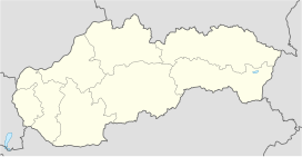
| map_caption = Location of Blatnica in Slovakia |
|||
| map_locator = Slovakia |
|||
| map1 = Žilina Region - outline map.svg |
|||
| map1_background = Žilina Region - background map.png |
|||
| map1_caption = Location of Blatnica Valley in the Žilina Region |
|||
| map1_locator = Žilina Region |
|||
<!-- *** Websites *** --> |
|||
| commons = |
|||
| statistics = |
|||
| website = |
|||
<!-- *** Footnotes *** --> |
|||
| footnotes = |
|||
<!-- Processed by Geoboxer 3.0 on 2007-10-14T10:10:28+02:00 --> }} |
|||
The '''Blatnica Valley''' ({{ |
The '''Blatnica Valley''' ({{Langx|sk|Blatnická dolina}}) is a [[karst]] valley in the [[Greater Fatra]] Range in [[Slovakia]]. It is accessible from the [[village]] of [[Blatnica, Slovakia|Blatnica]] along a dirt road. Most of the valley is densely forested, in places with views at the surrounding [[limestone]] and [[Dolomite (rock)|dolomite]] [[strata]]. The best known part of the valley is the rock window at its lower part. [[Ostrá (Veľká Fatra)|Ostrá]] and [[Drieňok]] mountains can be climbed from the valley bottom. |
||
==References== |
|||
| ⚫ | |||
{{reflist}} |
|||
{{authority control}} |
|||
| ⚫ | |||
[[Category:Veľká Fatra]] |
[[Category:Veľká Fatra]] |
||
[[Category:Geography of Žilina Region]] |
|||
[[Category:Karst]] |
|||
| ⚫ | |||
| ⚫ | |||
[[nn:Blatnicadalen]] |
|||
[[sk:Blatnická dolina]] |
|||
Latest revision as of 02:09, 10 November 2024
| Blatnica | |
|---|---|
| Blatnická dolina | |
 Rock window in the Blatnica Valley | |
| Length | 8 km (5.0 mi) |
| Geography | |
| Country | Slovakia |
| State/Province | Žilina |
| District | Martin |
| Coordinates | 48°54′22″N 18°57′47″E / 48.90607°N 18.96319°E |
| Mountain range | Greater Fatra |
| River | Blatnica Stream |
The Blatnica Valley (Slovak: Blatnická dolina) is a karst valley in the Greater Fatra Range in Slovakia. It is accessible from the village of Blatnica along a dirt road. Most of the valley is densely forested, in places with views at the surrounding limestone and dolomite strata. The best known part of the valley is the rock window at its lower part. Ostrá and Drieňok mountains can be climbed from the valley bottom.
References
[edit]

