Saloi: Difference between revisions
Appearance
Content deleted Content added
clarif |
No edit summary Tags: Mobile edit Mobile web edit |
||
| (15 intermediate revisions by 12 users not shown) | |||
| Line 1: | Line 1: | ||
{{unreferenced}} |
|||
{{Infobox settlement |
{{Infobox settlement |
||
| name = Saloi |
| name = Saloi |
||
| settlement_type = Villages & Union Council |
| settlement_type = Villages & Union Council |
||
| image_skyline = |
| image_skyline = |
||
| imagesize = 240px |
|||
| image_caption = |
| image_caption = |
||
| image_map = |
| image_map = |
||
| mapsize = 100px |
|||
| pushpin_map = Punjab Pakistan#Pakistan |
| pushpin_map = Punjab Pakistan#Pakistan |
||
| pushpin_label_position = bottom<!-- left, right, top, bottom, none --> |
|||
| pushpin_map_caption = |
| pushpin_map_caption = |
||
| ⚫ | |||
| subdivision_type = Country |
| subdivision_type = Country |
||
| subdivision_name = |
| subdivision_name = {{flag|Pakistan}} |
||
| subdivision_type1 = [[Subdivisions of Pakistan| |
| subdivision_type1 = [[Subdivisions of Pakistan|Province]] |
||
| subdivision_type2 = [[ |
| subdivision_type2 = [[List of districts of Pakistan|District]] |
||
| subdivision_type3 = [[Tehsil]] |
| subdivision_type3 = [[Tehsil]] |
||
| subdivision_type4 = Villages in Union Council |
| subdivision_type4 = Villages in Union Council |
||
| Line 19: | Line 21: | ||
| subdivision_name2 = [[Chakwal District]] |
| subdivision_name2 = [[Chakwal District]] |
||
| subdivision_name3 = [[Choa Saidanshah]] |
| subdivision_name3 = [[Choa Saidanshah]] |
||
| subdivision_name4 = |
| subdivision_name4 = 8 |
||
| subdivision_name5 = |
| subdivision_name5 = |
||
| established_title = |
| established_title = |
||
| established_date = |
| established_date = |
||
| government_type = Local Gov. |
|||
| ⚫ | |||
| leader_party = [[Pakistan Muslim League (N)|PML-N]] |
|||
| ⚫ | |||
| ⚫ | |||
| ⚫ | |||
| total_type = Population |
|||
| area_total_km2 = |
| area_total_km2 = |
||
| elevation_footnotes = |
| elevation_footnotes = |
||
| elevation_m = |
| elevation_m = |
||
| elevation_ft = |
| elevation_ft = |
||
| population_total = 2800 |
|||
| ⚫ | |||
| postal_code_type = |
| postal_code_type = |
||
| postal_code = |
| postal_code = |
||
| Line 39: | Line 44: | ||
| utc_offset_DST = |
| utc_offset_DST = |
||
}} |
}} |
||
'''Saloi''' is a village, [[Union councils of Pakistan|union council |
'''Saloi''' is a village, [[Union councils of Pakistan|union council]], and administrative subdivision of [[Chakwal District]] in the [[Punjab, Pakistan|Punjab Province]] of [[Pakistan]]. It is part of [[Choa Saidan Shah Tehsil]].<ref>[[:Category:Union councils of Chakwal District|Tehsil_Union_councils_of_Chakwal_District]]</ref> |
||
== Location == |
== Location == |
||
Saloi is located 35 km southeast of [[Chakwal]], [[Pakistan]]. It has a total population of 2,800. It is located in between mountains |
Saloi is located 35 km southeast of [[Chakwal]], [[Pakistan]]. It has a total [[population]] of 2,800. It is located in between [[mountains]]. |
||
| ⚫ | |||
== Villages in union council == |
|||
| ⚫ | |||
Golepur [[Union councils of Pakistan|Union Councils]] is subdivided into 8 [[Village]]s. |
|||
* Chanyana |
|||
* [[Kandla]] |
|||
* Kussak |
|||
* Mohra |
|||
* [[Ratuchah]] |
|||
* Saloi |
|||
* Takwan |
|||
* Wahali |
|||
==References== |
==References== |
||
| Line 52: | Line 68: | ||
[[Category:Union councils of Chakwal District]] |
[[Category:Union councils of Chakwal District]] |
||
[[Category:Villages in |
[[Category:Villages in Chakwal District]] |
||
Latest revision as of 06:50, 11 November 2024
Saloi | |
|---|---|
Villages & Union Council | |
| Coordinates: 32°44′42″N 73°05′44″E / 32.74500°N 73.09556°E | |
| Country | |
| Province | Punjab |
| District | Chakwal District |
| Tehsil | Choa Saidanshah |
| Villages in Union Council | 8 |
| Government | |
| • Type | Local Gov. |
| • Chairman UC | Mujtaba Haider Malik (PML-N) |
| Population | |
• Population | 2,800 |
| Time zone | UTC+5 (PST) |
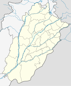
Saloi is a village, union council, and administrative subdivision of Chakwal District in the Punjab Province of Pakistan. It is part of Choa Saidan Shah Tehsil.[1]
Location
[edit]Saloi is located 35 km southeast of Chakwal, Pakistan. It has a total population of 2,800. It is located in between mountains.
It was founded by Mehmood Ghazni around a thousand years ago. The local language spoken in Saloi is Punjabi. The economy is based around agriculture.
Villages in union council
[edit]Golepur Union Councils is subdivided into 8 Villages.
References
[edit]


