Prieska: Difference between revisions
m Reverted edit by 41.144.133.195 (talk) to last version by 50.81.237.112 |
|||
| (29 intermediate revisions by 23 users not shown) | |||
| Line 1: | Line 1: | ||
{{Use dmy dates|date=April 2022}} |
|||
{{Infobox South African town |
|||
{{Infobox settlement |
|||
|censuscode = 31304 |
|||
| name = Prieska |
| name = Prieska |
||
| |
| image_skyline = Prieska, South Africa.jpg |
||
| image_caption = Prieska |
|||
| native_name_lang = <!-- ISO 639-2 code e.g. "fr" for French. If more than one, use {{lang}} instead --> |
|||
| pushpin_map = South Africa Northern Cape#South Africa#Africa |
|||
| settlement_type = Town |
|||
| coordinates = {{coord|29|40|6|S|22|44|38|E|region:ZA|display=inline,title}} |
|||
| image_skyline = South Africa-Prieska-001.jpg |
|||
| |
| subdivision_type = [[Country]] |
||
| |
| subdivision_name = [[South Africa]] |
||
| subdivision_type1 = [[Provinces of South Africa|Province]] |
|||
| image_caption = Prieska as seen from the N10 National road |
|||
| |
| subdivision_name1 = [[Northern Cape]] |
||
| |
| subdivision_type2 = [[List of districts of South Africa|District]] |
||
| subdivision_name2 = [[Pixley ka Seme District Municipality|Pixley ka Seme]] |
|||
| flag_alt = |
|||
| |
| subdivision_type3 = Municipality |
||
| subdivision_name3 = [[Siyathemba Local Municipality|Siyathemba]] |
|||
| seal_size = |
|||
| |
| subdivision_type4 = Main Place |
||
| |
| established_title = Established |
||
| |
| leader_title = Councillor |
||
| area_footnotes = <ref name="census2011">{{cite web |url=http://census2011.adrianfrith.com/place/375005 |title = Main Place Prieska |work=Census 2011}}</ref> |
|||
| shield_alt = |
|||
| |
| area_total_km2 = 195.52 |
||
| population_footnotes = <ref name="census2011" /> |
|||
| blank_emblem_type = |
|||
| |
| population_total = 14246 |
||
| |
| population_as_of = 2011 |
||
| population_density_km2 = auto |
|||
| nickname = |
|||
<!-- demographics (section 1) --> |
|||
| motto = |
|||
| |
| demographics_type1 = Racial makeup (2011) |
||
| demographics1_footnotes = <ref name="census2011" /> |
|||
| mapsize = |
|||
| demographics1_title1 = [[Bantu peoples of South Africa|Black African]] |
|||
| map_alt = |
|||
| |
| demographics1_info1 = 23.6% |
||
| demographics1_title2 = [[Coloureds|Coloured]] |
|||
| image_map1 = |
|||
| |
| demographics1_info2 = 67.4% |
||
| demographics1_title3 = [[Indian South African|Indian]]/[[Asian South African|Asian]] |
|||
| map_alt1 = |
|||
| |
| demographics1_info3 = 0.5% |
||
| demographics1_title4 = [[White South African|White]] |
|||
| image_dot_map = |
|||
| |
| demographics1_info4 = 8.0% |
||
| |
| demographics1_title5 = Other |
||
| |
| demographics1_info5 = 0.4% |
||
<!-- demographics (section 2) --> |
|||
| dot_map_caption = |
|||
| demographics_type2 = [[First language]]s (2011) |
|||
| dot_x = |dot_y = |
|||
| demographics2_footnotes = <ref name="census2011" /> |
|||
| pushpin_map = South Africa Northern Cape |
|||
| demographics2_title1 = [[Afrikaans]] |
|||
| pushpin_label_position = |
|||
| |
| demographics2_info1 = 92.6% |
||
| demographics2_title2 = [[Xhosa language|Xhosa]] |
|||
| pushpin_mapsize = |
|||
| |
| demographics2_info2 = 4.4% |
||
| demographics2_title3 = [[South African English|English]] |
|||
| latd =29 |latm =40 |lats =6 |latNS = S |
|||
| demographics2_info3 = 1.0% |
|||
| longd =22 |longm =44 |longs =38 |longEW = E |
|||
| |
| demographics2_title4 = |
||
| demographics2_info4 = |
|||
| coordinates_type = region:ZA_type:city |
|||
| demographics2_title5 = Other |
|||
| coordinates_display = inline,title |
|||
| |
| demographics2_info5 = 2.0% |
||
<!-- blank fields (section 2) --> |
|||
| subdivision_type = [[List of sovereign states|Country]] |
|||
<!-- Other information --> |
|||
| subdivision_name = [[South Africa]] |
|||
| |
| timezone1 = [[South African Standard Time|SAST]] |
||
| subdivision_name1 = [[Northern Cape]] |
|||
| subdivision_type2 = [[District municipality (South Africa)|District municipality]] |
|||
| subdivision_name2 = [[Pixley ka Seme District Municipality|Pixley ka Seme]] |
|||
| subdivision_type3 = [[Local municipality (South Africa)|Local municipality]] |
|||
| subdivision_name3 = [[Siyathemba Local Municipality|Siyathemba]] |
|||
| established_title = |
|||
| established_date = |
|||
| founder = |
|||
| named_for = |
|||
| seat_type = |
|||
| seat = |
|||
| government_footnotes = |
|||
| government_type = |
|||
| leader_party = |
|||
| leader_title = |
|||
| leader_name = |
|||
| leader_title1 = |
|||
| leader_name1 = |
|||
| total_type = |
|||
| unit_pref = |
|||
| area_magnitude = |
|||
| area_footnotes = |
|||
| area_total_km2 = |
|||
| area_total_sq_mi = |
|||
| area_total_dunam = |
|||
| area_land_km2 = |
|||
| area_land_sq_mi = |
|||
| area_water_km2 = |
|||
| area_water_sq_mi = |
|||
| area_water_percent = |
|||
| area_note = |
|||
| elevation_footnotes = |
|||
| elevation_m = |
|||
| elevation_ft = |
|||
| population_footnotes = |
|||
| population_total = |
|||
| population_as_of = |
|||
| population_density_km2 = |
|||
| population_density_sq_mi= |
|||
| population_est = |
|||
| pop_est_as_of = |
|||
| population_demonym = |
|||
| population_note = |
|||
| timezone1 = [[South Africa Standard Time]] |
|||
| utc_offset1 = +2 |
| utc_offset1 = +2 |
||
| postal_code_type = [[List of postal codes in South Africa|Postal code]] (street) |
|||
| timezone1_DST = |
|||
| |
| postal_code = 8940 |
||
| |
| postal2_code_type = [[Post-office box|PO box]] |
||
| |
| postal2_code = 8940 |
||
| area_code_type = |
| area_code_type = [[Telephone numbers in South Africa|Area code]] |
||
| area_code = |
| area_code = 053 |
||
| website = |
|||
| footnotes = |
|||
}} |
}} |
||
'''Prieska''' is a town on the south bank of the [[Orange River]], in the province of the [[Northern Cape]], in western [[South Africa]]. |
'''Prieska''' is a town on the south bank of the [[Orange River]], in the province of the [[Northern Cape]], in western [[South Africa]]. It is located on the southern bank of the [[Orange River]], 130 km north-west of [[Britstown]] and 75 km south-east of [[Marydale]]. |
||
==History== |
|||
Town on the southern bank of the [[Orange River]], 130 km north-west of [[Britstown]] and 75 km south-east of [[Marydale]]. It developed from a place to which farmers migrated when the pans were full, after rains. It was administered by a village management board from 1882 and attained municipal status in 1892. The name is derived from [[Korana_language|Korana]] and means ‘place of the lost she-goat’.<ref name=dsapn>{{cite web|title=Dictionary of Southern African Place Names (Public Domain)|url=http://archive.org/details/DictionaryOfSouthernAfricanPlaceNames|publisher=Human Science Research Council|page=375}}</ref> |
|||
It developed from a place to which farmers migrated when the pans were full, after rains. It was originally named ''Prieschap'', the name is derived from [[Khoemana|Korana]] and means ‘place of the lost she-goat’.<ref name=dsapn>{{cite web|title=Dictionary of Southern African Place Names (Public Domain)|url=https://archive.org/details/DictionaryOfSouthernAfricanPlaceNames|publisher=Human Science Research Council|page=375}}</ref><ref name="Pan731">{{Cite journal|date=1974|title=Copper by the Ton|url=https://archive.org/details/sim_south-african-panorama_1974-01_19_1/page/34/mode/2up|journal=South African Panorama|publisher=Information Service of South Africa|volume=19|issue=1|via=Internet Archive}}</ref>{{rp|41}} It was administered by a village management board from 1882 and attained municipal status in 1892. In 2011 the town had a population of 14,246. |
|||
Many residents, historically, worked at the nearby [[Koegas mine]] which extracted and processed [[blue asbestos]].<ref>{{cite news |last1=Steele |first1=Jonathan |title=Blue death |url=https://www.theguardian.com/lifeandstyle/2001/sep/15/weekend.jonathansteele |access-date=6 February 2021 |work=The Guardian |date=15 September 2001 |language=en}}</ref> |
|||
The town is 240 km south of [[Kimberley, Northern Cape|Kimberley]] and lies on the [[R357]] road. It was originally named ''Prieschap'', a [[Khoisan]] word meaning ‘place of the lost she-goat’. The town was founded in 1882, and in 2007 the town had a population of 11,187. |
|||
The town is 240 km south of [[Kimberley, Northern Cape|Kimberley]] and lies on the [[R357 (South Africa)|R357]] road. |
|||
== Notable natives and residents == |
|||
* [[Gert Thys]] - marathon runner |
|||
* [[Dricky Beukes]] - writer |
|||
==References== |
==References== |
||
| Line 116: | Line 77: | ||
==External links== |
==External links== |
||
{{ |
{{commons category|Prieska}} |
||
*[http://www.northerncape.org.za/getting_around/towns/Prieska/ Prieska's website] |
*[http://www.northerncape.org.za/getting_around/towns/Prieska/ Prieska's website] |
||
{{NorthernCape-geo-stub}} |
|||
{{Geographic Location |
{{Geographic Location |
||
| Line 133: | Line 92: | ||
}} |
}} |
||
{{Pixley ka Seme District Municipality}} |
{{Pixley ka Seme District Municipality}} |
||
{{Northern Cape_province}} |
|||
[[Category:Populated places established in 1882]] |
[[Category:Populated places established in 1882]] |
||
[[Category:Populated places in the Siyathemba Local Municipality]] |
[[Category:Populated places in the Siyathemba Local Municipality]] |
||
[[Category:Karoo]] |
[[Category:Karoo]] |
||
{{NorthernCape-geo-stub}} |
|||
Latest revision as of 14:37, 16 November 2024
Prieska | |
|---|---|
 Prieska | |
| Coordinates: 29°40′6″S 22°44′38″E / 29.66833°S 22.74389°E | |
| Country | South Africa |
| Province | Northern Cape |
| District | Pixley ka Seme |
| Municipality | Siyathemba |
| Area | |
• Total | 195.52 km2 (75.49 sq mi) |
| Population (2011)[1] | |
• Total | 14,246 |
| • Density | 73/km2 (190/sq mi) |
| Racial makeup (2011) | |
| • Black African | 23.6% |
| • Coloured | 67.4% |
| • Indian/Asian | 0.5% |
| • White | 8.0% |
| • Other | 0.4% |
| First languages (2011) | |
| • Afrikaans | 92.6% |
| • Xhosa | 4.4% |
| • English | 1.0% |
| • Other | 2.0% |
| Time zone | UTC+2 (SAST) |
| Postal code (street) | 8940 |
| PO box | 8940 |
| Area code | 053 |
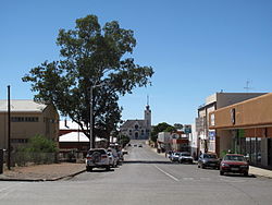
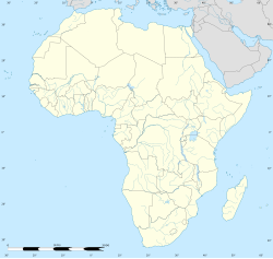
Prieska is a town on the south bank of the Orange River, in the province of the Northern Cape, in western South Africa. It is located on the southern bank of the Orange River, 130 km north-west of Britstown and 75 km south-east of Marydale.
History
[edit]It developed from a place to which farmers migrated when the pans were full, after rains. It was originally named Prieschap, the name is derived from Korana and means ‘place of the lost she-goat’.[2][3]: 41 It was administered by a village management board from 1882 and attained municipal status in 1892. In 2011 the town had a population of 14,246.
Many residents, historically, worked at the nearby Koegas mine which extracted and processed blue asbestos.[4]
The town is 240 km south of Kimberley and lies on the R357 road.
Notable natives and residents
[edit]- Gert Thys - marathon runner
- Dricky Beukes - writer
References
[edit]- ^ a b c d "Main Place Prieska". Census 2011.
- ^ "Dictionary of Southern African Place Names (Public Domain)". Human Science Research Council. p. 375.
- ^ "Copper by the Ton". South African Panorama. 19 (1). Information Service of South Africa. 1974 – via Internet Archive.
- ^ Steele, Jonathan (15 September 2001). "Blue death". The Guardian. Retrieved 6 February 2021.
External links
[edit]


