Cenadi: Difference between revisions
Appearance
Content deleted Content added
m robot Adding: war:Cenadi |
m →top: remove deprecated / unsupported {{{langx}}} / {{lang}} IETF parameters (1×); errors are possible |
||
| (32 intermediate revisions by 27 users not shown) | |||
| Line 1: | Line 1: | ||
{{more citations needed|date=November 2015}} |
|||
{{Infobox Italian comune |
{{Infobox Italian comune |
||
| name = Cenadi |
| name = Cenadi |
||
| official_name = Comune di Cenadi |
| official_name = Comune di Cenadi |
||
| native_name = |
| native_name = {{Langx|el|Genádioi}} |
||
| image_skyline = |
| image_skyline = |
||
| imagesize = |
| imagesize = |
||
| Line 14: | Line 15: | ||
| pushpin_label_position = |
| pushpin_label_position = |
||
| pushpin_map_alt = |
| pushpin_map_alt = |
||
| coordinates = {{coord|38|43|N|16|25|E|region:IT|display=inline,title}} |
|||
| latd = 38 |latm = 43 |lats = |latNS = N |
|||
| longd = 16 |longm = 25 |longs = |longEW = E |
|||
| coordinates_type = region:IT |
|||
| coordinates_display = title |
|||
| coordinates_footnotes = |
| coordinates_footnotes = |
||
| region = {{RegioneIT|sigla=CAL}} |
| region = {{RegioneIT|sigla=CAL}} |
||
| province = {{ProvinciaIT (short form)|sigla=CZ}} (CZ) |
| province = {{ProvinciaIT (short form)|sigla=CZ}} (CZ) |
||
| frazioni = |
|||
| mayor_party = |
| mayor_party = |
||
| mayor = |
| mayor = |
||
| area_footnotes = |
| area_footnotes = |
||
| area_total_km2 = 11 |
| area_total_km2 = 11 |
||
| population_footnotes = <ref name="istat">All demographics and other statistics from the Italian statistical institute ([[Istat]])</ref> |
| population_footnotes = <ref name="istat">All demographics and other statistics from the Italian statistical institute ([[National Institute of Statistics (Italy)|Istat]])</ref> |
||
| population_total = |
| population_total = 573 |
||
| population_as_of = |
| population_as_of = 31 December 2013 |
||
| pop_density_footnotes = |
| pop_density_footnotes = |
||
| population_demonym = Cenadesi |
| population_demonym = Cenadesi |
||
| Line 35: | Line 32: | ||
| elevation_max_m = |
| elevation_max_m = |
||
| elevation_m = 539 |
| elevation_m = 539 |
||
| |
| saint = [[John the Baptist|San Giovanni Battista]] |
||
| twin1_country = |
|||
| saint = [[San Giovanni Battista]] |
|||
| day = 24 June |
| day = 24 June |
||
| postal_code = 88067 |
| postal_code = 88067 |
||
| area_code = 0967 |
| area_code = 0967 |
||
| website = {{official|http://www.comunedicenadi.it}} |
| website = {{official website|http://www.comunedicenadi.it}} |
||
| footnotes = |
| footnotes = |
||
<!-- These are currently unused --> |
|||
| istat = 079024 |
| istat = 079024 |
||
| |
| frazioni = [[Cortale]], [[Olivadi]], [[Polia, Calabria|Polia]] (VV), [[San Vito sullo Ionio]], [[Vallefiorita]] |
||
| fiscal_code = C453 |
|||
}} |
}} |
||
'''Cenadi''' ({{ |
'''Cenadi''' ({{Langx|el-Latn|Genadioi}}) is a {{lang|it|[[comune]]}} and [[town]] in the province of [[Catanzaro]] in the [[Calabria]] region of [[Italy]]. |
||
== Etymology == |
|||
The town's name is derived from {{lang|it|cena}}, the Italian word for "dinner". A legend claims that St. John the Evangelist was passing through the town on his way to Rome, and stopped for dinner.{{Citation needed|date=November 2015}} <!-- (Commenting this sentence out because it doesn't make sense... did dinner have any effect on Rome? If you can elaborate, please do. Thanks!) It is unknown if the latter had any effect on the former. --> |
|||
==References== |
==References== |
||
| Line 54: | Line 50: | ||
{{Province of Catanzaro}} |
{{Province of Catanzaro}} |
||
{{authority control}} |
|||
[[Category:Cities and towns in Calabria]] |
[[Category:Cities and towns in Calabria]] |
||
| Line 59: | Line 58: | ||
{{Calabria-geo-stub}} |
{{Calabria-geo-stub}} |
||
[[bcl:Cenadi]] |
|||
[[de:Cenadi]] |
|||
[[es:Cenadi]] |
|||
[[eo:Cenadi]] |
|||
[[fr:Cenadi]] |
|||
[[it:Cenadi]] |
|||
[[hu:Cenadi]] |
|||
[[nl:Cenadi]] |
|||
[[ja:チェナーディ]] |
|||
[[nap:Cenadi]] |
|||
[[pl:Cenadi]] |
|||
[[pt:Cenadi]] |
|||
[[ru:Ченади]] |
|||
[[scn:Cenadi (CZ)]] |
|||
[[uk:Ченаді]] |
|||
[[vo:Cenadi]] |
|||
[[war:Cenadi]] |
|||
Latest revision as of 16:48, 17 November 2024
This article needs additional citations for verification. (November 2015) |
Cenadi
Greek: Genádioi | |
|---|---|
| Comune di Cenadi | |
| Coordinates: 38°43′N 16°25′E / 38.717°N 16.417°E | |
| Country | Italy |
| Region | Calabria |
| Province | Catanzaro (CZ) |
| Frazioni | Cortale, Olivadi, Polia (VV), San Vito sullo Ionio, Vallefiorita |
| Area | |
• Total | 11 km2 (4 sq mi) |
| Elevation | 539 m (1,768 ft) |
| Population (31 December 2013)[2] | |
• Total | 573 |
| • Density | 52/km2 (130/sq mi) |
| Demonym | Cenadesi |
| Time zone | UTC+1 (CET) |
| • Summer (DST) | UTC+2 (CEST) |
| Postal code | 88067 |
| Dialing code | 0967 |
| ISTAT code | 079024 |
| Patron saint | San Giovanni Battista |
| Saint day | 24 June |
| Website | Official website |
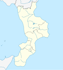
Cenadi (Greek: Genadioi) is a comune and town in the province of Catanzaro in the Calabria region of Italy.
Etymology
[edit]The town's name is derived from cena, the Italian word for "dinner". A legend claims that St. John the Evangelist was passing through the town on his way to Rome, and stopped for dinner.[citation needed]
References
[edit]- ^ "Superficie di Comuni Province e Regioni italiane al 9 ottobre 2011". Italian National Institute of Statistics. Retrieved 16 March 2019.
- ^ All demographics and other statistics from the Italian statistical institute (Istat)


