Wutongqiao, Leshan: Difference between revisions
Appearance
Content deleted Content added
No edit summary |
|||
| (4 intermediate revisions by 4 users not shown) | |||
| Line 14: | Line 14: | ||
|coordinates = {{coord|29|24|24|N|103|49|06|E|type:adm3rd_region:CN-51_source:kolossus-dewiki|format=dms|display=it}} |
|coordinates = {{coord|29|24|24|N|103|49|06|E|type:adm3rd_region:CN-51_source:kolossus-dewiki|format=dms|display=it}} |
||
|subdivision_type = Country |
|subdivision_type = Country |
||
|subdivision_name = [[ |
|subdivision_name = [[China]] |
||
|subdivision_type1 = [[Province (China)|Province]] |
|subdivision_type1 = [[Province (China)|Province]] |
||
|subdivision_name1 = [[Sichuan]] |
|subdivision_name1 = [[Sichuan]] |
||
|subdivision_type2 = [[Prefecture-level city]] |
|subdivision_type2 = [[Prefecture-level city]] |
||
|subdivision_name2 = [[Leshan]] |
|subdivision_name2 = [[Leshan]] |
||
| seat_type = District seat |
|||
| seat = |
|||
|area_code = |
|area_code = |
||
|area_land_km2 = |
|area_land_km2 = |
||
|area_total_km2 =474 |
|area_total_km2 =474 |
||
|area_water_km2 = |
|area_water_km2 = |
||
| ⚫ | |||
|population = |
|||
|population_as_of = |
|population_as_of = 2020 |
||
|population_density_km2 = auto |
|population_density_km2 = auto |
||
| ⚫ | |||
|leader_name = |
|leader_name = |
||
|leader_title = |
|leader_title = |
||
| Line 41: | Line 42: | ||
}} |
}} |
||
'''Wutongqiao District''' is an [[district (PRC)|urban district]] of the [[prefecture-level city]] of [[Leshan]], [[Sichuan]] province, China. As a separate city on the banks of the [[Min River (Sichuan)|Min River]], Wutongqiao was [[Postal Map Romanization|formerly]] [[romanization of Chinese|romanized]] as '''Wutungkiao'''.{{efn|The name was also sometimes romanized as {{nowrap|'''Woo-tung-keaou'''}}.<ref name=eb9/>}} |
'''Wutongqiao District''' is an [[district (PRC)|urban district]] of the [[prefecture-level city]] of [[Leshan]], [[Sichuan]] province, [[China]]. As a separate city on the banks of the [[Min River (Sichuan)|Min River]], Wutongqiao was [[Postal Map Romanization|formerly]] [[romanization of Chinese|romanized]] as '''Wutungkiao'''.{{efn|The name was also sometimes romanized as {{nowrap|'''Woo-tung-keaou'''}}.<ref name=eb9/>}} |
||
It has been known for producing [[table salt|salt]] since at least the 19th century.<ref name=eb9>{{cite EB9|mode=cs2|wstitle=China|ref={{harvid|''EB''|1878}}|volume=5}}</ref> |
It has been known for producing [[table salt|salt]] since at least the 19th century.<ref name=eb9>{{cite EB9|mode=cs2|wstitle=China|ref={{harvid|''EB''|1878}}|volume=5}}</ref> |
||
==Administrative divisions== |
|||
Wutongqiao District comprises 8 towns:<ref>{{cite web|url=http://www.stats.gov.cn/sj/tjbz/tjyqhdmhcxhfdm/2023/51/11/511112.html|script-title=zh:2023年统计用区划代码和城乡划分代码:五通桥区| publisher = [[National Bureau of Statistics of China]]| language = zh-hans| access-date =}}</ref> |
|||
*Zhugen 竹根镇 |
|||
*Niuhua 牛华镇 |
|||
*Jinsu 金粟镇 |
|||
*Jinshan 金山镇 |
|||
*Xiba 西坝镇 |
|||
*Guanying 冠英镇 |
|||
*Caijin 蔡金镇 |
|||
*Shilin 石麟镇 |
|||
==Transport== |
==Transport== |
||
Latest revision as of 18:57, 20 November 2024
Wutongqiao
五通桥区 | |
|---|---|
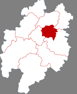
 Wutongqiao in Leshan | |
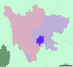
 Leshan in Sichuan | |
| Coordinates: 29°24′24″N 103°49′06″E / 29.40667°N 103.81833°E | |
| Country | China |
| Province | Sichuan |
| Prefecture-level city | Leshan |
| Area | |
• Total | 474 km2 (183 sq mi) |
| Population (2020) | |
• Total | 237,933 |
| • Density | 500/km2 (1,300/sq mi) |
| Time zone | UTC+8 (China Standard) |
| Wutongqiao, Leshan | |||||||||
|---|---|---|---|---|---|---|---|---|---|
| Traditional Chinese | 五通橋 | ||||||||
| Simplified Chinese | 五通桥 | ||||||||
| Postal | Wutungkiao | ||||||||
| Literal meaning | 5-Passage Bridge | ||||||||
| |||||||||
Wutongqiao District is an urban district of the prefecture-level city of Leshan, Sichuan province, China. As a separate city on the banks of the Min River, Wutongqiao was formerly romanized as Wutungkiao.[a]
It has been known for producing salt since at least the 19th century.[1]
Administrative divisions
[edit]Wutongqiao District comprises 8 towns:[2]
- Zhugen 竹根镇
- Niuhua 牛华镇
- Jinsu 金粟镇
- Jinshan 金山镇
- Xiba 西坝镇
- Guanying 冠英镇
- Caijin 蔡金镇
- Shilin 石麟镇
Transport
[edit]Notes
[edit]References
[edit]- ^ a b Baynes, T. S., ed. (1878), , Encyclopædia Britannica, vol. 5 (9th ed.), New York: Charles Scribner's Sons
- ^ 2023年统计用区划代码和城乡划分代码:五通桥区 (in Simplified Chinese). National Bureau of Statistics of China.
