Union Place: Difference between revisions
Appearance
Content deleted Content added
Jason Quinn (talk | contribs) sp fix of footnotes in Infobox Settlement template |
Tom.Reding (talk | contribs) m WP:STUBSPACING followup |
||
| (33 intermediate revisions by 22 users not shown) | |||
| Line 1: | Line 1: | ||
{{Infobox settlement |
{{Infobox settlement |
||
| name = Union Place |
| name = Union Place |
||
| native_name = යූනියන් පෙදෙස<br>யூனியன் பிளேஸ் |
|||
| settlement_type = [[Suburb]] |
| settlement_type = [[Suburb]] |
||
| motto = |
| motto = |
||
| image_skyline = |
| image_skyline = UG-LK Photowalk - Hilton Residencies - 2017-03-12 (4).jpg |
||
| imagesize = |
| imagesize = |
||
| image_caption = |
| image_caption = Looking southwest on Union Place |
||
| image_flag = |
| image_flag = |
||
| flag_size = |
| flag_size = |
||
| Line 14: | Line 15: | ||
| city_logo = |
| city_logo = |
||
| citylogo_size = |
| citylogo_size = |
||
| pushpin_map = Sri Lanka |
| pushpin_map = Sri Lanka Colombo Central#Sri Lanka Colombo Greater#Sri Lanka Colombo District#Sri Lanka |
||
| pushpin_label_position = |
| pushpin_label_position = |
||
| pushpin_map_caption = |
| pushpin_map_caption = |
||
| pushpin_mapsize = |
| pushpin_mapsize = |
||
| coordinates_display = inline,title |
|||
| coordinates_region = LK |
|||
| subdivision_type = [[List of countries|Country]] |
| subdivision_type = [[List of countries|Country]] |
||
| subdivision_name = [[Sri Lanka]] |
| subdivision_name = [[Sri Lanka]] |
||
| Line 38: | Line 37: | ||
| population_footnotes = | population_note = |
| population_footnotes = | population_note = |
||
| population_total = |
| population_total = |
||
| utc_offset = -5 |
|||
| timezone = [[Time zone#UTC .2B 6.2C F|Sri Lanka Standard Time Zone]] |
| timezone = [[Time zone#UTC .2B 6.2C F|Sri Lanka Standard Time Zone]] |
||
| utc_offset = +5:30 |
| utc_offset = +5:30 |
||
| timezone_DST = |
| timezone_DST = |
||
| utc_offset_DST = |
| utc_offset_DST = |
||
| coordinates = {{coord|6|55|18|N|79|51|19|E|region:LK|display=inline,title}} |
|||
| latd=6 | latm=55 | lats=18 | latNS=N |
|||
| longd=79 | longm=51 | longs=19 | longEW=E |
|||
| elevation_footnotes = |
| elevation_footnotes = |
||
| elevation_m = |
| elevation_m = |
||
| elevation_ft = |
| elevation_ft = |
||
| postal_code_type = [[Postal Code]] |
| postal_code_type = [[Postal Code]] |
||
| postal_code = |
| postal_code = 00200 |
||
| area_code = |
| area_code = |
||
| website = |
| website = |
||
| Line 55: | Line 52: | ||
}} |
}} |
||
'''Union Place''' is a suburb in [[Colombo]], [[Sri Lanka]]. Union Place is located approximately 1 kilometre south-east from the centre of Colombo, [[Fort (Colombo)|Fort]]. <ref>http://wikimapia.org/10911886/HSBC-Union-Place-Colombo-02</ref> |
'''Union Place''' is a suburb in [[Colombo]], [[Sri Lanka]]. Union Place is located approximately 1 kilometre south-east from the centre of Colombo, [[Fort (Colombo)|Fort]]. <ref>{{Cite web|url=http://wikimapia.org/10911886/HSBC-Union-Place-Colombo-02|title=HSBC Bank - Colombo Union Place}}</ref> |
||
== Demographic == |
== Demographic == |
||
Union Place is a multi-religious and multi-ethnic area. The major ethnic communities in Union Place are [[ |
Union Place is a multi-religious and multi-ethnic area. The major ethnic communities in Union Place are [[Sinhalese people|Sinhalese]] and [[Sri Lankan Tamils]]. There are also various other minorities, such as [[Burgher People|Burghers]], [[Sri Lankan Moors]] and others. Religions include [[Buddhism]], [[Hinduism]], [[Islam]], [[Christianity]] and various other religions and beliefs to a lesser extent. |
||
==Diplomatic missions== |
|||
*[[Consulate general|Consulate]] of [[Austria]] |
|||
*Consulate of [[Bhutan]] |
|||
*Consulate of [[Namibia]] |
|||
*Consulate of [[Uruguay]] |
|||
*Consulate of [[Tunisia]] |
|||
*Consulate of [[Croatia]] |
|||
*Consulate of [[Czech Republic|Czechia (Czech Republic)]] |
|||
{{Geographic Location (8-way) |
{{Geographic Location (8-way) |
||
| Centre = Union Place |
| Centre = Union Place |
||
| North = [[Pettah, |
| North = [[Pettah, Colombo|Pettah]] <br><br> [[Hultsdorf]] |
||
| Northeast = [[Maligawatta]] |
| Northeast = [[Maligawatta]] |
||
| East = <br> [[Maradana]] <br><br> [[Panchikawatte]] |
| East = <br> [[Maradana]] <br><br> [[Panchikawatte]] |
||
| Line 80: | Line 86: | ||
[[Category:Districts of Colombo]] |
[[Category:Districts of Colombo]] |
||
[[Category:Populated places in Western Province, Sri Lanka]] |
[[Category:Populated places in Western Province, Sri Lanka]] |
||
{{WesternLK-geo-stub}} |
{{WesternLK-geo-stub}} |
||
Latest revision as of 15:52, 30 November 2024
Union Place
යූනියන් පෙදෙස யூனியன் பிளேஸ் | |
|---|---|
 Looking southwest on Union Place | |
| Coordinates: 6°55′18″N 79°51′19″E / 6.92167°N 79.85528°E | |
| Country | Sri Lanka |
| Province | Western Province |
| District | Colombo District |
| Time zone | UTC+5:30 (Sri Lanka Standard Time Zone) |
| Postal Code | 00200 |
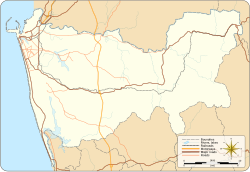
Union Place is a suburb in Colombo, Sri Lanka. Union Place is located approximately 1 kilometre south-east from the centre of Colombo, Fort. [1]
Demographic
[edit]Union Place is a multi-religious and multi-ethnic area. The major ethnic communities in Union Place are Sinhalese and Sri Lankan Tamils. There are also various other minorities, such as Burghers, Sri Lankan Moors and others. Religions include Buddhism, Hinduism, Islam, Christianity and various other religions and beliefs to a lesser extent.
Diplomatic missions
[edit]- Consulate of Austria
- Consulate of Bhutan
- Consulate of Namibia
- Consulate of Uruguay
- Consulate of Tunisia
- Consulate of Croatia
- Consulate of Czechia (Czech Republic)
References
[edit]


