Island Lake, Manitoba: Difference between revisions
m adding photos |
m Cleanup |
||
| (44 intermediate revisions by 29 users not shown) | |||
| Line 1: | Line 1: | ||
{{about|the community located along the lake|the lake|Island Lake (Manitoba)}} |
|||
| ⚫ | |||
| ⚫ | |||
| ⚫ | |||
| ⚫ | |||
| ⚫ | |||
| ⚫ | |||
| name = Island Lake |
|||
|image_lake = {{Location map|Canada Manitoba|lat=53.5210|long=-94.3906|width=200|caption=Location of Island Lake in [[Manitoba]]|label=Island Lake}} |
|||
| settlement_type = Unincorporated community |
|||
|caption_lake = |
|||
| image_skyline = Island Lake First Nations Community.jpg |
|||
|image_bathymetry = |
|||
| image_caption = Aerial view of the community |
|||
|caption_bathymetry = |
|||
| pushpin_map = Canada Manitoba |
|||
| pushpin_map_caption = Location of Island Lake |
|||
|coords = {{coord|53|47|N|94|29|W|region:CA_type:waterbody_source:GNS-enwiki|display=inline,title}} |
|||
| coordinates = {{coord|53|51|56|N|094|39|06|W|type:city_region:CA-MB|display=inline,title}} |
|||
|type = |
|||
| subdivision_type = Country |
|||
|inflow = |
|||
| subdivision_name = Canada |
|||
|outflow = |
|||
| subdivision_type1 = [[Provinces and territories of Canada|Province]] |
|||
|catchment = |
|||
| subdivision_name1 = [[Manitoba]] |
|||
|basin_countries = Canada |
|||
| population_total = 91 |
|||
|length = |
|||
| population_as_of = 2016 |
|||
|width = |
|||
| population_footnotes = <ref>{{Cite web|url=https://www12.statcan.gc.ca/census-recensement/2016/dp-pd/prof/details/page.cfm?Lang=E&Geo1=DPL&Code1=460023&Geo2=PR&Code2=46&SearchText=Island%20Lake&SearchType=Begins&SearchPR=01&B1=All&GeoLevel=PR&GeoCode=460023&TABID=1&type=0|title = Census Profile, 2016 Census, Statistics Canada – Validation Error}}</ref> |
|||
|area = {{convert|1223|km2|sqmi|abbr=on}} |
|||
| area_land_km2 = 1.99 |
|||
|depth = |
|||
|max-depth = |
|||
|residence_time = |
|||
|shore = |
|||
|elevation = 225 |
|||
|islands = |
|||
|cities = [[Garden Hill, Manitoba|Garden Hill]], Island Lake, [[St. Theresa Point, Manitoba|St. Theresa Point]] |
|||
}} |
}} |
||
'''Island Lake''' is a small community in northeast [[Manitoba]], Canada. The community consists of an [[archipelago]] near the north shore of [[Island Lake (Manitoba)|Island Lake]] which includes the following islands: Red Sucker Lake, Garden Hill, Wasagamack, St Theresa Point.<ref>https://www.gov.mb.ca/inr/publications/community_profiles/pubs/island-lake-2016.pdf {{Bare URL PDF|date=March 2022}}</ref> |
|||
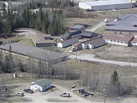
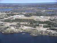
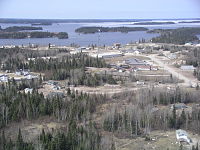
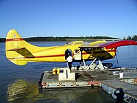
[[File:Garden Hill Health Centre.JPG|thumb|left|Garden Hill Health Centre]][[File:Garden Hill.JPG|thumb|Garden Hill]][[File:Garden Hill First Nations.JPG|thumb|Garden Hill First Nations]][[File:Island Lake Lodge dock.jpg|thumb|Island Lake Lodge dock]] |
|||
'''Island Lake''' in a small [[community]] in east central [[Manitoba]], [[Canada]]. |
|||
The community is located {{convert|297|km|abbr=on}} southeast of [[Thompson, Manitoba]] and {{convert|610|km|abbr=on}} northeast of [[Winnipeg]], Manitoba. Other nearby communities on the lake are [[Garden Hill First Nation|Garden Hill]], [[St. Theresa Point First Nation|St. Theresa Point]], and [[Wasagamack First Nation|Wasagamack]]. The community is served by the [[Island Lake Airport]]. |
|||
The community of Island Lake consists of several government and private agencies such as a [[D Division|Royal Canadian Mounted Police detachment]],<ref>{{Cite web|last=Government of Canada|first=Royal Canadian Mounted Police|date=2015-07-14|title=Island Lake detachment – Manitoba|url=https://www.rcmp-grc.gc.ca/detach/en/d/103|access-date=2021-08-18|website=rcmp-grc.gc.ca}}</ref> a [[Manitoba Conservation and Climate|Manitoba Conservation]] office, [[Politics of Manitoba|Government of Manitoba]] (who operates the airport), Stevenson Island School ([[Frontier School Division]]), [[Bell MTS]], [[Manitoba Hydro]] office, the [[North West Company]], which operates the [[Northern Store]], several small convenience stores and Island Lake Lodge, a [[fly fishing]] lodge on Stevenson Island. |
|||
| ⚫ | |||
| ⚫ | [[Perimeter Aviation]] has daily service to Island Lake from [[Winnipeg James Armstrong Richardson International Airport]] using [[De Havilland Canada Dash 8|Bombardier Dash 8]] and [[Fairchild Swearingen Metroliner]]s. They also have a [[Medical evacuation|Medevac Base]] on Stevenson Island serving the community 365 days a year. |
||
== Climate == |
== Climate == |
||
With 21.11 hours of fog annually, Island Lake is one of the least foggy places in Canada. Only [[Penticton|Penticton, British Columbia]], gets less fog during the year, and no one gets less fog in February when Island Lake averages a mere 0.67 hours.{{citation needed|date=June 2014}} |
|||
<div style=width:65%> |
|||
{{Weather box |
|||
Island Lake has a [[subarctic climate]] ([[Köppen climate classification|Dfc]]) with mild, rainy summers and severely cold winters. |
|||
|location = Island Lake |
|||
{{Weather box|width=auto; margin:auto |
|||
|metric first = yes |
|||
| ⚫ | |||
|single line = yes |
|||
| |
| metric first = yes |
||
| |
| single line = yes |
||
| |
| Jan record high C = 5.9 |
||
| |
| Feb record high C = 7.5 |
||
| |
| Mar record high C = 16.2 |
||
| |
| Apr record high C = 29.2 |
||
| |
| May record high C = 32.2 |
||
| |
| Jun record high C = 37.3 |
||
| |
| Jul record high C = 35 |
||
| |
| Aug record high C = 32.3 |
||
| |
| Sep record high C = 30.4 |
||
| |
| Oct record high C = 21.7 |
||
| |
| Nov record high C = 15 |
||
| |
| Dec record high C = 4.4 |
||
| |
| year record high C = 37.3 |
||
| |
| Jan high C = -17.7 |
||
| |
| Feb high C = -12.4 |
||
| |
| Mar high C = -3.8 |
||
| |
| Apr high C = 5.6 |
||
| |
| May high C = 13.7 |
||
| |
| Jun high C = 19.5 |
||
| |
| Jul high C = 22.5 |
||
| |
| Aug high C = 21.1 |
||
| |
| Sep high C = 13.5 |
||
| |
| Oct high C = 5.7 |
||
| |
| Nov high C = -4.9 |
||
| |
| Dec high C = -14.8 |
||
| |
| year high C = 4 |
||
| |
| Jan mean C = −22.9 |
||
| |
| Feb mean C = −18.6 |
||
| |
| Mar mean C = −10.8 |
||
| |
| Apr mean C = -0.8 |
||
| |
| May mean C = 7.7 |
||
| |
| Jun mean C = 14 |
||
| |
| Jul mean C = 17.5 |
||
| |
| Aug mean C = 16.4 |
||
| |
| Sep mean C = 9.5 |
||
| |
| Oct mean C = 2.6 |
||
| |
| Nov mean C = -8.3 |
||
| |
| Dec mean C = −19.4 |
||
| |
| year mean C = -1.1 |
||
| |
| Jan low C = -28.1 |
||
| |
| Feb low C = -24.8 |
||
| |
| Mar low C = -17.8 |
||
| |
| Apr low C = -7.1 |
||
| |
| May low C = 1.5 |
||
| |
| Jun low C = 8.4 |
||
| |
| Jul low C = 12.5 |
||
| |
| Aug low C = 11.6 |
||
| |
| Sep low C = 5.5 |
||
| |
| Oct low C = -0.6 |
||
| |
| Nov low C = -11.6 |
||
| |
| Dec low C = -23.9 |
||
| |
| year low C = -6.2 |
||
| |
| Jan record low C = -45 |
||
| |
| Feb record low C = -43.3 |
||
| |
| Mar record low C = -42.2 |
||
| |
| Apr record low C = -28.9 |
||
| |
| May record low C = -16.6 |
||
| |
| Jun record low C = -1.9 |
||
| |
| Jul record low C = 2.2 |
||
| |
| Aug record low C = 2.2 |
||
| |
| Sep record low C = -4.4 |
||
| |
| Oct record low C = -13.4 |
||
| |
| Nov record low C = -34.8 |
||
| Dec record low C = -43.3 |
|||
| ⚫ | |||
| year record low C = -45 |
|||
| ⚫ | |||
| |
|precipitation colour = green |
||
| |
| Jan precipitation mm = 20.1 |
||
| |
| Feb precipitation mm = 18.6 |
||
| |
| Mar precipitation mm = 24 |
||
| |
| Apr precipitation mm = 26.2 |
||
| |
| May precipitation mm = 42.8 |
||
| |
| Jun precipitation mm = 69.1 |
||
| |
| Jul precipitation mm = 89.4 |
||
| |
| Aug precipitation mm = 77.4 |
||
| |
| Sep precipitation mm = 61.8 |
||
| |
| Oct precipitation mm = 55.8 |
||
| ⚫ | |||
| ⚫ | |source 1 = [[Environment Canada]]<ref name= |
||
| ⚫ | |||
| ⚫ | |||
| year precipitation mm = 546.2 |
|||
}}</div> |
|||
| ⚫ | | source 1 = [[Environment Canada]]<ref name="climate">[[Environment Canada]]—[http://climate.weatheroffice.gc.ca/climate_normals/results_e.html?Province=MAN%20&StationName=&SearchType=&LocateBy=Province&Proximity=25&ProximityFrom=City&StationNumber=&IDType=MSC&CityName=&ParkName=&LatitudeDegrees=&LatitudeMinutes=&LongitudeDegrees=&LongitudeMinutes=&NormalsClass=A&SelNormals=&StnId=3880& Canadian Climate Normals 1971–2000]{{Dead link|date=September 2024 |bot=InternetArchiveBot |fix-attempted=yes }}, accessed 27 April 2010</ref> |
||
| ⚫ | |||
}} |
|||
== Demographics == |
== Demographics == |
||
In the [[ |
In the [[2021 Canadian census|2021 Census of Population]] conducted by [[Statistics Canada]], Island Lake had a population of 54 living in 21 of its 66 total private dwellings, a change of {{percentage|{{#expr:54-79}}|79|1}} from its 2016 population of 79. With a land area of {{cvt|3.54|km2}}, it had a population density of {{Pop density|54|3.54|km2|sqmi|prec=1}} in 2021.<ref name=2021census>{{cite web | url=https://www150.statcan.gc.ca/t1/tbl1/en/cv.action?pid=9810001201 | title=Population and dwelling counts: Canada and designated places | publisher=[[Statistics Canada]] | date=9 February 2022 | accessdate=3 September 2022}}</ref> |
||
== Gallery == |
|||
<gallery widths=200 heights=150> |
|||
File:Garden Hill Health Centre.JPG|Garden Hill Health Centre |
|||
File:Garden Hill.JPG|Garden Hill |
|||
| ⚫ | |||
File:Island Lake Lodge dock.jpg|Island Lake Lodge dock |
|||
</gallery> |
|||
== References == |
== References == |
||
{{Reflist}} |
{{Reflist}} |
||
== External links == |
|||
*[http://www.islandlakeman.com Island Lake Lodge] |
|||
{{Manitoba}} |
{{Manitoba}} |
||
{{Use dmy dates|date=August 2010}} |
|||
{{Use Canadian English|date=June 2013}} |
|||
[[Category:Island Lake Region, Manitoba| ]] |
|||
[[Category:Designated places in Manitoba]] |
[[Category:Designated places in Manitoba]] |
||
[[Category:Hudson's Bay Company trading posts]] |
[[Category:Hudson's Bay Company trading posts]] |
||
[[Category: |
[[Category:Northern communities in Manitoba]] |
||
{{Manitoba-geo-stub}} |
{{Manitoba-geo-stub}} |
||
[[es:Lago Island]] |
|||
[[eo:Island (Lago)]] |
|||
[[lv:Ailends]] |
|||
[[pt:Lago ilha]] |
|||
[[ru:Айленд (Манитоба)]] |
|||
[[fi:Island Lake (järvi)]] |
|||
[[fi:Island Lake (Kanada)]] |
|||
[[zh:艾兰湖 (马尼托巴省)]] |
|||
Latest revision as of 21:49, 1 December 2024
Island Lake | |
|---|---|
Unincorporated community | |
 Aerial view of the community | |
| Coordinates: 53°51′56″N 094°39′06″W / 53.86556°N 94.65167°W | |
| Country | Canada |
| Province | Manitoba |
| Area | |
| • Land | 1.99 km2 (0.77 sq mi) |
| Population (2016)[1] | |
• Total | 91 |
Island Lake is a small community in northeast Manitoba, Canada. The community consists of an archipelago near the north shore of Island Lake which includes the following islands: Red Sucker Lake, Garden Hill, Wasagamack, St Theresa Point.[2]
The community is located 297 km (185 mi) southeast of Thompson, Manitoba and 610 km (380 mi) northeast of Winnipeg, Manitoba. Other nearby communities on the lake are Garden Hill, St. Theresa Point, and Wasagamack. The community is served by the Island Lake Airport.
The community of Island Lake consists of several government and private agencies such as a Royal Canadian Mounted Police detachment,[3] a Manitoba Conservation office, Government of Manitoba (who operates the airport), Stevenson Island School (Frontier School Division), Bell MTS, Manitoba Hydro office, the North West Company, which operates the Northern Store, several small convenience stores and Island Lake Lodge, a fly fishing lodge on Stevenson Island.
Perimeter Aviation has daily service to Island Lake from Winnipeg James Armstrong Richardson International Airport using Bombardier Dash 8 and Fairchild Swearingen Metroliners. They also have a Medevac Base on Stevenson Island serving the community 365 days a year.
Climate
[edit]With 21.11 hours of fog annually, Island Lake is one of the least foggy places in Canada. Only Penticton, British Columbia, gets less fog during the year, and no one gets less fog in February when Island Lake averages a mere 0.67 hours.[citation needed]
Island Lake has a subarctic climate (Dfc) with mild, rainy summers and severely cold winters.
| Climate data for Island Lake | |||||||||||||
|---|---|---|---|---|---|---|---|---|---|---|---|---|---|
| Month | Jan | Feb | Mar | Apr | May | Jun | Jul | Aug | Sep | Oct | Nov | Dec | Year |
| Record high °C (°F) | 5.9 (42.6) |
7.5 (45.5) |
16.2 (61.2) |
29.2 (84.6) |
32.2 (90.0) |
37.3 (99.1) |
35 (95) |
32.3 (90.1) |
30.4 (86.7) |
21.7 (71.1) |
15 (59) |
4.4 (39.9) |
37.3 (99.1) |
| Mean daily maximum °C (°F) | −17.7 (0.1) |
−12.4 (9.7) |
−3.8 (25.2) |
5.6 (42.1) |
13.7 (56.7) |
19.5 (67.1) |
22.5 (72.5) |
21.1 (70.0) |
13.5 (56.3) |
5.7 (42.3) |
−4.9 (23.2) |
−14.8 (5.4) |
4 (39) |
| Daily mean °C (°F) | −22.9 (−9.2) |
−18.6 (−1.5) |
−10.8 (12.6) |
−0.8 (30.6) |
7.7 (45.9) |
14 (57) |
17.5 (63.5) |
16.4 (61.5) |
9.5 (49.1) |
2.6 (36.7) |
−8.3 (17.1) |
−19.4 (−2.9) |
−1.1 (30.0) |
| Mean daily minimum °C (°F) | −28.1 (−18.6) |
−24.8 (−12.6) |
−17.8 (0.0) |
−7.1 (19.2) |
1.5 (34.7) |
8.4 (47.1) |
12.5 (54.5) |
11.6 (52.9) |
5.5 (41.9) |
−0.6 (30.9) |
−11.6 (11.1) |
−23.9 (−11.0) |
−6.2 (20.8) |
| Record low °C (°F) | −45 (−49) |
−43.3 (−45.9) |
−42.2 (−44.0) |
−28.9 (−20.0) |
−16.6 (2.1) |
−1.9 (28.6) |
2.2 (36.0) |
2.2 (36.0) |
−4.4 (24.1) |
−13.4 (7.9) |
−34.8 (−30.6) |
−43.3 (−45.9) |
−45 (−49) |
| Average precipitation mm (inches) | 20.1 (0.79) |
18.6 (0.73) |
24 (0.9) |
26.2 (1.03) |
42.8 (1.69) |
69.1 (2.72) |
89.4 (3.52) |
77.4 (3.05) |
61.8 (2.43) |
55.8 (2.20) |
36.3 (1.43) |
24.4 (0.96) |
546.2 (21.50) |
| Source: Environment Canada[4] | |||||||||||||
Demographics
[edit]In the 2021 Census of Population conducted by Statistics Canada, Island Lake had a population of 54 living in 21 of its 66 total private dwellings, a change of -31.6% from its 2016 population of 79. With a land area of 3.54 km2 (1.37 sq mi), it had a population density of 15.3/km2 (39.5/sq mi) in 2021.[5]
Gallery
[edit]-
Garden Hill Health Centre
-
Garden Hill
-
Garden Hill First Nations
-
Island Lake Lodge dock
References
[edit]- ^ "Census Profile, 2016 Census, Statistics Canada – Validation Error".
- ^ https://www.gov.mb.ca/inr/publications/community_profiles/pubs/island-lake-2016.pdf [bare URL PDF]
- ^ Government of Canada, Royal Canadian Mounted Police (14 July 2015). "Island Lake detachment – Manitoba". rcmp-grc.gc.ca. Retrieved 18 August 2021.
- ^ Environment Canada—Canadian Climate Normals 1971–2000[permanent dead link], accessed 27 April 2010
- ^ "Population and dwelling counts: Canada and designated places". Statistics Canada. 9 February 2022. Retrieved 3 September 2022.


