Kyaukme: Difference between revisions
m new clashes |
No edit summary |
||
| (4 intermediate revisions by 3 users not shown) | |||
| Line 36: | Line 36: | ||
| website = |
| website = |
||
| name = |
| name = |
||
}}{{For|other topics with the same term}} |
|||
}} |
|||
| ⚫ | '''Kyaukme''' ({{langx|my|ကျောက်မဲမြို့}} {{IPA-my|tɕaʊʔ mɛ́ mjo̰|}}) is a town in northern [[Shan State]] of [[Burma]]. It is situated on the [[Mandalay]] - [[Lashio]] road, after [[Pyin Oo Lwin]] and [[Nawnghkio]], and before [[Hsipaw]], on what is now the [[Mandalay]] - [[Muse (Shan State)|Muse]] road, part of the [[Asian Highway]] route 14 (AH14).<ref>{{Cite web|url=http://www.unescap.org/ttdw/Publications/TIS_pubs/pub_2303/MyanmarB5.pdf|title=Asian Highway in Myanmar|website=unescap.org|access-date=2009-02-02|archive-date=2011-04-29|archive-url=https://web.archive.org/web/20110429003140/http://www.unescap.org/ttdw/Publications/TIS_pubs/pub_2303/MyanmarB5.pdf|url-status=dead}}</ref><ref>{{Cite news|url=http://www.myanmar.com/myanmartimes/MyanmarTimes12-236/dis10.htm|title=Historic road links wilderness and culture|author=Win Nyunt Lwin|publisher=[[Myanmar Times]] October 4–10, 2004|access-date=2009-02-02|archive-url=https://web.archive.org/web/20081006205047/http://www.myanmar.com/myanmartimes/MyanmarTimes12-236/dis10.htm|archive-date=2008-10-06|url-status=dead}}</ref><ref>{{Cite web|url=http://www.mytripjournal.com/travel-187692-hsipaw-naung-hkio-town-food-guesthouse-guys-night-place|title=Pyin Oo Lwin to Kyaukme|publisher=MyTripJournal.com|date=October 31, 2006|access-date=2009-02-02}}</ref> It is also connected to [[Momeik]] (Mongmit) in the [[Shweli River]] valley and [[Mogok]] with its [[ruby]] mines.<ref>{{Cite news|url=http://www.myanmar.gov.mm/NLM-2004/Jun04/enlm/Jun16_rg1.html|title=Lt-Gen Aung Htwe tours Kyaukme District|publisher=[[New Light of Myanmar]], June 16, 2004|access-date=2009-02-02|url-status=dead|archive-url=https://archive.today/20070822213342/http://www.myanmar.gov.mm/NLM-2004/Jun04/enlm/Jun16_rg1.html|archive-date=August 22, 2007}}</ref> Kyaukme can be reached by train on the Mandalay-Lashio [[railway line]].<ref>{{Cite web|url=http://www.seat61.com/Burma.htm#Mandalay%20-%20Pyin%20Oo%20Lwin|title=Train travel in Myanmar(Burma)|website=seat61.com|access-date=2009-02-02}}</ref> As of 2014, the population was 39,930.<ref>{{Cite web|title=Myanmar: Regions, States, Major Cities & Towns - Population Statistics, Maps, Charts, Weather and Web Information|url=https://www.citypopulation.de/en/myanmar/cities/?cityid=33765|access-date=2021-04-02|website=www.citypopulation.de}}</ref> |
||
| ⚫ | '''Kyaukme''' ({{ |
||
==History== |
==History== |
||
| Line 45: | Line 44: | ||
On 12 February 1945, [[Great Britain|British]] and [[US|American]] units of Lt Gen Sultan's [[Northern Combat Area Command]] (NCAC) were advancing south towards Lashio and Kyaukme but were being held up by heavy fighting near the Shweli River. Kyaukme was captured on 31 March 1945 by the [[British 36th Infantry Division]] and Chinese 6th Army units, which cleared the [[Burma Road]] from Mandalay to Lashio.<ref>{{Cite web|url=http://www.burmastar.org.uk/1945.htm|title=1945|publisher=[[Burma Star]] Association|access-date=2008-12-29|archive-url=https://web.archive.org/web/20080905040701/http://www.burmastar.org.uk/1945.htm|archive-date=2008-09-05|url-status=dead}}</ref> |
On 12 February 1945, [[Great Britain|British]] and [[US|American]] units of Lt Gen Sultan's [[Northern Combat Area Command]] (NCAC) were advancing south towards Lashio and Kyaukme but were being held up by heavy fighting near the Shweli River. Kyaukme was captured on 31 March 1945 by the [[British 36th Infantry Division]] and Chinese 6th Army units, which cleared the [[Burma Road]] from Mandalay to Lashio.<ref>{{Cite web|url=http://www.burmastar.org.uk/1945.htm|title=1945|publisher=[[Burma Star]] Association|access-date=2008-12-29|archive-url=https://web.archive.org/web/20080905040701/http://www.burmastar.org.uk/1945.htm|archive-date=2008-09-05|url-status=dead}}</ref> |
||
During [[Operation 1027]] of the [[Myanmar civil war (2021–present)|Myanmar Civil War]], the town experienced an influx of people fleeing from fighting from rural areas in the township.<ref>{{Cite web |date=11 January 2024 |title=Civilians Flee Myanmar Junta Barrage as TNLA Advances on Shan Town |url=https://www.irrawaddy.com/news/burma/civilians-flee-myanmar-junta-barrage-as-tnla-advances-on-shan-town.html |website=The Irrawaddy}}</ref> During renewed fighting in June 2024, the town was the site of clashes between the [[Ta'ang National Liberation Army]] |
During [[Operation 1027]] of the [[Myanmar civil war (2021–present)|Myanmar Civil War]], the town experienced an influx of people fleeing from fighting from rural areas in the township.<ref>{{Cite web |date=11 January 2024 |title=Civilians Flee Myanmar Junta Barrage as TNLA Advances on Shan Town |url=https://www.irrawaddy.com/news/burma/civilians-flee-myanmar-junta-barrage-as-tnla-advances-on-shan-town.html |website=The Irrawaddy}}</ref> During renewed fighting in June 2024, the town was the site of clashes between junta forces and the [[Ta'ang National Liberation Army]], who eventually took control of the town.<ref>{{Cite web |date=26 June 2024 |title=TNLA Seizes Town and Myanmar Regime Positions in Northern Shan State |url=https://www.irrawaddy.com/news/war-against-the-junta/tnla-seizes-town-and-myanmar-regime-positions-in-northern-shan-state.html |website=The Irrawaddy}}</ref><ref>{{Cite web |date=1 July 2024 |title=Op. 1027 Update: TNLA Captures Seven Myanmar Junta Bases, Two Battalion HQs |url=https://www.irrawaddy.com/news/war-against-the-junta/op-1027-update-tnla-captures-seven-myanmar-junta-bases-two-battalion-hqs.html |website=The Irrawaddy}}</ref> |
||
==Climate== |
==Climate== |
||
| Line 115: | Line 114: | ||
During the [[Saffron Revolution]], on 24 September 2007, 37 [[Buddhist]] [[monk]]s in Kyaukme staged a peaceful [[protest march]] which ended without interference from the authorities, but they were prevented from repeating the protest the next day.<ref>{{Cite news|url=http://www.shanland.org/politics/2007/unreported-protest-in-shan-state/|title=Unreported protest in Shan State|publisher=S.H.A.N.|date=3 October 2007|access-date=2009-02-04|url-status=dead|archive-url=https://web.archive.org/web/20090210233544/http://www.shanland.org/politics/2007/unreported-protest-in-shan-state/|archive-date=10 February 2009}}</ref> |
During the [[Saffron Revolution]], on 24 September 2007, 37 [[Buddhist]] [[monk]]s in Kyaukme staged a peaceful [[protest march]] which ended without interference from the authorities, but they were prevented from repeating the protest the next day.<ref>{{Cite news|url=http://www.shanland.org/politics/2007/unreported-protest-in-shan-state/|title=Unreported protest in Shan State|publisher=S.H.A.N.|date=3 October 2007|access-date=2009-02-04|url-status=dead|archive-url=https://web.archive.org/web/20090210233544/http://www.shanland.org/politics/2007/unreported-protest-in-shan-state/|archive-date=10 February 2009}}</ref> |
||
==Notable People== |
|||
[[Sai Ohn Kyaw]] (born 1944) - politician |
|||
== Gallery == |
== Gallery == |
||
Latest revision as of 05:53, 5 December 2024
Kyaukme
ၵျွၵ်းမႄး | |
|---|---|
Town | |
 Downtown of Kyaukme | |
| Coordinates: 22°32′21″N 97°1′42″E / 22.53917°N 97.02833°E | |
| Country | |
| State | |
| District | Kyaukme District |
| Township | Kyaukme Township |
| Population (2014) | 39,930 |
| • Ethnicities | Shan Palaung Bamar Gurkha |
| • Religions | Buddhism |
| Time zone | UTC+6.30 (MST) |
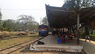
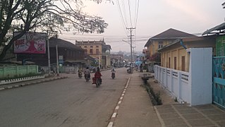
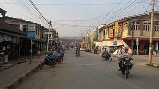
Kyaukme (Burmese: ကျောက်မဲမြို့ [tɕaʊʔ mɛ́ mjo̰]) is a town in northern Shan State of Burma. It is situated on the Mandalay - Lashio road, after Pyin Oo Lwin and Nawnghkio, and before Hsipaw, on what is now the Mandalay - Muse road, part of the Asian Highway route 14 (AH14).[1][2][3] It is also connected to Momeik (Mongmit) in the Shweli River valley and Mogok with its ruby mines.[4] Kyaukme can be reached by train on the Mandalay-Lashio railway line.[5] As of 2014, the population was 39,930.[6]
History
[edit]During the Second World War, the B-25s and P-47s of the USAAF Tenth Air Force carried out bombing raids between October 1944 and March 1945 on Kyaukme station, rolling stock, tracks and roads as well as Japanese troop concentrations in the area.[7]
On 12 February 1945, British and American units of Lt Gen Sultan's Northern Combat Area Command (NCAC) were advancing south towards Lashio and Kyaukme but were being held up by heavy fighting near the Shweli River. Kyaukme was captured on 31 March 1945 by the British 36th Infantry Division and Chinese 6th Army units, which cleared the Burma Road from Mandalay to Lashio.[8]
During Operation 1027 of the Myanmar Civil War, the town experienced an influx of people fleeing from fighting from rural areas in the township.[9] During renewed fighting in June 2024, the town was the site of clashes between junta forces and the Ta'ang National Liberation Army, who eventually took control of the town.[10][11]
Climate
[edit]| Climate data for Kyaukme, elevation 759 m (2,490 ft), (1983–2010) | |||||||||||||
|---|---|---|---|---|---|---|---|---|---|---|---|---|---|
| Month | Jan | Feb | Mar | Apr | May | Jun | Jul | Aug | Sep | Oct | Nov | Dec | Year |
| Mean daily maximum °C (°F) | 24.7 (76.5) |
27.7 (81.9) |
31.0 (87.8) |
32.9 (91.2) |
31.0 (87.8) |
29.8 (85.6) |
29.0 (84.2) |
29.1 (84.4) |
29.3 (84.7) |
28.5 (83.3) |
25.9 (78.6) |
23.8 (74.8) |
28.6 (83.4) |
| Mean daily minimum °C (°F) | 6.5 (43.7) |
8.2 (46.8) |
11.8 (53.2) |
16.2 (61.2) |
19.6 (67.3) |
21.5 (70.7) |
21.7 (71.1) |
21.5 (70.7) |
20.6 (69.1) |
18.3 (64.9) |
13.0 (55.4) |
8.3 (46.9) |
15.6 (60.1) |
| Average precipitation mm (inches) | 6.5 (0.26) |
9.3 (0.37) |
12.9 (0.51) |
62.3 (2.45) |
252.4 (9.94) |
418.4 (16.47) |
429.9 (16.93) |
391.2 (15.40) |
262.1 (10.32) |
176.1 (6.93) |
79.4 (3.13) |
13.7 (0.54) |
2,114.2 (83.25) |
| Source: Norwegian Meteorological Institute[12] | |||||||||||||
Economy
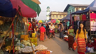
[edit]Kyaukme has been, since before British colonial rule, the main trading centre for tea from Tawngpeng, and the hills around Kyaukme itself, inhabited by the Palaung.[13][14]
Burma and China signed a contract in August 2003 for a hydro power project. A dam is under construction on the Shweli River near Namhkam aiming to supply electricity to Kyaukme, Hsipaw, Lashio and Namtu.[15]
Health
[edit]Malaria is endemic in the area, and its control has been the concern of the WHO since the 1950s.[16] Women of reproductive age (15-49) in Kyaukme and Nawnghkio have been targeted for improvement in reproductive health in the community in collaboration with Japan. A study mission was started in June 2004, with the project continuing for the period January 2005- December 2009.[17][18]
Politics
[edit]The Shan State Army - North (SSA-North)'s Third Brigade has been active in Mongmit, Kyaukme, Hsipaw, Namtu and Lashio. It reached a cease-fire agreement with the Burmese military government (SLORC) in 1989, and its activities have been severely curtailed.[19][20]
During the Saffron Revolution, on 24 September 2007, 37 Buddhist monks in Kyaukme staged a peaceful protest march which ended without interference from the authorities, but they were prevented from repeating the protest the next day.[21]
Notable People
[edit]Sai Ohn Kyaw (born 1944) - politician
Gallery
[edit]
|
Notes
[edit]- ^ "Asian Highway in Myanmar" (PDF). unescap.org. Archived from the original (PDF) on 2011-04-29. Retrieved 2009-02-02.
- ^ Win Nyunt Lwin. "Historic road links wilderness and culture". Myanmar Times October 4–10, 2004. Archived from the original on 2008-10-06. Retrieved 2009-02-02.
- ^ "Pyin Oo Lwin to Kyaukme". MyTripJournal.com. October 31, 2006. Retrieved 2009-02-02.
- ^ "Lt-Gen Aung Htwe tours Kyaukme District". New Light of Myanmar, June 16, 2004. Archived from the original on August 22, 2007. Retrieved 2009-02-02.
- ^ "Train travel in Myanmar(Burma)". seat61.com. Retrieved 2009-02-02.
- ^ "Myanmar: Regions, States, Major Cities & Towns - Population Statistics, Maps, Charts, Weather and Web Information". www.citypopulation.de. Retrieved 2021-04-02.
- ^ Gary Goldblatt. "CHINA-BURMA-INDIA THEATER OF OPERATIONS (Tenth Air Force)". Retrieved 2008-12-29.
- ^ "1945". Burma Star Association. Archived from the original on 2008-09-05. Retrieved 2008-12-29.
- ^ "Civilians Flee Myanmar Junta Barrage as TNLA Advances on Shan Town". The Irrawaddy. 11 January 2024.
- ^ "TNLA Seizes Town and Myanmar Regime Positions in Northern Shan State". The Irrawaddy. 26 June 2024.
- ^ "Op. 1027 Update: TNLA Captures Seven Myanmar Junta Bases, Two Battalion HQs". The Irrawaddy. 1 July 2024.
- ^ "Myanmar Climate Report" (PDF). Norwegian Meteorological Institute. Archived from the original (PDF) on 20 October 2018. Retrieved 21 February 2023.
- ^ Maule, Robert. "Tea Production On the Periphery of the British Empire" (PDF). shanyoma.org. Archived from the original (PDF) on 2017-02-11. Retrieved 2017-02-09.
- ^ "Palaung". MODiNS.ne t. Retrieved 2009-02-04.
- ^ "Shweli Hydel Power Project". Ministry of Foreign Affairs. September 1, 2003. Archived from the original on January 15, 2006. Retrieved 2009-02-04.
- ^ Weeks, E B (6 September 1954). "Experiences in the Control of Malaria Carried by A. minimus in Burma" (PDF). WHO. Retrieved 2009-02-04.
- ^ "Preparation for the New Project on Reproductive Health with Community Initiative in Myanmar". Japanese Organization for International Cooperation in Family Planning (JOICFP). September 2004. Retrieved 2009-02-04.
- ^ Dr Kyee Myint. "Country Presentation:The 4th Asean & Japan High Level Officials Meeting on Caring Societies, 28.8.2006.to 31.8.2006" (PDF). Ministry of Health. Archived from the original (PDF) on 2011-05-01. Retrieved 2009-02-04.
- ^ "Ceasefire group gets marching orders". S.H.A.N. 2005-08-30. Archived from the original on 2009-02-10. Retrieved 2009-02-04.
- ^ "Truce Brings Only Grief, Says Ceasefire Leader". S.H.A.N. 2005-05-23. Archived from the original on 2009-02-10. Retrieved 2009-02-04.
- ^ "Unreported protest in Shan State". S.H.A.N. 3 October 2007. Archived from the original on 10 February 2009. Retrieved 2009-02-04.


