Church of Our Lady, Assens: Difference between revisions
m Changing locally defined but nonexistent Commons category (Category:Vor Frue Kirke (Assens Kommune)) to the one from Wikidata (Category:Vor Frue Kirke (Assens)) |
m Merging Category:Churches completed in 1488 to Category:Buildings and structures completed in 1488 and Category:Churches completed in the 1480s per Wikipedia:Categories for discussion/Log/2024 November 30#Medieval religious buildings |
||
| (2 intermediate revisions by 2 users not shown) | |||
| Line 48: | Line 48: | ||
==Burials== |
==Burials== |
||
More than 450 people were buried inside the church in the 18th century. Some were covered with richly decorated tomb stones while others were covered with brick or simple wooden planks. All the burials were removed from the church in the beginning of the 19th century when burials inside churches were abolished due to health risk. The tomb stones were then placed along the external walls of the church.<ref>{{cite web|url=http://www.nordenskirker.dk/Tidligere/Assens_kirke/Assens_kirke.htm|title=Assens kirke|language=Danish|publisher=nordenskirker.dk|accessdate=2012-07-28}}</ref> |
More than 450 people were buried inside the church in the 18th century. Some were covered with richly decorated tomb stones while others were covered with brick or simple wooden planks. All the burials were removed from the church in the beginning of the 19th century when burials inside churches were abolished due to health risk. The tomb stones were then placed along the external walls of the church.<ref>{{cite web|url=http://www.nordenskirker.dk/Tidligere/Assens_kirke/Assens_kirke.htm|title=Assens kirke|language=Danish|publisher=nordenskirker.dk|accessdate=2012-07-28|archive-date=2011-01-31|archive-url=https://web.archive.org/web/20110131095058/http://nordenskirker.dk/Tidligere/Assens_kirke/Assens_kirke.htm|url-status=dead}}</ref> |
||
==Panoramas== |
==Panoramas== |
||
| Line 67: | Line 67: | ||
{{Coord|55.2693|9.8940|type:landmark_region:DK|display=title}} |
{{Coord|55.2693|9.8940|type:landmark_region:DK|display=title}} |
||
[[Category: |
[[Category:Buildings and structures completed in 1488]] |
||
[[Category:Churches completed in the 1480s]] |
|||
[[Category:Buildings and structures in Assens Municipality]] |
[[Category:Buildings and structures in Assens Municipality]] |
||
[[Category:Gothic architecture in Denmark]] |
[[Category:Gothic architecture in Denmark]] |
||
[[Category:Churches in |
[[Category:Churches in Funen]] |
||
[[Category:Tourist attractions in Assens Municipality]] |
|||
[[Category:Lutheran churches converted from Roman Catholicism]] |
[[Category:Lutheran churches converted from Roman Catholicism]] |
||
[[Category:Churches in the diocese of Funen]] |
[[Category:Churches in the diocese of Funen]] |
||
Latest revision as of 21:34, 8 December 2024
| Church of Our Lady | |
|---|---|
Vor Frue Kirke | |
 | |
 | |
| Location | Damgade 17, 5610 [[Assens, Denmark |Assens]] |
| Country | Denmark |
| Denomination | Church of Denmark |
| Previous denomination | Roman Catholic Church |
| History | |
| Founded | 1488 |
| Administration | |
| Diocese | Diocese of Funen |
| Deanery | Assens Provsti |
| Parish | Assens Sogn |
The Church of Our Lady in Assens is located on (Fyn). It is a Church of Denmark parish church.
History
[edit]
The main chapel on the north side of the church and the lower, square part of the tower are remains of a Romanesque church. In 1488 the church stood in its present form. The Catholic past of the building is heralded in a monstrance, now located to the right of the altar, and a stoup in what was then the porch.[1]
After the Reformation, it came into use as a protestant church. It underwent rough-handed restoration work in 1842-56 and 1881-84.

Architecture
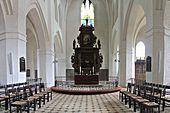
[edit]The church is a three-nave church built in large, red brick of the type in Denmark known as monk stone (munkesten). Typically of Gothic churches, the roofs of the aisles are lower than that of the central nave, allowing light to enter through clerestory windows.
The tower stands at 48 metres. Its octagonal upper part is unusual in Danish church architecture, the only similar design is that of the five towers of Church of Our Lady in Kalundborg.
Furnishings
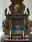
[edit]The altarpiece dates from about 1620. The painting is from 1826 and by Dankvart Dreyer. It was a gift from the painter who was born in Assens and settled there again later in life.[2] Another work by a local artist found in the church is a marble angel created by the sculptor Jens Adolf Jerichau who was born in Assens in 1816, incidentally the same year as Dreyer.
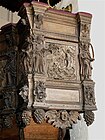
The pulpit, from the second half of the 17th century, was made in Hans Nielsen Bangs's workshop and is decorated with woodcarvings depicting scenes from the Passion on the sides, and nine wooden figures on the edges, probably representing nine of the disciples. Figures of the last three disciples may have decorated the stairs leading up to the pulpit. It also has an hour glass from the 18th century, probably to ensure that the priest's services did not last more than one hour.
The wrought iron balustrade of the altar rails feature a crossed hammer and key, the trademark of King Christian IV's court smith, Casper Finck.
The pews are from 2007. Individual chairs were introduced as seating in the early 1940s. They have an integrated sound system in the backrests and heated seats.[1]
-
The altar
-
Altar piece
-
Pulpit
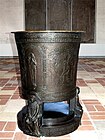
-
Bronze font, 1910
-
Jerichau's marble angel
Burials
[edit]More than 450 people were buried inside the church in the 18th century. Some were covered with richly decorated tomb stones while others were covered with brick or simple wooden planks. All the burials were removed from the church in the beginning of the 19th century when burials inside churches were abolished due to health risk. The tomb stones were then placed along the external walls of the church.[3]
Panoramas
[edit]

References
[edit]- ^ a b "Om Vor Frue Kirke". Vor Frue Kirke. Retrieved 2012-08-28.
- ^ "Nyt om Dankvart Dreyer (og Assens Kirke)" (in Danish). Nationalmuseet. Retrieved 2012-08-01.[permanent dead link]
- ^ "Assens kirke" (in Danish). nordenskirker.dk. Archived from the original on 2011-01-31. Retrieved 2012-07-28.


