Calçado: Difference between revisions
Appearance
Content deleted Content added
No edit summary Tags: Mobile edit Mobile web edit |
|||
| (4 intermediate revisions by 3 users not shown) | |||
| Line 1: | Line 1: | ||
{{Short description|City in Pernambuco, Brazil}} |
{{Short description|City in Pernambuco, Brazil}} |
||
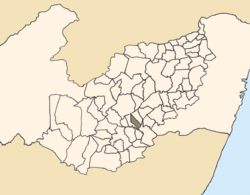
[[File:PE-mapa-Calçado.png|thumb|right|250px|Location of Calçado within Pernambuco.]] |
[[File:PE-mapa-Calçado.png|thumb|right|250px|Location of Calçado within Pernambuco.]] |
||
| ⚫ | '''Calçado''' is a city located in the [[Federative units of Brazil|state]] of [[Pernambuco]], [[Brazil]]. Located at 200 km away from [[Recife]], capital of the state of Pernambuco. Has an estimated ([[Brazilian Institute of Geography and Statistics|IBGE 2020]]) population of 11,018 inhabitants.<ref>[https://cidades.ibge.gov.br/brasil/pe/calcado/panorama IBGE 2020]</ref> |
||
| ⚫ | '''Calçado''' is a city located in the state of [[Pernambuco]], [[Brazil]]. Located at 200 km away from [[Recife]], capital of the state of Pernambuco. Has an estimated ([[Brazilian Institute of Geography and Statistics|IBGE 2020]]) population of 11,018 inhabitants.<ref>[https://cidades.ibge.gov.br/brasil/pe/calcado/panorama IBGE 2020]</ref> |
||
==Geography== |
==Geography== |
||
| Line 63: | Line 61: | ||
|- |
|- |
||
|} |
|} |
||
== See also == |
|||
* [[List of municipalities in Pernambuco]] |
|||
==References== |
==References== |
||
Latest revision as of 16:08, 16 December 2024

Calçado is a city located in the state of Pernambuco, Brazil. Located at 200 km away from Recife, capital of the state of Pernambuco. Has an estimated (IBGE 2020) population of 11,018 inhabitants.[1]
Geography
[edit]- State - Pernambuco
- Region - Agreste Pernambucano
- Boundaries - Lajedo (N and E); Canhotinho (S); Angelim and Jupi (W)
- Area - 423.08 km2
- Elevation - 643 m
- Hydrography - Mundaú and Una rivers
- Vegetation - Caatinga Hiperxerófila
- Clima - Hot and humid
- Annual average temperature - 22.1 c
- Distance to Recife - 200 km
Economy
[edit]The main economic activities in Calçado are based in agribusiness, especially manioc, beans; and livestock such as cattle, sheep and poultry.
Economic indicators
[edit]| Population[2] | GDP x(1000 R$).[3] | GDP pc (R$) | PE |
|---|---|---|---|
| 11.619 | 40.140 | 3.541 | 0.07% |
Economy by Sector 2006
| Primary sector | Secondary sector | Service sector |
|---|---|---|
| 26.76% | 6.86% | 66.38% |
Health indicators
[edit]| HDI (2000) | Hospitals (2007) | Hospitals beds (2007) | Children's Mortality every 1000 (2005) |
|---|---|---|---|
| 0.582 | 1 | 13 | 38.5 |
See also
[edit]References
[edit]- ^ IBGE 2020
- ^ http://www.ibge.gov.br/home/estatistica/populacao/estimativa2009/POP2009_DOU.pdfIBGE Population 2009 Calçado, page 32]
- ^ Calçado 2007 GDP IBGE page 29 Archived March 4, 2016, at the Wayback Machine
- ^ PE State site - City by city profile

