Balfour River: Difference between revisions
Appearance
Content deleted Content added
JarrahTree (talk | contribs) Importing Wikidata short description: "River in New Zealand" |
removed Category:Westland Tai Poutini National Park; added Category:Rivers of Westland Tai Poutini National Park using HotCat |
||
| (8 intermediate revisions by 5 users not shown) | |||
| Line 1: | Line 1: | ||
{{Short description|River in New Zealand}} |
{{Short description|River in the South Island of New Zealand}} |
||
{{Use New Zealand English|date=April 2024}} |
|||
{{Use dmy dates|date=July 2019}} |
{{Use dmy dates|date=July 2019}} |
||
{{Infobox river |
{{Infobox river |
||
| name = Balfour River |
| name = Balfour River |
||
| |
| native_name = |
||
| |
| image = |
||
| |
| image_size = |
||
| |
| image_caption = |
||
| map = {{Maplink|frame=yes|type=line|plain=yes|zoom=10|frame-align=center|frame-width=270|frame-height=270|stroke-color=#0000ff|stroke-width=2}} |
|||
| ⚫ | |||
| map_size = |
|||
| ⚫ | |||
| map_caption = Route of the Balfour River |
|||
| ⚫ | |||
| |
| map_alt = |
||
| pushpin_map = New Zealand South Island#New Zealand |
|||
| ⚫ | |||
| pushpin_map_size = 270px |
|||
| ⚫ | |||
| pushpin_map_caption = Mouth of the Balfour River |
|||
| ⚫ | |||
| |
| pushpin_map_alt = |
||
| source1 = Balfour Glacier |
|||
| source1_location = |
|||
| source1_coordinates = {{coord|-43.5504|170.0630|type:river_region:NZ|display=inline}} |
|||
| ⚫ | |||
| source2_elevation = |
|||
| ⚫ | |||
| ⚫ | |||
| mouth_coordinates = {{coord|-43.52666|169.98777|region:NZ|format=dms|display=inline,title}} |
|||
| ⚫ | |||
| ⚫ | |||
| subdivision_type2 = Region |
|||
| subdivision_name2 = [[West Coast Region|West Coast]] |
|||
| subdivision_type3 = [[Districts of New Zealand|District]] |
|||
| subdivision_name3 = [[Westland District|Westland]] |
|||
| length = {{convert|7.4|km|mi}} |
|||
| ⚫ | |||
| basin_size = |
|||
| progression = '''Balfour River''' → [[Cook River / Weheka]] → [[Tasman Sea]] |
|||
| river_system = |
|||
| tributaries_left = |
|||
| tributaries_right = McKenna Creek, Craig Creek |
|||
| waterfalls = |
|||
| bridges = |
|||
}} |
}} |
||
The '''Balfour River''' is a river in the [[Westland, New Zealand|Westland]] district of [[New Zealand]]. Its source is the [[Balfour Glacier]] and it runs west then northwest for about {{convert| |
The '''Balfour River''' is a river in the [[Westland, New Zealand|Westland]] district of [[New Zealand]]. Its source is the [[Balfour Glacier]] and it runs west then northwest for about {{convert|7.4|km|mi|0}} to the [[Cook River / Weheka]]. |
||
==See also== |
==See also== |
||
| Line 24: | Line 49: | ||
*[https://web.archive.org/web/20081014041929/http://www.linz.govt.nz/placenames/search/index.aspx Land Information New Zealand] - Search for Place Names |
*[https://web.archive.org/web/20081014041929/http://www.linz.govt.nz/placenames/search/index.aspx Land Information New Zealand] - Search for Place Names |
||
{{Westland Tai Poutini National Park}} |
|||
{{coord|43|32|0.96|S|169|59|53.52|E|region:NZ|display=title}} |
|||
{{Westland landforms}} |
{{Westland landforms}} |
||
[[Category:Westland District]] |
[[Category:Westland District]] |
||
[[Category:Rivers of the West Coast |
[[Category:Rivers of the West Coast Region]] |
||
[[Category:Rivers of |
[[Category:Rivers of Westland Tai Poutini National Park]] |
||
Latest revision as of 10:51, 1 January 2025
| Balfour River | |
|---|---|
 Route of the Balfour River | |
| Location | |
| Country | New Zealand |
| Region | West Coast |
| District | Westland |
| Physical characteristics | |
| Source | Balfour Glacier |
| • coordinates | 43°33′01″S 170°03′47″E / 43.5504°S 170.0630°E |
| Mouth | |
• location | Cook River / Weheka |
• coordinates | 43°31′36″S 169°59′16″E / 43.52666°S 169.98777°E |
• elevation | 160 m (520 ft) |
| Length | 7.4 kilometres (4.6 mi) |
| Basin features | |
| Progression | Balfour River → Cook River / Weheka → Tasman Sea |
| Tributaries | |
| • right | McKenna Creek, Craig Creek |
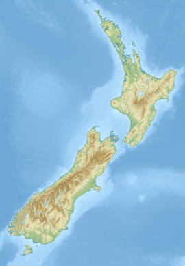
The Balfour River is a river in the Westland district of New Zealand. Its source is the Balfour Glacier and it runs west then northwest for about 7.4 kilometres (5 mi) to the Cook River / Weheka.
See also
[edit]References
[edit]- Land Information New Zealand - Search for Place Names


