Capacsaya: Difference between revisions
Appearance
Content deleted Content added
m →References: copyedit, already indirectly in category, refine cat, and AWB general fixes using AWB |
No edit summary Tags: Visual edit Mobile edit Mobile web edit |
||
| (20 intermediate revisions by 10 users not shown) | |||
| Line 1: | Line 1: | ||
{{short description|Mountain in Peru}} |
|||
{{Infobox mountain |
{{Infobox mountain |
||
| name = |
| name = Capacsaya |
||
| photo = |
| photo = |
||
| photo_caption = |
| photo_caption = |
||
| |
| map = Peru |
||
| ⚫ | |||
| elevation_ref = <ref name=geographic>[http://www.geographic.org/geographic_names/name.php?uni=6592819&fid=4557&c=peru geographic.org] "Nevado Capacsaya: Peru", retrieved on January 1, 2014</ref> |
|||
| location = [[Peru]], [[Cusco Region]] |
|||
| ⚫ | |||
| coordinates = {{coord|13|11|20|S|72|06|43|W|type:mountain_region:PE_scale:100000|format=dms|display=inline,title}} |
|||
| elevation_m = 5043 |
|||
| elevation_ref = |
|||
| prominence_m = |
| prominence_m = |
||
| prominence_ref = |
| prominence_ref = |
||
| range = [[Andes]], [[Urupampa mountain range|Urupampa]] |
|||
| listing = |
| listing = |
||
| |
| range = [[Andes]], [[Urubamba mountain range|Urubamba]] |
||
| map = Peru | region = PE |
|||
| ⚫ | |||
| ⚫ | |||
| ⚫ | |||
| lat_d = 13| lat_m = 11| lat_s = 20| lat_NS = S |
|||
| long_d =72| long_m =06| long_s =42| long_EW= W |
|||
| ⚫ | |||
| topo = |
| topo = |
||
| range_coordinates = |
|||
| ⚫ | |||
| type = |
| type = |
||
| age = |
| age = |
||
| first_ascent = |
| first_ascent = |
||
| easiest_route = |
| easiest_route = |
||
| ⚫ | |||
}} |
}} |
||
''' |
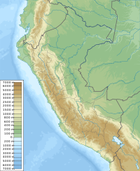
'''Capacsaya,'''<ref name=":0">{{Cite journal|last=Echevarría|first=Evelio|date=1973|title=A Survey of Andean Ascents|journal=American Alpine Journal|volume=18-2|issue=47|page=390|isbn=9780930410704}}</ref><ref name=":1">{{Cite book|title=Peru 1:100 000, Urubamba (27-r)|publisher=IGN (Instituto Geográfico Nacional - Perú)}}</ref> '''Ccapacsaya'''<ref name=":2">{{Cite book|url=http://www.rgs.org/NR/rdonlyres/B11E3D06-3E97-45FC-9E82-D394EFA751BD/0/MAPeru.pdf|title=Mountaineering in the Andes|last=Neate|first=Jill|publisher=RGS-IBG Expedition Advisory Centre|year=1994|isbn=0-907649-64-5|pages=55|chapter=Peru|url-status=dead|archive-url=https://web.archive.org/web/20160304185849/http://www.rgs.org/NR/rdonlyres/B11E3D06-3E97-45FC-9E82-D394EFA751BD/0/MAPeru.pdf|archive-date=2016-03-04}}</ref> (possibly from [[Quechua language|Quechua]] ''qhapaq'' mighty, ''saya'' slope,<ref>{{Ref Laime}}</ref> "mighty slope"), '''Media Luna'''<ref name=":2" /> or '''Huayurioc'''<ref name=":2" /> is a mountain in the [[Urubamba mountain range|Urubamba]] mountain range in the [[Andes]] of [[Peru]], about {{convert|5043|m|ft|0}} high.<ref name=":1" /> It is located in the [[Cusco Region]], [[Calca Province]], [[Lares District]], and in the [[Urubamba Province]], [[Urubamba District]]. Capacsaya lies northwest of [[Chicón]] and east of [[Pumahuanca]], near Pumahuancajasa pass.<ref name=":1" /> |
||
==References== |
==References== |
||
{{reflist}} |
{{reflist}} |
||
[[Category: |
[[Category:Five-thousanders of the Andes]] |
||
[[Category:Mountains of Cusco Region]] |
[[Category:Mountains of Cusco Region]] |
||
Latest revision as of 15:25, 9 January 2025
| Capacsaya | |
|---|---|
| Highest point | |
| Elevation | 5,043 m (16,545 ft) |
| Coordinates | 13°11′20″S 72°06′43″W / 13.18889°S 72.11194°W |
| Geography | |
| Location | Peru, Cusco Region |
| Parent range | Andes, Urubamba |
Capacsaya,[1][2] Ccapacsaya[3] (possibly from Quechua qhapaq mighty, saya slope,[4] "mighty slope"), Media Luna[3] or Huayurioc[3] is a mountain in the Urubamba mountain range in the Andes of Peru, about 5,043 metres (16,545 ft) high.[2] It is located in the Cusco Region, Calca Province, Lares District, and in the Urubamba Province, Urubamba District. Capacsaya lies northwest of Chicón and east of Pumahuanca, near Pumahuancajasa pass.[2]
References
[edit]- ^ Echevarría, Evelio (1973). "A Survey of Andean Ascents". American Alpine Journal. 18–2 (47): 390. ISBN 9780930410704.
- ^ a b c Peru 1:100 000, Urubamba (27-r). IGN (Instituto Geográfico Nacional - Perú).
- ^ a b c Neate, Jill (1994). "Peru". Mountaineering in the Andes (PDF). RGS-IBG Expedition Advisory Centre. p. 55. ISBN 0-907649-64-5. Archived from the original (PDF) on 2016-03-04.
- ^ Teofilo Laime Ajacopa (2007). Diccionario Bilingüe: Iskay simipi yuyayk’anch: Quechua – Castellano / Castellano – Quechua (PDF). La Paz, Bolivia: futatraw.ourproject.org.

